Ukraine's General Staff reports 16 clashes on Kostiantynivka axis by 22:00 on 16 October
What happened
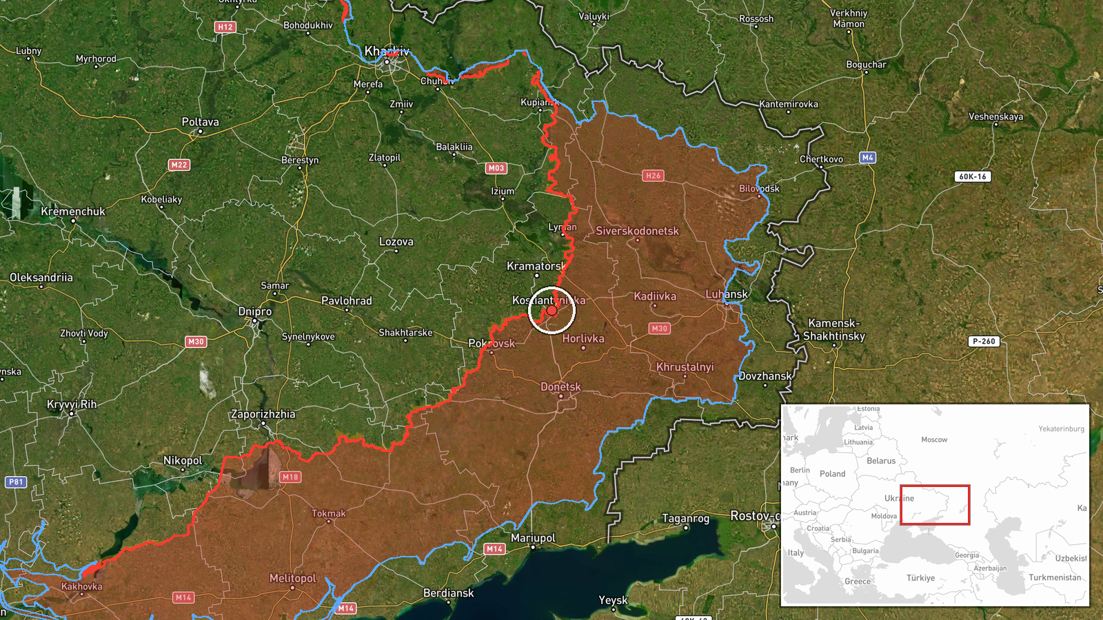
Ukraine's General Staff reported, in a Telegram post, that by 22:00 local time on 16 October 2026 it had recorded 16 combat clashes on the Kostiantynivka axis in Donetsk Oblast. The report names the areas of Kostiantynivka, Dovha Balka, Novoselivka, Druzhkivka, Oleksiievo-Druzhkivka and Mykolaipilia, and states that two of the clashes were still ongoing at the time of writing. The original Ukrainian wording uses the term 'бойові зіткнення' (combat clashes) and does not specify which side initiated them, what weapons were used, or what the outcome was. The attribution to Russia on this page comes from the event classification, not from the report's wording. The entry is timestamped 19:03 UTC.
Context and assessment
Kostiantynivka sits close to Druzhkivka and the wider Donetsk-Kramatorsk-Sloviansk urban belt, which makes it a recurring focus of ground fighting. The related events on this page suggest sustained pressure across the day rather than a single incident. Earlier on 16 October, the General Staff reported 27 Russian attacks on the same direction, including assaults near Kostiantynivka and Dovha Balka and toward Rozkishne. The 22:00 tally of 16 clashes reads as a later summary of that activity, with the named localities overlapping. Elsewhere that day, a separate report noted a guided glide bomb heading toward Donetsk Oblast, a DeepState update recorded a Russian advance of roughly 6 km² in the Minkivka sector, and a Lyman-axis summary described repelled attacks and attempted advances. Taken together, these reports point to multi-axis pressure in which Ukrainian sources describe repeated local engagements around the city rather than a decisive breakthrough. Operationally, the cluster may reflect efforts to fix Ukrainian reserves along the Kostiantynivka approaches while probing for weak points. That reading remains tentative, since a single channel's clash count does not establish which side gained ground.
Sources and confidence
The only source recorded for this event is the Telegram account of Ukraine's General Staff. No independent outlet, wire service, or second official channel has been linked to it on this page yet. The confidence score of 8.1 reflects a primary official source with a clear timestamp and named localities, but also a single-channel origin, an aggregated count that cannot be checked incident by incident, and no accompanying imagery or geolocated footage. Confidence would rise with corroboration from local officials, frontline mapping such as DeepState, or verified footage placing clashes in the named villages. It would fall if the General Staff revised the count or if later reporting contradicted the description of ongoing clashes.
Location
The coordinates correspond to Kostiantynivka itself and are recorded at settlement precision, so the marker identifies the town rather than a specific street or facility. The report covers several surrounding villages, so the pin represents the focal settlement rather than the full extent of the clashes. Kostiantynivka lies in Donetsk Oblast in eastern Ukraine's industrial belt, adjacent to Druzhkivka and within the corridor linking Donetsk city with Kramatorsk and Sloviansk. The terrain is largely open steppe with urban and industrial built-up areas, which shape how ground movement and observation work in the area.
Related events nearby
- Ukrainian General Staff reports 27 Russian attacks on the Kostiantynivka direction, including assaults near Ko2026-10-16 05:06 UTC · Combat · Kostiantynivka, Donetsk Oblast, Ukraine
- Ukrainian air monitoring: 1 Russian guided glide bomb (KAB) heading toward Donetsk Oblast.2026-10-16 01:04 UTC · Airstrike · Donetsk Oblast, Ukraine
- Russian forces advanced (~6 km²) in the Minkivka sector per DeepState frontline update. No settlement center c2026-10-16 00:20 UTC · Combat · Minkivka sector, Ukraine
- Russian FPV drone struck Ukrainian soldiers while they were evacuating civilians. No casualty or location deta2026-10-15 21:51 UTC · FPV Drone · Near Yampil', Donetsk, Ukraine (front line, estima
- Ukrainian forces repelled eight Russian attacks on the Lyman axis and two on the Sloviansk axis, plus three at2026-10-16 05:05 UTC · Combat · Lyman, Donetsk Oblast, Ukraine
▶ View this event on the live map

Intel Mapper aggregates open-source reports from monitored Telegram and X channels, geolocates them, cross-checks duplicates across sources and assigns a confidence score. Entries are updated as new confirmations arrive. Read how we verify events.