Ukraine says it struck a drone storage and launch site near Donetsk on October 17-18
What happened
Ukraine's General Staff reported through its Telegram channel (@GeneralStaffZSU) that Defense Forces units struck a storage, preparation and launch site for attack drones in the Donetsk area on October 17 and during the night into October 18, 2026. The Ukrainian-language statement says the strike reduces the adversary's ability to attack Ukrainian territory and civilian infrastructure with drones of various modifications. The post gives no damage assessment, casualty figures, or independent confirmation of the site's identity. The summary's wording that the strike reportedly reduced Russian drone-strike capacity reflects the claim, not verified results. The event is recorded at settlement level in Donetsk, a city in Donetsk Oblast that has been under Russian occupation since 2022.
Context and assessment
Donetsk has been held by Russian forces since 2022 and sits within the wider Donbas front, where both sides have repeatedly targeted logistics, command and launch infrastructure. The same day brought several related reports. A ballistic missile strike near Vuhledar was reportedly linked to a claim of 68 Russian soldiers killed, a figure cited through a Wall Street Journal report and not independently verified. Ukrainian forces were also said to have repelled 15 Russian assaults near Kostiantynivka. Air monitoring reports tracked guided glide bombs heading toward Donetsk Oblast and Kramatorsk, and a Banderol mini cruise missile heading toward Pivdennyi. Taken together, these reports show a high tempo of Russian standoff strikes, which makes reducing launch capacity a plausible Ukrainian priority. Operationally, a combined storage, preparation and launch site suggests drones are staged close to the front, so a strike there could disrupt short-term launch rates. The effect on overall capacity would depend on how many other sites and stockpiles exist, which the data does not show.
Sources and confidence
The report rests on a single channel, the official Telegram account of Ukraine's General Staff, and the data lists no independent outlet covering the same strike. The confidence score of 8.0 reflects that the claim comes from an official military source, includes a specific time window and a clear description of the target type. It is held below the top of the scale because there is no imagery, satellite damage assessment, geolocation or Russian response, and because the claim comes from a party to the conflict. Confirmation from geolocated video, commercial satellite imagery or a Russian acknowledgment would raise confidence. A correction, a contradicting account or evidence that the target was misidentified would lower it.
Location
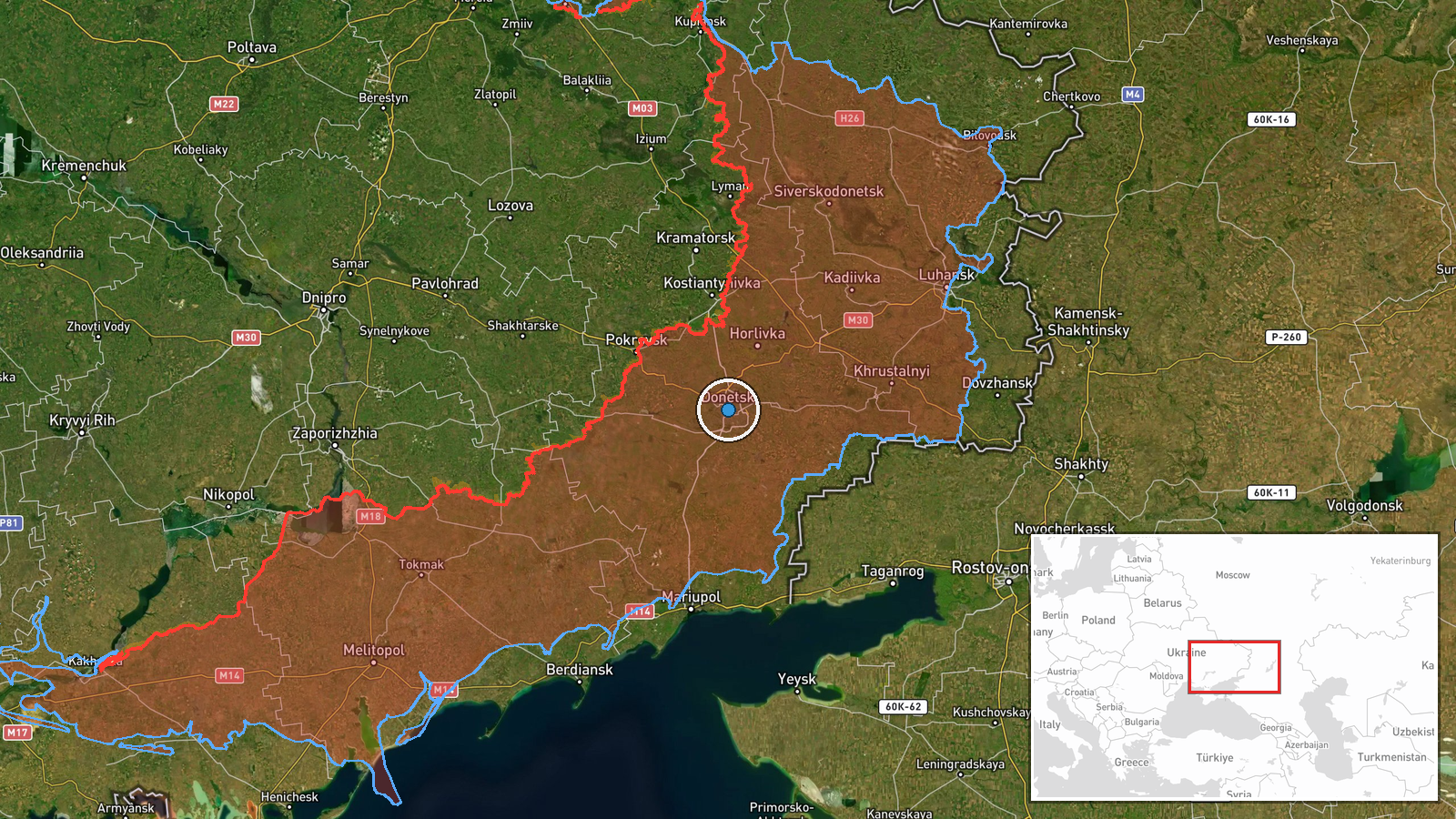
The point is placed at settlement level in the city of Donetsk, at roughly 48.02 N, 37.80 E, because the statement names only the district of Donetsk and not a specific facility. The map marker therefore indicates the city rather than the exact site. Donetsk is an industrial and urban centre in eastern Ukraine, lying along the Kalmius River in the Donbas. Its dense built-up terrain would make small drone sites difficult to distinguish from surrounding structures in open-source imagery.
Related events nearby
- Ukrainian missiles struck coordinates shared by Russian Lt. Lev Stupnikov, reportedly killing 68 Russian soldi2026-10-17 20:32 UTC · Ballistic Missile · Vuhledar area, Ukraine
- Ukrainian General Staff: Ukrainian forces repelled 15 Russian assaults near Kostiantynivka and toward Novoseli2026-10-17 19:03 UTC · Combat · Kostiantynivka, Donetsk, Ukraine
- Ukrainian air monitoring: 1 Russian guided glide bomb (KAB) heading toward Donetsk Oblast.2026-10-18 06:28 UTC · Airstrike · Donetsk Oblast, Ukraine
- Ukrainian air monitoring: 1 Russian Banderol mini cruise missile passing Sharivka, heading toward Pivdennyi.2026-10-18 08:14 UTC · Cruise Missile · Pivdennyi, Ukraine
- Ukrainian air monitoring: 1 Russian guided glide bomb (KAB) heading toward Kramatorsk.2026-10-18 07:00 UTC · Airstrike · Kramatorsk, Ukraine
▶ View this event on the live map

Intel Mapper aggregates open-source reports from monitored Telegram and X channels, geolocates them, cross-checks duplicates across sources and assigns a confidence score. Entries are updated as new confirmations arrive. Read how we verify events.