Ukraine reports six Russian assault attempts near Kupiansk and Radkivka as of 18 October 2026
What happened
Ukraine's General Staff, posting on its official Telegram channel, said that as of 22:00 on 18 October 2026 Russian forces had made six attempts to improve their positions on the Kupiansk axis in Kharkiv Oblast, conducting assault actions toward the city of Kupiansk and the village of Radkivka. The original Ukrainian wording describes these as assault actions (штурмові дії) and attempts to improve positions, a formulation that reports the fact of attacks without giving casualty figures, unit identities, or outcomes. The update follows the General Staff's standard operational summary format. The data provided contains no independent confirmation of the attacks, their scale, or their results, so the account rests on a single official Ukrainian source.
Context and assessment
The Kupiansk area has been one of the most contested sectors of the Kharkiv front since Russian forces occupied the town in early 2022 and Ukrainian forces retook it later that year. Its importance lies largely in its position on the Oskil River, where control of crossings and nearby high ground affects movement across the northeastern front. Attacks toward both Kupiansk and the smaller village of Radkivka suggest pressure on this river line rather than a single isolated thrust. The same day's related reports show a wide air picture: Shahed-type and jet-powered Geran-3 drones tracked over Izyum, Kharkiv, and Blyzniuky, a guided glide bomb heading toward Kramatorsk, and a Banderol mini cruise missile tracked toward Pivdennyi. These records do not establish a link to the Kupiansk ground attacks. Operationally, sustained assault attempts combined with long-range air activity across several oblasts could be intended to stretch local defenders and fix reserves in place, though the data alone cannot confirm that purpose.
Sources and confidence
The event rests on one channel, the Telegram account of the Ukrainian General Staff, which carries a confidence score of 8.0 and a source count of one. The channel is an official military source with a regular publication pattern, which supports a relatively high score, but it is a single party to the conflict and it does not give detail that outside observers could verify. No independent outlet, satellite imagery, or second Ukrainian or Russian statement appears in the provided data. Confidence would rise if regional military administrations, independent monitors, or geolocated footage confirmed attacks near Kupiansk or Radkivka on the same date. It would fall if later General Staff updates revised the count or if Russian statements contradicted the report.
Location
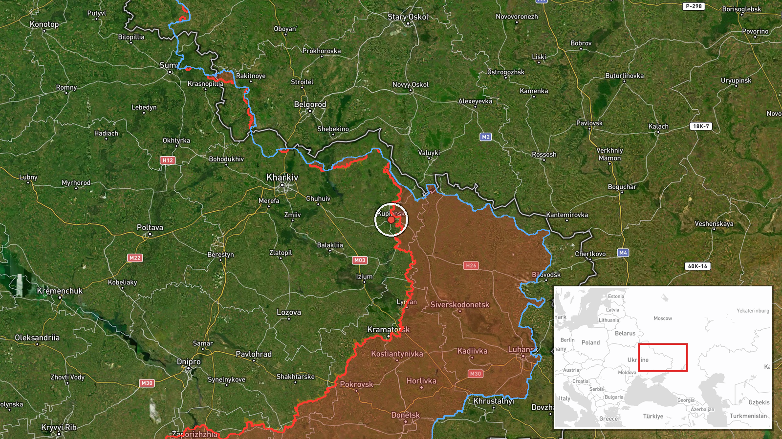
The location is recorded at settlement precision, meaning the coordinates mark the town of Kupiansk in Kharkiv Oblast rather than a specific street or position. Radkivka is named in the report but is not separately geocoded in the data. Kupiansk lies in northeastern Ukraine on the Oskil River, a waterway whose floodplain, bridges, and wooded banks shape movement and defensive positions in the area. The town's built-up areas and river crossings are the features most relevant to ground assaults.
Related events nearby
- Ukrainian air monitoring: 1 Russian Shahed-type drone over Izyum.2026-10-18 06:59 UTC · Drone Transit · Izyum, Ukraine
- Ukrainian air monitoring: 1 Russian jet-powered Shahed (Geran-3) drone heading toward Kharkiv.2026-10-18 03:31 UTC · Drone Transit · Kharkiv, Ukraine
- Ukrainian air monitoring: 1 Russian guided glide bomb (KAB) heading toward Kramatorsk.2026-10-18 07:00 UTC · Airstrike · Kramatorsk, Ukraine
- Ukrainian air monitoring: 1 Russian jet-powered Shahed (Geran-3) drone from Donetsk Oblast toward Blyzniuky.2026-10-18 02:49 UTC · Drone Transit · Blyzniuky, Ukraine
- Ukrainian air monitoring: 1 Russian Banderol mini cruise missile passing Sharivka, heading toward Pivdennyi.2026-10-18 08:14 UTC · Cruise Missile · Pivdennyi, Ukraine
▶ View this event on the live map

Intel Mapper aggregates open-source reports from monitored Telegram and X channels, geolocates them, cross-checks duplicates across sources and assigns a confidence score. Entries are updated as new confirmations arrive. Read how we verify events.