Russian artillery reportedly shells more than two dozen Sumy Oblast villages and Khrinivka
What happened
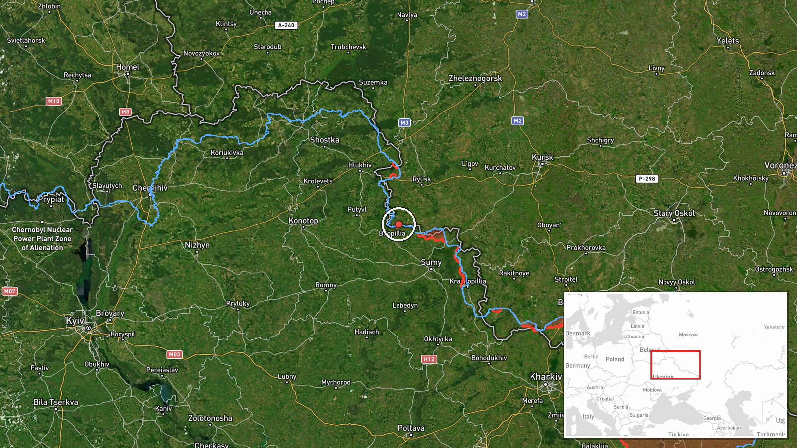
Ukraine's General Staff reported on its Telegram channel that Russian forces shelled a long list of settlements in Sumy Oblast during the previous day. The post named more than two dozen localities, including Bezsalivka, Koreniok, Tovstodubove, Oleksiivka and Kucherivka, and said Khrinivka in neighboring Chernihiv Oblast was also hit. The wording refers to shelling in general terms. It does not describe damage, casualties or specific weapon types beyond the artillery classification applied in this record. The timestamp is 05:05 UTC on 22 October 2026, and the event is placed at Bezsalivka as the representative point for the list.
Context and assessment
Sumy Oblast sits on Ukraine's northeastern border with Russia, and its villages have been under sustained pressure for much of the war. Shelling of such a long list of places in one overnight report suggests fire spread across a wide area rather than a single targeted position, which is consistent with harassing or suppressive fire along the front. Related events in the feed point the same way. On 21 October, Russian forces on the Northern Slobozhanshchyna and Kursk axes reportedly carried out one airstrike, two guided aerial bombs and 37 shellings of Ukrainian positions and settlements near Kindrativka. The same day, several Shahed-type drones were logged moving over Sumy Oblast, some heading toward Sumy and others toward Kharkiv, which indicates the region lies along routes used for long-range strikes. Ukrainian forces also reported strikes on Russian concentrations around Pysarivka, a village that appears in the shelled list, suggesting fire is moving in both directions across the same area. Operationally, dispersed artillery of this kind is often used to fix defenders, disrupt movement and degrade local infrastructure, though a single-channel report cannot confirm intent.
Sources and confidence
Only one channel is cited: the Telegram account of the Ukrainian General Staff (@GeneralStaffZSU). No independent outlet, monitoring group or imagery source in the data corroborates the shelling, so the event rests on a single official-channel claim. The confidence score of 8.0 reflects a credible institutional origin and a specific, time-stamped report, offset by the lack of corroboration and the absence of damage or casualty detail. Confidence would rise with local authority statements, regional military administration reports or geolocated imagery of impact sites in the named villages. It would fall if follow-up reporting disputed the list or if the channel later issued a correction.
Location
Coordinates point to Bezsalivka in Sumy Oblast at settlement-level precision, with normal location confidence. The report names about two dozen other villages, so the marker represents only the first place listed rather than the full affected area. Sumy Oblast lies in northeastern Ukraine and borders Russia's Kursk and Bryansk regions. Much of its terrain is flat to gently rolling farmland, with river valleys and forest belts. Khrinivka, the second place named, is in neighboring Chernihiv Oblast and is not part of this coordinate.
Related events nearby
- Ukrainian aviation, missile troops and artillery struck Russian personnel and equipment concentrations in thre2026-10-22 05:06 UTC · Airstrike · Novokostiantynivka, Ukraine
- Russian forces on the Northern Slobozhanshchyna and Kursk axes carried out one airstrike, two guided aerial bo2026-10-21 19:02 UTC · Airstrike · Near Kindrativka, Sumy, Ukraine (front line, estim
- Ukrainian air monitoring: 1 Russian Shahed-type drone passing northern Sumy Oblast, heading west.2026-10-21 16:39 UTC · Drone Transit · northern Sumy Oblast, Ukraine
- Ukrainian air monitoring: 1 Russian Shahed-type drone over Sumy Oblast; 1 Russian Shahed-type drone heading to2026-10-21 18:38 UTC · Drone Transit · Sumy Oblast, Ukraine
- Ukrainian air monitoring: 1 Russian Shahed-type drone heading toward Sumy.2026-10-21 09:37 UTC · Drone Transit · Sumy, Ukraine
▶ View this event on the live map

Intel Mapper aggregates open-source reports from monitored Telegram and X channels, geolocates them, cross-checks duplicates across sources and assigns a confidence score. Entries are updated as new confirmations arrive. Read how we verify events.