Four Sumy Oblast settlements hit by airstrikes, per Ukrainian General Staff
What happened
Ukraine's General Staff, posting on its Telegram channel @GeneralStaffZSU, said that over the preceding day the enemy carried out airstrikes on the settlements of Pysarivka, Kyianytsia, Pustohorod and Novokostiantynivka. In the same report, the General Staff said that Ukrainian aviation, missile forces and artillery struck three areas where Russian personnel and equipment were concentrated. The structured event record attributes the airstrikes to Ukraine, but the original Ukrainian wording describes the settlement strikes as enemy action and the counterstrikes as Ukrainian operations. The report names no locations for the three concentration areas beyond the settlement names, and it gives no casualty figures or damage assessment. The timestamp is 05:06 UTC on 22 October 2026, and the record is mapped to Novokostiantynivka.
Context and assessment
The settlements named in the report lie in the border belt of Sumy Oblast, a area where Russian and Ukrainian forces have repeatedly exchanged fire. The related events show sustained pressure on this zone over the preceding day. On 21 October, a report described one airstrike, two guided aerial bombs and 37 shellings against Ukrainian positions and settlements on the Northern Slobozhanshchyna and Kursk axes, with Kindrativka placed near the front line. Overnight into 22 October, artillery reportedly hit multiple Sumy Oblast settlements and Khrinivka in Chernihiv Oblast. Several single Shahed-type drones were also tracked over Sumy Oblast and toward Sumy and Kharkiv during the same period. Taken together, the pattern suggests a mix of air, glide-bomb, artillery and drone activity along the border rather than a single isolated incident. Operationally, airstrikes on border villages may indicate attempts to disrupt positions or logistics close to the frontier, while reported Ukrainian fire on concentrations could point to targeting of staging or assembly areas. Neither side's claims can be verified from this record alone.
Sources and confidence
The event rests on one channel, the official Telegram account of Ukraine's General Staff, and no other outlet in the dataset independently reports it. The confidence score of 8.0 reflects a named official source, specific settlement names, a timestamp and a clear description of the event type. It is still a belligerent's own account, unverified and without casualty or imagery details. The attribution discrepancy between the structured summary and the original wording also argues for caution. Confidence would rise with independent corroboration such as Sumy Oblast officials' statements, local media, satellite imagery, or geolocated footage matching the named villages. It would fall if other outlets dispute the strikes, if the wording is revised, or if the attribution remains inconsistent.
Location
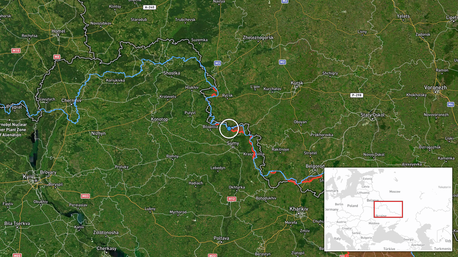
The coordinates point to the settlement centroid of Novokostiantynivka in Sumy Oblast, northeastern Ukraine, close to the Russian border, which fits the settlement-level precision recorded. The point marks a village rather than a specific facility, and the other three named villages are in the same border belt but are not separately geolocated here. The terrain is mostly flat to gently rolling farmland, with small river valleys and forest belts typical of the region's frontier.
Related events nearby
- Russian forces on the Northern Slobozhanshchyna and Kursk axes carried out one airstrike, two guided aerial bo2026-10-21 19:02 UTC · Airstrike · Near Kindrativka, Sumy, Ukraine (front line, estim
- Russian forces shelled multiple Sumy Oblast settlements overnight, plus Khrinivka in Chernihiv Oblast; casualt2026-10-22 05:05 UTC · Artillery · Bezsalivka, Sumy Oblast, Ukraine
- Ukrainian air monitoring: 1 Russian Shahed-type drone over Sumy Oblast; 1 Russian Shahed-type drone heading to2026-10-21 18:38 UTC · Drone Transit · Sumy Oblast, Ukraine
- Ukrainian air monitoring: 1 Russian Shahed-type drone heading toward Sumy.2026-10-21 09:37 UTC · Drone Transit · Sumy, Ukraine
- Ukrainian air monitoring: 1 Russian Shahed-type drone passing northern Sumy Oblast, heading west.2026-10-21 16:39 UTC · Drone Transit · northern Sumy Oblast, Ukraine
▶ View this event on the live map

Intel Mapper aggregates open-source reports from monitored Telegram and X channels, geolocates them, cross-checks duplicates across sources and assigns a confidence score. Entries are updated as new confirmations arrive. Read how we verify events.