Russian jet-powered drone transits Chornobyl Exclusion Zone heading west
What happened
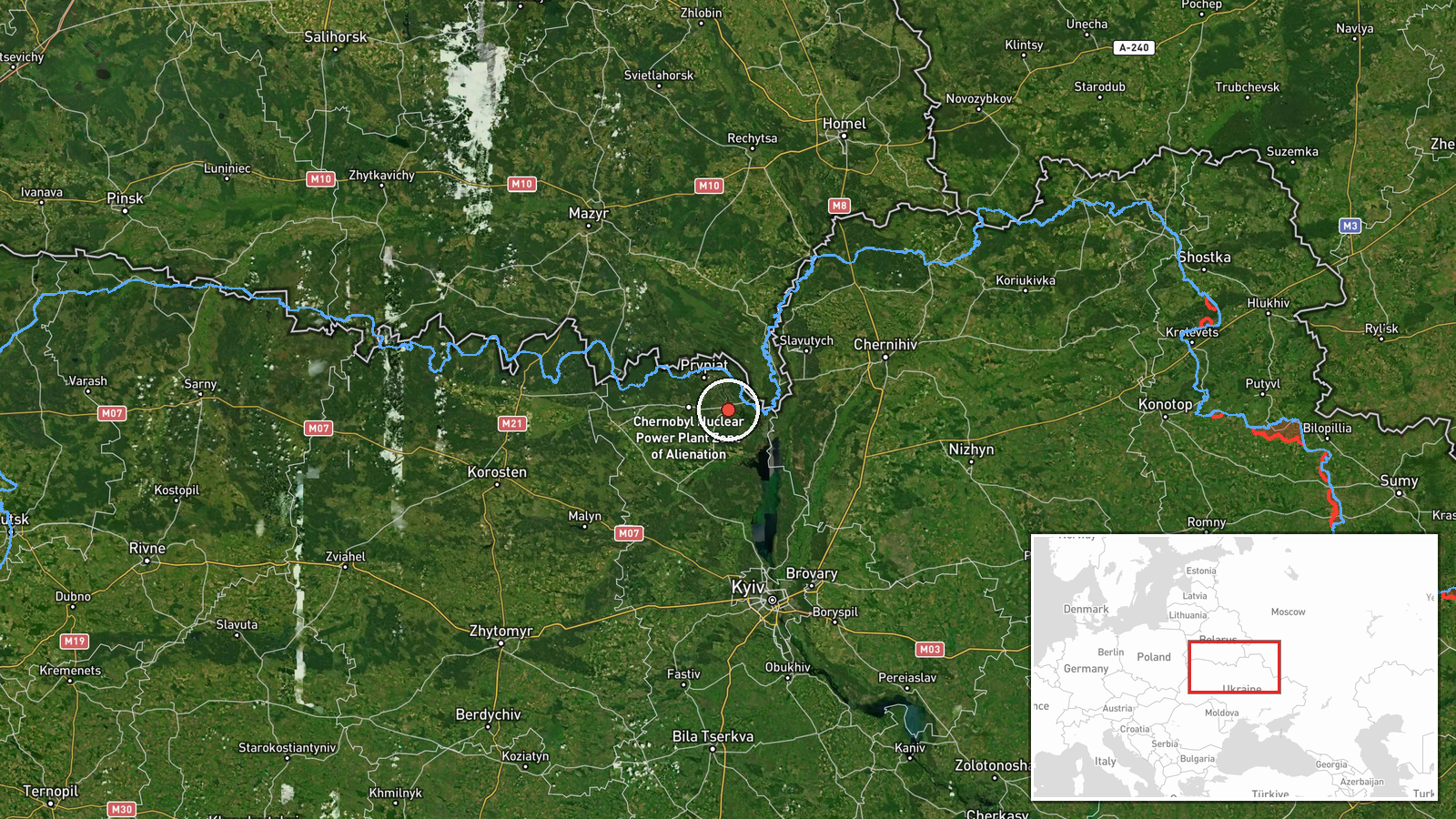
Ukrainian air monitoring reportedly detected one Russian jet-powered Shahed (Geran-3) drone transiting through the Chornobyl Exclusion Zone in Kyiv Oblast on the morning of October 15, traveling westward toward central Ukraine. The Geran-3 is a Russian cruise drone variant with extended range. The detection was reported by Telegram channel @kpszsu, which aggregates Ukrainian air defense and monitoring alerts. The drone's exact target or final destination was not specified in the monitoring report.
Context and assessment
The Chornobyl Exclusion Zone, a demilitarized area around the defunct nuclear power plant, has increasingly become a transit corridor for Russian air strikes into central and northwestern Ukraine since the 2022 invasion. The zone's low population and limited air defenses make it an attractive ingress route. On the same date, Ukrainian monitors tracked multiple Geran-3 drones heading toward Ivankiv and Slavutych, both settlements within or near the exclusion zone, suggesting a coordinated multi-drone operation. Geran-3 variants, reportedly upgraded with turbojets for higher speed and altitude, represent an evolution in Russia's long-range strike capability and have been deployed with increasing frequency against targets in central Ukraine.
Sources and confidence
Report sourced from Telegram channel @kpszsu, run by Ukrainian air monitoring volunteers. Only a single source confirms this specific transit. Confidence is moderate (8.0/10) due to single-source reporting but bolstered by corroborating detections of similar drones on identical bearings and timeframes from the same monitoring network on October 15, suggesting part of a coordinated strike package.
Location
Chornobyl Exclusion Zone, northern Kyiv Oblast, centered approximately 51.27°N, 30.22°E. The zone encompasses the abandoned nuclear power station and surrounding 30-kilometer radius of restricted territory. The drone reportedly transited westward from the zone toward central Ukraine, likely toward Kyiv city or surrounding infrastructure.
Related events nearby
- Ukrainian air monitoring: 1 Russian jet-powered Shahed (Geran-3) drone heading toward Ivankiv.2026-10-15 05:16 UTC · Drone Transit · Ivankiv, Ukraine
- Ukrainian air monitoring: 1 Russian jet-powered Shahed (Geran-3) drone passing Pivnichnyi, heading toward Ivan2026-10-15 04:51 UTC · Drone Transit · Ivankiv, Ukraine
- Ukrainian air monitoring: 2+ Russian jet-powered Shahed (Geran-3) drones heading toward Ivankiv.2026-10-15 01:54 UTC · Drone Transit · Ivankiv, Ukraine
- Ukrainian air monitoring: 2+ Russian jet-powered Shahed (Geran-3) drones heading toward Slavutych.2026-10-15 05:14 UTC · Drone Transit · Slavutych, Ukraine
- Ukrainian air monitoring: 2+ Russian jet-powered Shahed (Geran-3) drones heading toward Slavutych.2026-10-15 01:52 UTC · Drone Transit · Slavutych, Ukraine
▶ View this event on the live map

Intel Mapper aggregates open-source reports from monitored Telegram and X channels, geolocates them, cross-checks duplicates across sources and assigns a confidence score. Entries are updated as new confirmations arrive. Read how we verify events.