Single jet-powered Shahed drone reported moving toward Klavdiievo-Tarasove in Kyiv Oblast
What happened
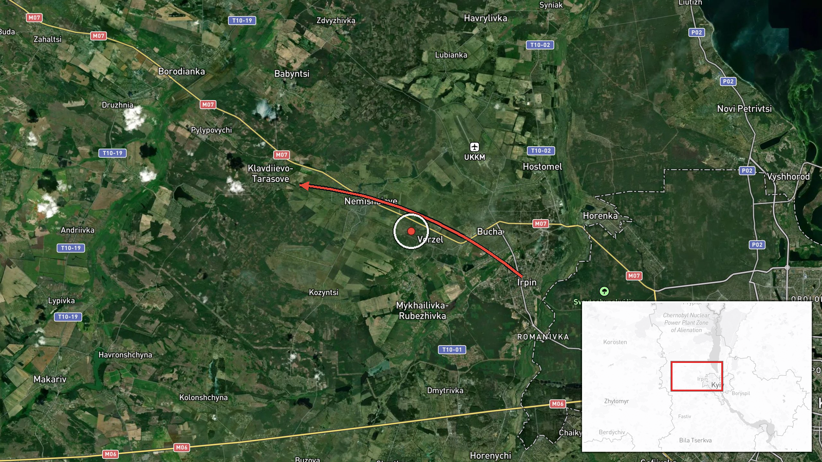
Ukrainian air monitoring reported on Telegram via the channel @kpszsu that one Russian jet-powered Shahed (Geran-3) drone was heading toward Klavdiievo-Tarasove in Kyiv Oblast, approaching from the north. The alert was logged at 03:47 UTC on 16 October 2026. The original post, written in Ukrainian, describes a jet-type UAV moving in the direction of Klavdiievo-Tarasove in the Kyiv region from the north. The report does not state whether the drone struck anything, was intercepted, or was lost from track, and no damage or casualties are mentioned. The entry is a transit alert rather than a confirmed impact.
Context and assessment
Klavdiievo-Tarasove sits in the Bucha-Irpin area of Kyiv Oblast, a corridor that drones frequently cross on routes toward the capital and toward western Ukraine. The event belongs to a series of Drone Transit alerts in the same oblast over roughly 24 hours. On 15 October, air monitoring reported drones toward Makariv at 07:38 UTC, toward Borodianka at 04:55 and 13:50 UTC, and across northern Kyiv Oblast toward Zhytomyr Oblast at 11:51 UTC. On 16 October, a drone was reported toward Hostomel at 02:43 UTC, shortly before this alert. The sequence of nearby settlements suggests one or more Geran-3 airframes tracking through a north-to-south or north-to-east band of the oblast, though the reports do not confirm a single continuous flight. Operationally, repeated transit reports of this kind usually indicate reconnaissance of air defence coverage, route testing, or a broader strike package passing through the region rather than an isolated launch. Because each alert is a separate observation, the pattern is best read as a regional trend and not as proof of coordinated intent.
Sources and confidence
The event rests on one Telegram channel, @kpszsu, which relays Ukrainian air monitoring messages. No second independent outlet in the provided data confirms this specific report. The confidence score of 8.0 reflects a high-frequency, specific, time-stamped official-style alert that matches a consistent series of nearby reports, but it is not higher because the source count is one and the post contains no imagery or independent verification. Confidence would rise with corroboration from a second monitoring channel, Ukrainian Air Force statements, or a geolocated video. It would fall if later updates contradicted the track or if the alert were revised or withdrawn.
Location
The coordinates correspond to Klavdiievo-Tarasove, a settlement-level location, and the location confidence is rated high. The alert gives a directional approach from the north rather than a precise drone position, so the point marks the named target town rather than the drone's actual path. Klavdiievo-Tarasove lies in Kyiv Oblast, northwest of the capital, in relatively flat terrain with farmland, forest belts, and the Irpin and Kozarovychi-area waterways nearby. The area is close to the Kyiv reservoir region and to the main routes linking the capital with Zhytomyr.
Related events nearby
- Ukrainian air monitoring: 2+ Russian jet-powered Shahed (Geran-3) drones from Kyiv Oblast toward Borodianka.2026-10-15 13:50 UTC · Drone Transit · Borodianka, Ukraine
- Ukrainian air monitoring: 1 Russian jet-powered Shahed (Geran-3) drone heading toward Borodianka.2026-10-15 04:55 UTC · Drone Transit · Borodianka, Ukraine
- Ukrainian air monitoring reports 1+ Russian jet-powered Shahed (Geran-3) drone(s) transiting northern Kyiv Obl2026-10-15 11:51 UTC · Drone Transit · Northern Kyiv Oblast, Ukraine
- Ukrainian air monitoring: 1 Russian jet-powered Shahed (Geran-3) drone heading toward Hostomel.2026-10-16 02:43 UTC · Drone Transit · Hostomel, Ukraine
- Ukrainian air monitoring: 1 Russian jet-powered Shahed (Geran-3) drone heading toward Makariv.2026-10-15 07:38 UTC · Drone Transit · Makariv, Ukraine
▶ View this event on the live map

Intel Mapper aggregates open-source reports from monitored Telegram and X channels, geolocates them, cross-checks duplicates across sources and assigns a confidence score. Entries are updated as new confirmations arrive. Read how we verify events.