Single jet-powered Geran-3 drone reported heading toward Vasylkiv, Kyiv Oblast, from the south
What happened
Ukrainian air monitoring reported at 15:44 UTC on 16 October 2026 that one Russian jet-powered Shahed-type drone, identified as a Geran-3, was heading toward Vasylkiv, a town in Kyiv Oblast. The original Ukrainian-language post describes a jet-powered unmanned aerial vehicle approaching Vasylkiv from the south, which signals an airborne track rather than a confirmed impact. The report does not mention explosions, damage, casualties, or interception. The event is classified as drone transit, meaning it records an aircraft in flight toward the settlement. The only named source is a single Telegram channel, @kpszsu, and the item logs one drone.
Context and assessment
Vasylkiv lies in Kyiv Oblast, southwest of the capital, and sits within the belt of towns that air-alert reporting frequently tracks when drones move toward or around Kyiv. Its presence in these reports is therefore not unusual by itself. The related events give the item more weight. On 15 October at 17:31 UTC, a single jet-powered Geran-3 was reported moving from northern Kyiv Oblast toward Vasylkiv. On 16 October at 14:30 UTC, a Shahed-type drone was reported heading toward the same town. Earlier that day, at 02:16, two or more jet-powered drones were reported passing south of Kyiv heading west, and at 02:20 another was reported toward Vyshneve. A Geran-3 was also reported toward Boyarka on 15 October. Taken together, the pattern shows repeated single-drone tracks across the Kyiv suburban belt over roughly a day. Operationally, this may point to reconnaissance, to probing of air-defense coverage, or to routing through corridors toward western or central targets. It could also reflect several separate airframes or repeated reporting of the same track. The sequence alone does not establish intent.
Sources and confidence
All of the information comes from one Telegram channel, @kpszsu, which is widely associated with Ukraine's Air Force air-monitoring reporting. The dataset contains no independent cross-confirmation, and the related events come from the same reporting stream. The confidence score of 8.0 reflects a credible, specific report with a named aircraft type and direction, offset by the single-source basis and the absence of corroborating flight tracking, imagery, or impact reports. Confidence would rise with independent flight-tracking data, a later official air-alert confirmation, or wreckage or impact reports matching the track. It would fall if the channel corrected or retracted the item, or if later reporting disputed the track or its timing.
Location
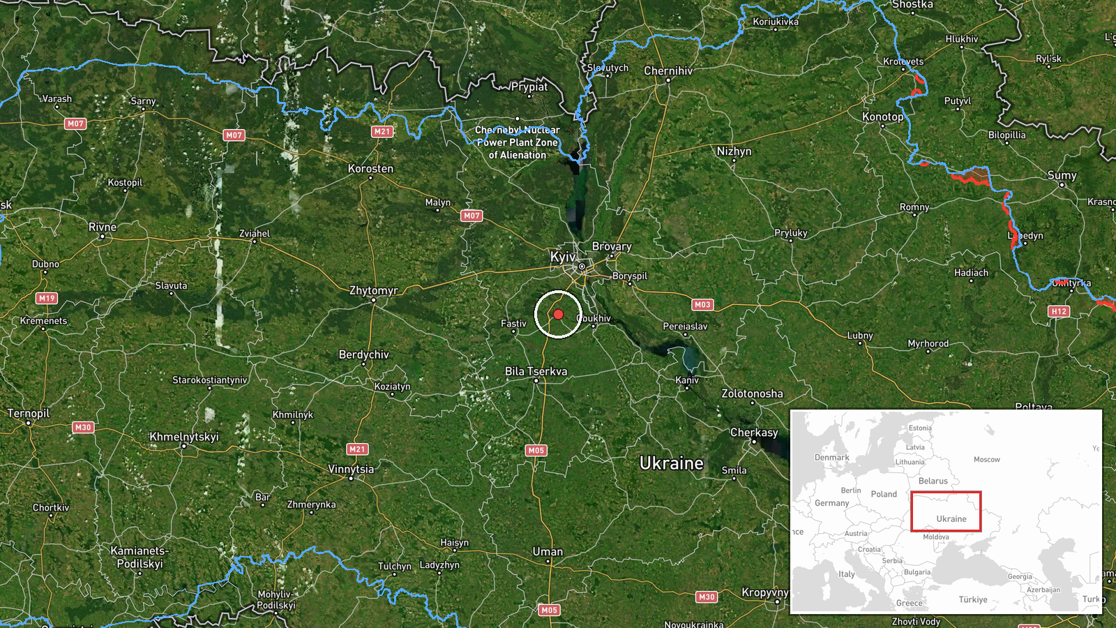
The coordinates were assigned at settlement precision, so the point marks the town of Vasylkiv rather than a specific facility, and the location confidence is rated high. Vasylkiv lies in Kyiv Oblast, southwest of central Kyiv, in relatively flat terrain typical of the region. Surrounding features include farmland, wooded belts, and river valleys common across the Kyiv area. The exact track of the drone within the district is not given in the data.
Related events nearby
- Ukrainian air monitoring: 1 Russian Shahed-type drone heading toward Vasylkiv.2026-10-16 14:30 UTC · Drone Transit · Vasylkiv, Ukraine
- Ukrainian air monitoring: 1 Russian jet-powered Shahed (Geran-3) drone from northern Kyiv Oblast toward Vasylk2026-10-15 17:31 UTC · Drone Transit · Vasylkiv, Ukraine
- Ukrainian air monitoring: 2+ Russian jet-powered Shahed (Geran-3) drones passing south of Kyiv, heading west.2026-10-16 02:16 UTC · Drone Transit · south of Kyiv, Ukraine
- Ukrainian air monitoring: 1 Russian jet-powered Shahed (Geran-3) drone heading toward Vyshneve.2026-10-16 02:20 UTC · Drone Transit · Vyshneve, Ukraine
- Ukrainian air monitoring: 1 Russian jet-powered Shahed (Geran-3) drone heading toward Obukhiv.2026-10-15 17:42 UTC · Drone Transit · Obukhiv, Ukraine
▶ View this event on the live map

Intel Mapper aggregates open-source reports from monitored Telegram and X channels, geolocates them, cross-checks duplicates across sources and assigns a confidence score. Entries are updated as new confirmations arrive. Read how we verify events.