Shahed-type drone reported passing Tulchyn en route to Vinnytsia, per Ukrainian air monitoring
What happened
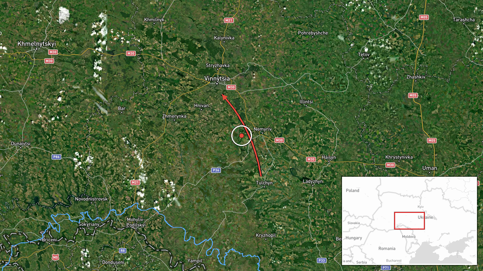
Ukrainian air-monitoring channel @kpszsu reported at 19:59 UTC on 16 October 2026 that one Russian Shahed-type drone was passing Tulchyn in the direction of Vinnytsia. The original Ukrainian text is terse, roughly 'UAV past Tulchyn toward Vinnytsia,' preceded by a marker emoji. The report describes a transit only; it mentions no impact, damage, casualties, or interception. It gives no altitude, speed, or confirmed position at posting, so the drone's exact track is not established. The map pin sits on Vinnytsia city, the named destination, rather than on Tulchyn.
Context and assessment
Vinnytsia lies in central-west Ukraine, and its oblast sits on a path that drones moving from the south and east toward western and northern Ukraine have repeatedly crossed. The related entries show this on a single day. At 12:28 UTC a jet-powered Shahed-type drone, described in Ukrainian reporting as a Geran-3, was logged moving from Odesa Oblast toward Vinnytsia Oblast. Between 14:31 and 14:40 UTC further drones were reported over or past the oblast, some heading west and one toward Zhytomyr Oblast. At 18:36 UTC another drone was reported heading toward Vinnytsia, and the Tulchyn report followed about 80 minutes later. The sequence points to sustained traffic through the oblast rather than one stray aircraft. Operationally, such transit reports may indicate routing along western corridors toward targets beyond Vinnytsia, or overflight during longer flights. A transit alert alone does not establish an intended target in the city, and the data does not show any impact. The cluster is best read as recurring airspace use.
Sources and confidence
Only one channel, Telegram @kpszsu, carries this report, so there is no independent cross-confirmation. The confidence score of 8.0 reflects a specific time, direction, and official-style air-monitoring format, offset by single-source status. The related entries come from the same feed and show a busy drone pattern across the oblast, but do not independently confirm this track. Confidence would rise with a second monitoring source or radar-based track reporting, and fall if later updates contradicted the direction or identified a different object.
Location
The coordinates correspond to Vinnytsia city, the named destination, and are marked at settlement precision with high location confidence. The pin is not placed at Tulchyn, which the message uses only as a waypoint, so the exact drone position is approximate. Vinnytsia sits on the Southern Bug River in central-west Ukraine, and the surrounding oblast is largely agricultural with rolling terrain.
Related events nearby
- Ukrainian air monitoring: 1 Russian Shahed-type drone heading toward Vinnytsia.2026-10-16 20:12 UTC · Drone Transit · Vinnytsia, Ukraine
- Ukrainian air monitoring: 1 Russian Shahed-type drone heading toward Vinnytsia.2026-10-16 18:36 UTC · Drone Transit · Vinnytsia, Ukraine
- Ukrainian air monitoring: 1 Russian Shahed-type drone passing Vinnytsia Oblast, heading west; 1 Russian Shahed2026-10-16 14:40 UTC · Drone Transit · Vinnytsia Oblast, Ukraine
- Ukrainian air monitoring: 2+ Russian jet-powered Shahed (Geran-3) drones passing Vinnytsia Oblast, heading wes2026-10-16 14:32 UTC · Drone Transit · Vinnytsia Oblast, Ukraine
- Ukrainian air monitoring: 1 Russian jet-powered Shahed (Geran-3) drone over Vinnytsia.2026-10-16 14:31 UTC · Drone Transit · Vinnytsia, Ukraine
▶ View this event on the live map

Intel Mapper aggregates open-source reports from monitored Telegram and X channels, geolocates them, cross-checks duplicates across sources and assigns a confidence score. Entries are updated as new confirmations arrive. Read how we verify events.