Ukrainian air monitoring reports jet-powered Shahed drones heading toward Vinnytsia
What happened
Ukrainian air monitoring reported at about 02:41 UTC on 17 October 2026 that two or more Russian jet-powered Shahed drones, described as Geran-3 type, were heading toward Vinnytsia. The message was posted to the Telegram channel @kpszsu, which is commonly associated with Ukrainian air monitoring reporting. The original Ukrainian wording, 'Реактивні БпЛА курсом на Вінницю', translates literally as 'jet-powered UAVs on course to Vinnytsia.' The text does not state a launch site, a confirmed target, or any impact. No casualties, damage, or interceptions are mentioned in the source. The entry is logged as a drone transit with settlement-level location precision for Vinnytsia.
Context and assessment
Vinnytsia is a major regional city in west-central Ukraine and the administrative centre of Vinnytsia Oblast. Its position between the front-facing east and the western part of the country means drones moving through the oblast can be on routes toward several destinations, so a track toward the city does not on its own indicate a strike target. The related events show a sequence over roughly twelve hours. At 14:32 on 16 October, two or more Geran-3 drones were reported passing Vinnytsia Oblast heading west. At 14:40, one Shahed-type drone was reported passing the oblast heading west, while another was heading toward Zhytomyr Oblast. Later reports at 18:36 and 20:12 described single drones heading toward Vinnytsia, and at 19:59 a drone was reported passing Tulchyn, southeast of the city, on the same approach. This report continues the pattern. Operationally, repeated tracks toward the same city may indicate a sustained transit corridor, a deliberate focus on the area, or attempts to stretch air defence through multiple small groups. The data cannot distinguish these possibilities. The jet-powered Geran-3 variant is generally faster than the piston-engine Shahed types, which may reduce warning time for populated areas.
Sources and confidence
The entry rests on a single Telegram channel, and the source count is one. The confidence score of 8.0 reflects the specific wording, the stated drone type, and the direction of travel, together with the monitoring-style format of the message. It is held below the top of the scale because no second channel, official statement, or independent track confirmation appears in the data. Confidence would rise with corroboration from other Ukrainian official channels, regional military administration statements, or independent flight-tracking analysis showing the same track. It would fall if the track failed to materialise, if the report was amended or retracted, or if other sources contradicted the drone type or direction.
Location
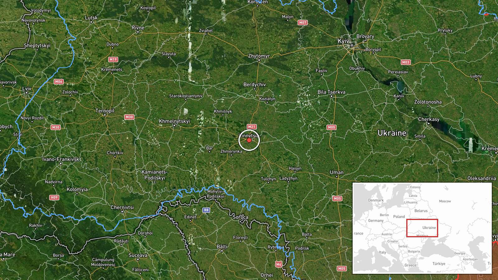
The location is recorded at settlement precision, with high location confidence, centred on Vinnytsia city at approximately 49.23 N, 28.47 E. This is a city-level point rather than a specific facility, and the report itself names only the city. Vinnytsia lies on the Southern Bug river, in the rolling Podolian Upland of west-central Ukraine. Tulchyn, referenced in one related event, lies to the southeast within the same oblast.
Related events nearby
- Ukrainian air monitoring: 1 Russian Shahed-type drone heading toward Vinnytsia.2026-10-16 20:12 UTC · Drone Transit · Vinnytsia, Ukraine
- Ukrainian air monitoring: 1 Russian Shahed-type drone passing Tulchyn, heading toward Vinnytsia.2026-10-16 19:59 UTC · Drone Transit · Vinnytsia, Ukraine
- Ukrainian air monitoring: 1 Russian Shahed-type drone heading toward Vinnytsia.2026-10-16 18:36 UTC · Drone Transit · Vinnytsia, Ukraine
- Ukrainian air monitoring: 1 Russian Shahed-type drone passing Vinnytsia Oblast, heading west; 1 Russian Shahed2026-10-16 14:40 UTC · Drone Transit · Vinnytsia Oblast, Ukraine
- Ukrainian air monitoring: 2+ Russian jet-powered Shahed (Geran-3) drones passing Vinnytsia Oblast, heading wes2026-10-16 14:32 UTC · Drone Transit · Vinnytsia Oblast, Ukraine
▶ View this event on the live map

Intel Mapper aggregates open-source reports from monitored Telegram and X channels, geolocates them, cross-checks duplicates across sources and assigns a confidence score. Entries are updated as new confirmations arrive. Read how we verify events.