Single Shahed-type drone reported transiting western Chernihiv Oblast heading south
What happened
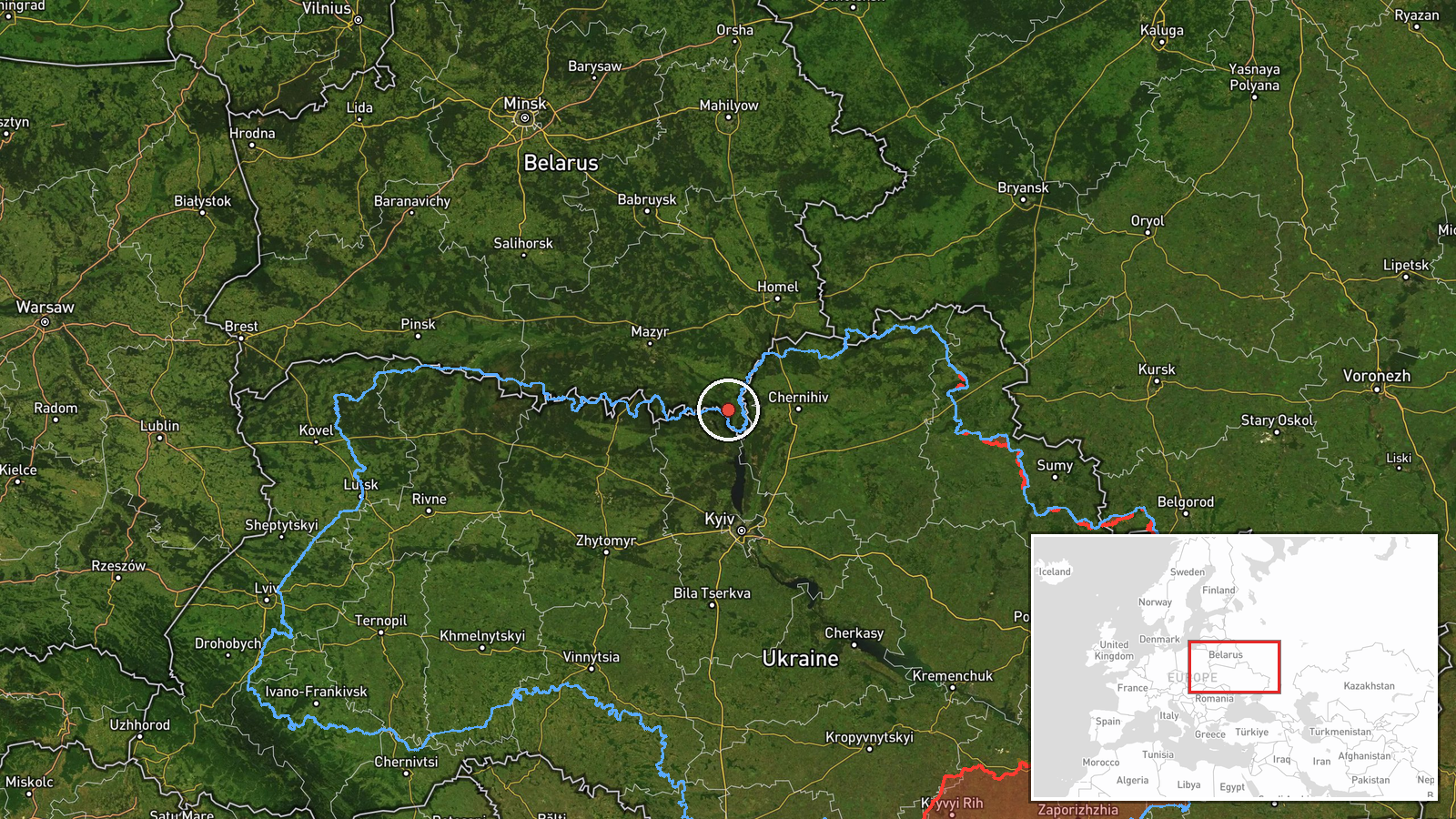
Ukrainian air monitoring reported one Russian Shahed-type drone passing through western Chernihiv Oblast on 17 October 2026 at about 04:25 UTC, moving on a southern heading. The original Ukrainian-language post, relayed on Telegram by the channel @kpszsu, describes an unmanned aerial vehicle in western Chernihiv region on a southern course. It names no settlement, altitude, or impact. The report is a transit notice rather than a strike report: it records a track through the area, not any detonation, damage, or casualties. Because the post names a region instead of a place, the event is logged at regional precision. The platform lists the attack type as drone transit and the attributed actor as Russia, following the wording of the monitoring message.
Context and assessment
Western Chernihiv Oblast appears repeatedly in the surrounding reports, so this track is best read as part of a wider pattern rather than an isolated sighting. On 16 October, monitoring messages described Shahed-type drones moving from northern Chernihiv Oblast toward Slavutych, including a jet-powered Geran-3 at 06:54 UTC and a group of three or more at 10:40 UTC. Early on 17 October, a Geran-3 was tracked west of Chernihiv heading south at 01:22 UTC, and another was reported heading toward Honcharivske at 03:36 UTC. Together these reports suggest a sustained series of transits through the Chernihiv corridor, which lies between the Belarusian border and the approaches to Kyiv. Operationally, repeated passage along this axis may indicate routing of long-range drones toward targets further south, or simply the flight paths used on a given night. The data alone cannot distinguish between these. A separate report at 04:26 UTC places a drone passing northern Kyiv Oblast heading west, but that is a distinct track and should not be assumed to be the same object.
Sources and confidence
All information comes from a single Telegram channel, @kpszsu, which relays Ukrainian air-monitoring messages. No second independent channel, wire service, or open-source tracker in the current dataset confirms this specific track, so cross-confirmation is absent. The confidence score of 8.0 reflects a credible, timestamped official-style source, offset by the lack of a second source and the absence of a precise location. Confidence would rise if independent monitors or regional authorities corroborated the track, or if the flight path matched tracking data. It would fall if the report were corrected or withdrawn. The record is currently uncorrected.
Location
The location is a regional approximation. The coordinates, 51.49 N and 30.34 E, fall in western Chernihiv Oblast rather than at a named settlement, and the source gave no place name, so the precision is recorded as region with low location confidence. The area lies in northern Ukraine close to the Belarusian border, within the wooded and marshy Polissia zone, with the Desna river system nearby. Treat the pin as a broad marker, not a flight-path point.
Related events nearby
- Ukrainian air monitoring: 3+ Russian Shahed-type drones from northern Chernihiv Oblast toward Slavutych.2026-10-16 10:40 UTC · Drone Transit · Slavutych, Ukraine
- Ukrainian air monitoring: 1 Russian jet-powered Shahed (Geran-3) drone from northern Chernihiv Oblast toward S2026-10-16 06:54 UTC · Drone Transit · Slavutych, Ukraine
- Ukrainian air monitoring: 1 Russian jet-powered Shahed (Geran-3) drone heading toward Honcharivske.2026-10-17 03:36 UTC · Drone Transit · Honcharivske, Ukraine
- Ukrainian air monitoring: one Russian jet-powered Shahed (Geran-3) drone tracked west of Chernihiv, heading so2026-10-17 01:22 UTC · Drone Transit · West of Chernihiv, Chernihiv Oblast, Ukraine
- Ukrainian air monitoring: 1 Russian Shahed-type drone passing northern Kyiv Oblast, heading west.2026-10-17 04:26 UTC · Drone Transit · northern Kyiv Oblast, Ukraine
▶ View this event on the live map

Intel Mapper aggregates open-source reports from monitored Telegram and X channels, geolocates them, cross-checks duplicates across sources and assigns a confidence score. Entries are updated as new confirmations arrive. Read how we verify events.