Ukrainian air monitoring reports one Shahed-type drone heading toward Chernihiv
What happened
Ukrainian air monitoring, relayed through the Telegram channel @kpszsu, reported one Russian Shahed-type drone heading toward Chernihi, the regional capital in northern Ukraine. The report is timestamped 17 October 2026 at 06:55 UTC. The original Ukrainian-language post, which includes a drone emoji, describes a UAV moving toward Chernihiv from the west. This is standard phrasing in air-alert updates and signals a tracked flight path rather than a confirmed strike. The post does not mention impacts, damage, casualties, or interception. The attribution to Russia and the Shahed-type designation reflect the channel's own identification and are not independently verified in this record. The entry is a single-source report with no separate confirmation at the time of logging.
Context and assessment
Chernihiv sits in the north of Ukraine, close to the Belarus border, and it has repeatedly appeared on air-monitoring feeds as a point on drone routes heading toward or past the city. The related events in this record show a steady sequence over roughly a day. On 16 October at 10:21 UTC, monitoring reported three or more Shahed-type drones heading toward Chernihiv. Early on 17 October, two or more were reported at 00:08, and a jet-powered Geran-3 was tracked west of the city heading south at 01:22. Another Geran-3 was reported heading toward Sedniv at 00:39, a settlement in the same northern corridor. The 03:24 report of a single drone toward Chernihiv fits this pattern of smaller, more frequent tracks following larger groups. Operationally, repeated single-drone tracks in one area may indicate routing toward targets elsewhere, reconnaissance of air defence coverage, or the use of decoys alongside more capable munitions. Such an interpretation remains a hypothesis; the feed alone does not show intent or the final destination of any drone.
Sources and confidence
This event rests on one Telegram channel, @kpszsu, which posts Ukrainian air-monitoring updates. The confidence score of 8.0 reflects that the channel is an established official-style feed with a consistent format, and that this report aligns in timing and direction with several related entries. It is still a single source with no independent confirmation logged. Confidence would rise with corroboration from other monitoring channels, regional military administration statements, or reports of an impact or interception in the area. It would fall if the track were later revised, if the channel corrected or retracted the post, or if nearby feeds did not register the same drone.
Location
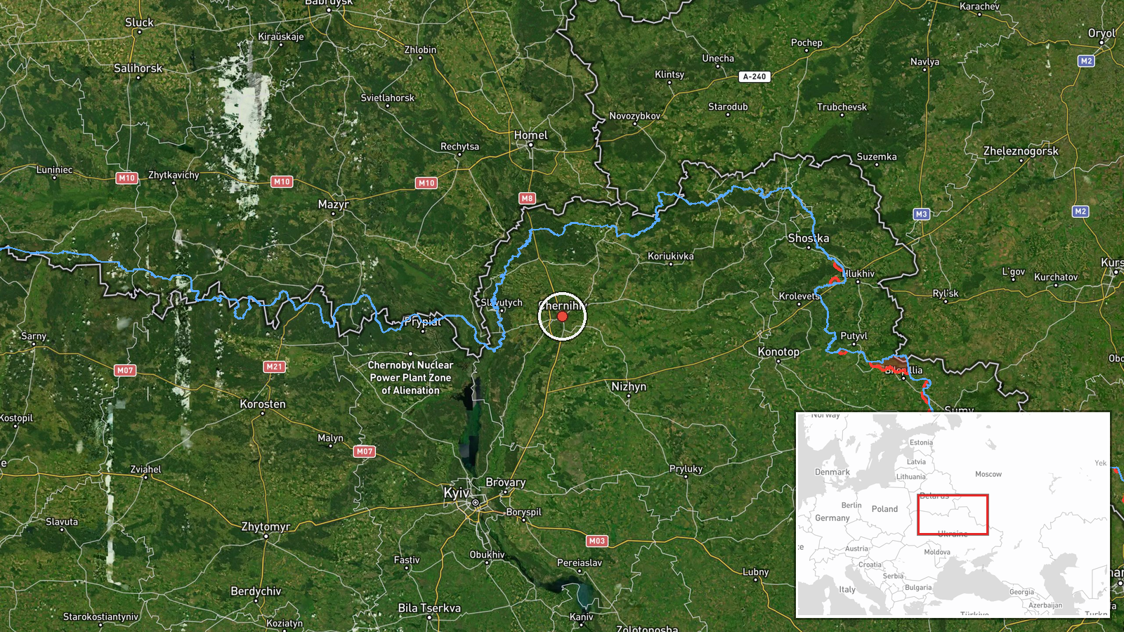
The location is recorded at settlement level, placed at the centre of Chernihiv city at approximately 51.49 N, 31.29 E, with high location confidence. Because the report describes a drone heading toward the city rather than an impact, the point marks the reported destination area and not a specific facility. Chernihiv lies on the Desna River in northern Ukraine, with wooded and marshy terrain to the north and west that extends toward the Belarus frontier.
Related events nearby
- Ukrainian air monitoring: 1 Russian Shahed-type drone heading toward Chernihiv.2026-10-17 03:24 UTC · Drone Transit · Chernihiv, Ukraine
- Ukrainian air monitoring: 2+ Russian Shahed-type drones heading toward Chernihiv.2026-10-17 00:08 UTC · Drone Transit · Chernihiv, Ukraine
- Ukrainian air monitoring: 3+ Russian Shahed-type drones heading toward Chernihiv.2026-10-16 10:21 UTC · Drone Transit · Chernihiv, Ukraine
- Ukrainian air monitoring: one Russian jet-powered Shahed (Geran-3) drone tracked west of Chernihiv, heading so2026-10-17 01:22 UTC · Drone Transit · West of Chernihiv, Chernihiv Oblast, Ukraine
- Ukrainian air monitoring: 1 Russian jet-powered Shahed (Geran-3) drone heading toward Sedniv; 1 Russian jet-po2026-10-17 00:39 UTC · Drone Transit · Sedniv, Ukraine
▶ View this event on the live map

Intel Mapper aggregates open-source reports from monitored Telegram and X channels, geolocates them, cross-checks duplicates across sources and assigns a confidence score. Entries are updated as new confirmations arrive. Read how we verify events.