Single Shahed-type drone reported heading toward Borodianka, Kyiv Oblast, from the north
What happened
Ukrainian air monitoring reported one Russian Shahed-type drone heading toward Borodianka, a town in Kyiv Oblast, at 07:28 UTC on 17 October 2026. The original Ukrainian-language post, which reads roughly as 'UAV toward Borodianka from the north,' gives a direction of approach but no altitude, speed, or onward track. The report describes a drone in transit, not a confirmed strike, and the source states no damage, casualties, or interception. The alert was published on Telegram by the channel @kpszsu, which is associated with Ukraine's Air Force. The event is logged as a Drone Transit with Russia as the attributed actor, and no origin location was recorded.
Context and assessment
Borodianka is a small town northwest of Kyiv that became widely known in 2022, when it was occupied and later found to contain civilian deaths and heavy destruction. Its name remains a reference point in reporting on the northern Kyiv region, and any drone activity near it tends to draw attention. Earlier on the same morning, related monitoring entries describe a sequence of Shahed-type drones moving through Chernihiv Oblast, the Vyshhorod district, Kyiv, Hlevakha, Moshchun and Kyiv Oblast between roughly 00:28 and 06:39 UTC. One of these reportedly came from Belarus, and another was identified as a jet-powered Geran-3 variant. Taken together, the entries suggest several drones crossing the northern approaches to the capital over several hours, with individual tracks reported as they moved. Operationally, a single track toward a named settlement most plausibly reflects a drone following a planned route rather than a confirmed aim point. The pattern could indicate attempts to saturate air defense coverage, probing of routes, or diversion, but the data alone cannot distinguish between these explanations.
Sources and confidence
The event rests on a single Telegram channel, @kpszsu, with no second channel, independent monitor, or imagery cited in the data. The confidence score of 8.0 reflects the official-looking origin of the post and its consistency with a dense cluster of same-morning drone reports in the same area. It is held below the top of the scale because of the single-source status and the lack of any follow-up. Confidence would rise with corroboration from other air monitoring channels, statements from Kyiv Oblast authorities, or local reports of sound, debris or impact. It would fall if the alert were updated, withdrawn or not followed by any further reporting.
Location
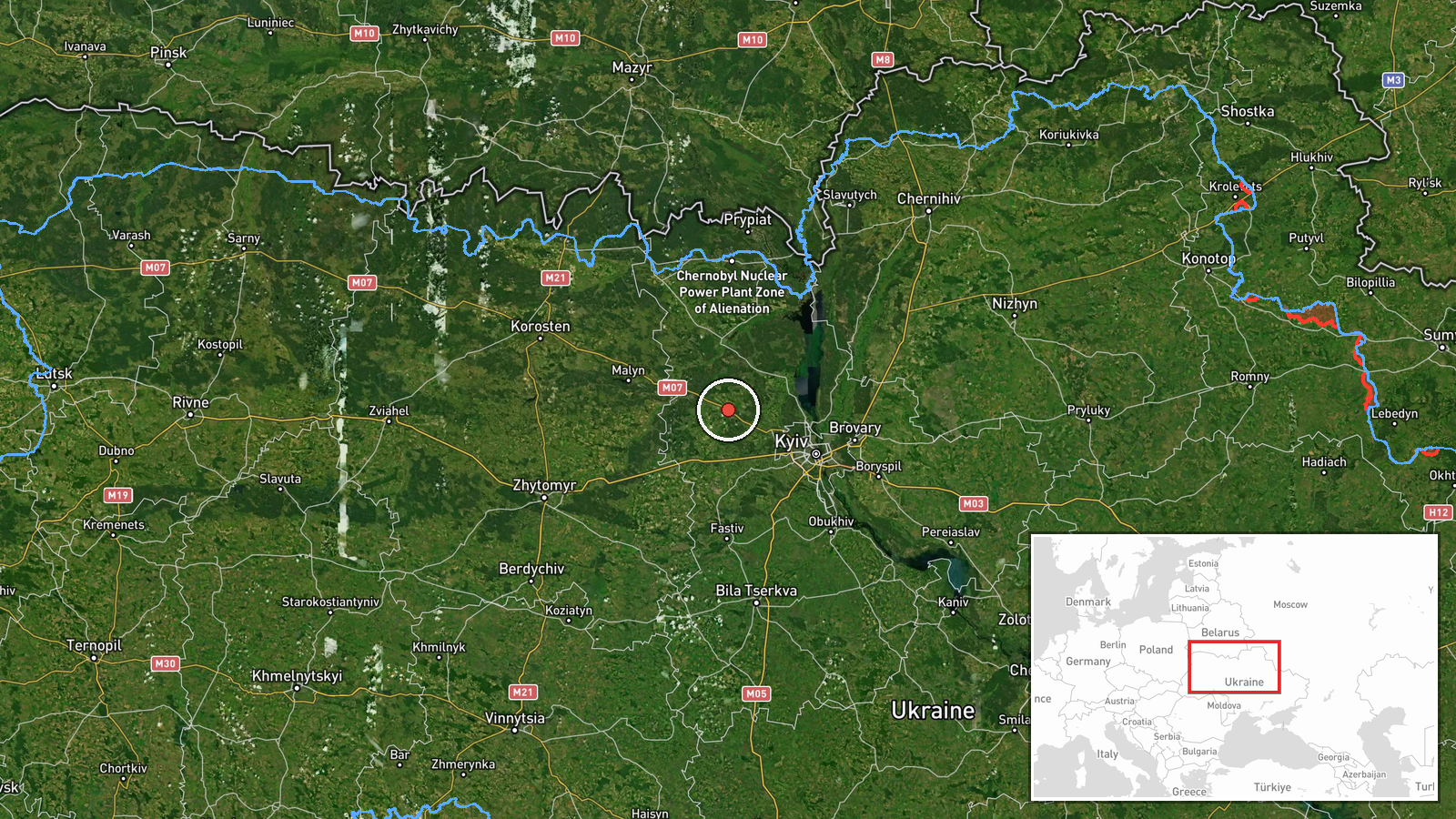
The location is assigned at settlement level, with coordinates of approximately 50.643 N, 29.923 E for Borodianka. The location confidence is rated high because the report names the town directly, though the coordinates mark the settlement rather than any specific site. Borodianka lies in Kyiv Oblast northwest of the capital. The surrounding terrain is low and rolling, with river valleys, forest belts and farmland typical of the northern approaches to Kyiv, which are frequently used by drones moving toward the city.
Related events nearby
- Ukrainian air monitoring: 1 Russian Shahed-type drone over Moshchun.2026-10-17 04:25 UTC · Drone Transit · Moshchun, Ukraine
- Ukrainian air monitoring: 1 Russian jet-powered Shahed (Geran-3) drone from Chernihiv Oblast toward Vyshhorod 2026-10-17 00:28 UTC · Drone Transit · Vyshhorod district, Ukraine
- Ukrainian air monitoring: 1 Russian Shahed-type drone from Belarus toward Kyiv Oblast.2026-10-17 06:39 UTC · Drone Transit · Kyiv Oblast, Ukraine
- Ukrainian air monitoring: 1 Russian Shahed-type drone heading toward Kyiv; 1 Russian jet-powered Shahed (Geran2026-10-17 04:07 UTC · Drone Transit · Kyiv, Ukraine
- Ukrainian air monitoring: 3+ Russian Shahed-type drones from western Chernihiv Oblast toward Kyiv Oblast; 1 Ru2026-10-17 03:59 UTC · Drone Transit · Kyiv Oblast, Ukraine
▶ View this event on the live map

Intel Mapper aggregates open-source reports from monitored Telegram and X channels, geolocates them, cross-checks duplicates across sources and assigns a confidence score. Entries are updated as new confirmations arrive. Read how we verify events.