Single Shahed-type drone reported heading toward Novyi Buh, Mykolaiv Oblast
What happened
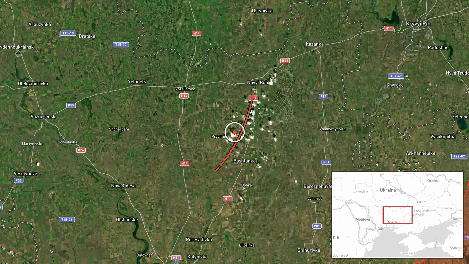
Ukrainian air monitoring reported a single Russian Shahed-type drone moving toward Novyi Buh, a settlement in Mykolaiv Oblast, at about 13:24 UTC on 17 October 2026. The report was posted on the Telegram channel @kpszsu. Its original Ukrainian wording, 'Ударні БпЛА на Новий Буг на Миколаївщині', describes strike drones bound for Novyi Buh, which frames the item as a drone in flight rather than a confirmed impact. The post does not state whether the drone struck anything, was intercepted, or caused casualties. The event is classified as a drone transit, so the report concerns the aircraft's movement rather than any outcome on the ground.
Context and assessment
Novyi Buh is a small town, but its position in the Southern Buh valley places it within a corridor of towns and infrastructure that Russian long-range drones have repeatedly crossed in this region. The same day's record shows several single-drone reports across the Mykolaiv and Kryvyi Rih area. A drone was logged heading toward Kryvyi Rih at 01:47, passing Bereznehuvate heading north at 03:24, and moving through the Bashtanka district westward at 11:08. Further reports placed a drone heading toward Bashtanka at 11:13 and passing Bashtanka toward Nova Odesa at 12:09, before the Novyi Buh report at 13:24. Because the data do not indicate whether these entries describe separate aircraft or repeated tracking of one or more drones, the sequence cannot be read as a confirmed count of launches. Operationally, a run of single-drone tracks across several towns is consistent with routine long-range flights, with reconnaissance, or with attempts against industrial or logistics nodes, but the record alone does not establish which. The cluster is best understood as evidence of sustained aerial activity over this sector during the day.
Sources and confidence
The report rests on one channel, the Telegram account @kpszsu, which is widely associated with Ukraine's Air Force monitoring output. No independent outlet, local official, or second monitoring account is listed as confirming the Novyi Buh item. The confidence score of 8.0 reflects the official-style origin of the channel and the consistency of the surrounding same-day reports, while the single-source status keeps it below the top of the scale. Confidence would rise with corroboration from local authorities, impact or debris imagery, or a second monitoring feed matching the track. It would fall if the surrounding tracks were later shown to be duplicates or if the channel issued a correction.
Location
The location is recorded at settlement precision, with coordinates near 47.69 N, 32.51 E, and location confidence rated high. The point most likely reflects the town center rather than any specific facility, since the report names only the settlement. Novyi Buh lies in Mykolaiv Oblast on the steppe of southern Ukraine, where the land is flat and open and the Southern Buh river runs through the wider region. Kryvyi Rih lies to the northeast, and several other towns in the day's reports sit along the same general axis.
Related events nearby
- Ukrainian air monitoring: 1 Russian Shahed-type drone heading toward Bashtanka.2026-10-17 11:13 UTC · Drone Transit · Bashtanka, Ukraine
- Ukrainian air monitoring: 1 Russian Shahed-type drone passing Bashtanka district, heading west.2026-10-17 11:08 UTC · Drone Transit · Bashtanka district, Ukraine
- Ukrainian air monitoring: 1 Russian Shahed-type drone passing Bereznehuvate, heading north.2026-10-17 03:24 UTC · Drone Transit · Bereznehuvate, Ukraine
- Ukrainian air monitoring: 1 Russian Shahed-type drone passing Bashtanka, heading toward Nova Odesa.2026-10-17 12:09 UTC · Drone Transit · Nova Odesa, Ukraine
- Ukrainian air monitoring: 1 Russian Shahed-type drone heading toward Kryvyi Rih.2026-10-17 01:47 UTC · Drone Transit · Kryvyi Rih, Ukraine
▶ View this event on the live map

Intel Mapper aggregates open-source reports from monitored Telegram and X channels, geolocates them, cross-checks duplicates across sources and assigns a confidence score. Entries are updated as new confirmations arrive. Read how we verify events.