Jet-powered Shahed-type drone reported passing Hradyzk, Poltava region, heading northwest
What happened
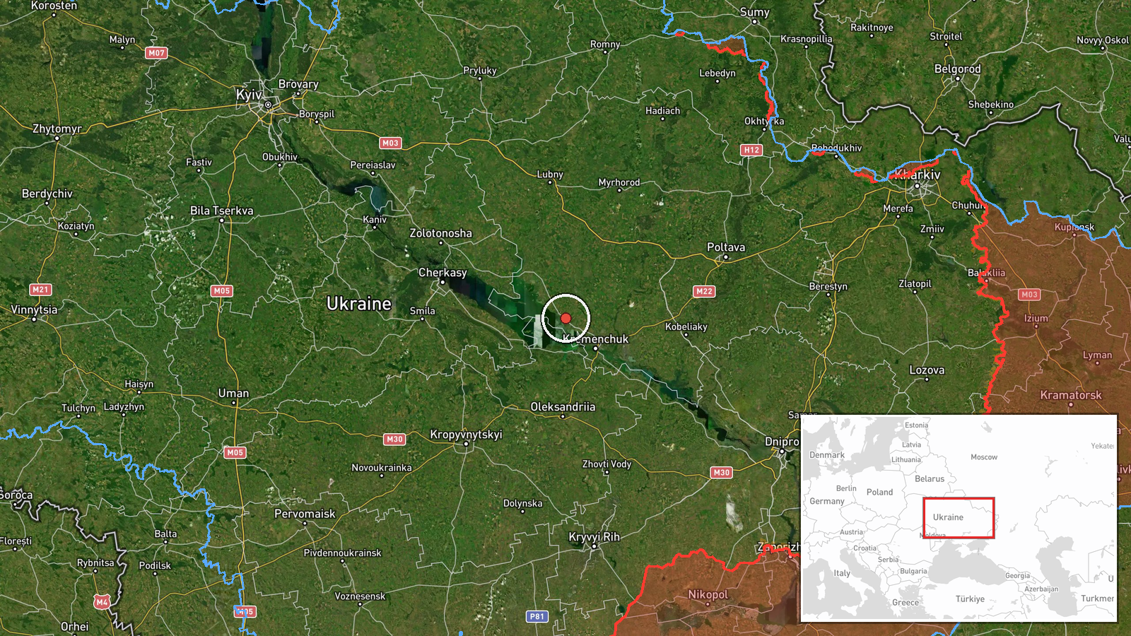
The Telegram channel @kpszsu, which carries Ukrainian air-monitoring updates, reported at 13:42 UTC on 17 October 2026 that one Russian jet-powered Shahed (Geran-3) drone was passing Hradyzk and moving in a northwest direction. The original Ukrainian wording describes a jet-type unmanned aerial vehicle passing the town, using the place name Градизьк. The post reports no damage, casualties, or interception, and it does not state where the drone was launched. This is a transit notice rather than a strike report, meaning the drone was tracked in flight over the settlement, not confirmed to have hit anything. The event carries a single source and a confidence score of 8.0.
Context and assessment
Hradyzk lies in Poltava Oblast in central Ukraine, a region that appears often in air-alert reporting when drones move across the country. The related events from the same day show a cluster of transit notices across this area: Khorol and Kozelshchyna in Poltava Oblast, Hlobyne in the same oblast, Kremenchuk farther south along the Dnipro, and Chyhyryn in Cherkasy Oblast. Several of these entries describe the same jet-powered Geran-3 type, and one describes a drone traveling from Mykolaiv Oblast, though that entry is truncated in the data. Taken together, the reports suggest that multiple drones were tracked moving through central Ukraine within roughly twelve hours. This may indicate that drones were being routed along a corridor and followed by air monitoring as they crossed several oblasts, rather than that each was aimed at a single target. Transit reports record movement, not impact, so the pattern points to route tracking but does not by itself reveal intended targets. Later reports of explosions or damage in the area would be needed to judge whether any of these tracks ended in a strike.
Sources and confidence
The report was published only on the Telegram channel @kpszsu, which relays Ukrainian Air Force air-monitoring updates, and no other outlet is attached to this event. No independent source has been linked to confirm the sighting. The confidence score of 8.0 reflects that the channel is an official and generally reliable air-alert source, but the event rests on one post without corroboration, and the drone was observed in transit rather than confirmed through debris or impact. Confidence would rise with a second official or regional report, corroborating air-alert data, or local reporting of debris. It would fall if the post were corrected or if later statements contradicted the track or location.
Location
The location is set at settlement level for Hradyzk in Poltava Oblast, with coordinates of approximately 49.24 N, 33.14 E and high location confidence. The point marks the town rather than the drone's exact position when the post was made, so the precise track is unknown. Hradyzk sits in the farmland and steppe-forest zone of central Ukraine, an area of flat terrain and agricultural land. The report names no specific facility or infrastructure site, so no installation is attached to this point.
Related events nearby
- Ukrainian air monitoring: 1 Russian jet-powered Shahed (Geran-3) drone heading toward Hlobyne.2026-10-17 00:06 UTC · Drone Transit · Hlobyne, Ukraine
- Ukrainian air monitoring: 1 Russian Shahed-type drone heading toward Kremenchuk.2026-10-16 18:29 UTC · Drone Transit · Kremenchuk, Ukraine
- Ukrainian air monitoring: 1 Russian Shahed-type drone heading toward Chyhyryn; 1 Russian jet-powered Shahed (G2026-10-17 01:57 UTC · Drone Transit · Chyhyryn, Ukraine
- Ukrainian air monitoring: 2+ Russian jet-powered Shahed (Geran-3) drones passing Kozelshchyna, heading northwe2026-10-17 11:55 UTC · Drone Transit · Kozelshchyna, Ukraine
- Ukrainian air monitoring: 1 Russian Shahed-type drone from Poltava Oblast toward Khorol.2026-10-17 11:31 UTC · Drone Transit · Khorol, Ukraine
▶ View this event on the live map

Intel Mapper aggregates open-source reports from monitored Telegram and X channels, geolocates them, cross-checks duplicates across sources and assigns a confidence score. Entries are updated as new confirmations arrive. Read how we verify events.