One Russian Shahed-type drone reported heading toward Novhorod-Siverskyi, Ukraine
What happened
Ukrainian air monitoring reported one Russian Shahed-type drone moving toward Novhorod-Siverskyi on 17 October 2026, with the entry logged at 14:06 UTC. The original Ukrainian-language post, published on the Telegram channel @kpszsu, reads as a strike drone approaching the town 'from the north' ('Ударний БпЛА на Новгород-Сіверський з півночі'). The post does not describe impact, damage, casualties, or interception, and no follow-up confirmation has been identified in the data. The event is classed as a drone transit, meaning the report concerns the aircraft's movement rather than a confirmed strike. The attribution to Russia reflects the type of drone named in the report.
Context and assessment
Novhorod-Siverskyi lies in northeastern Chernihiv Oblast, close to the Russian border, and the wider area has seen repeated drone and missile activity in recent days. The related events show a sustained pattern across the North Slobozhansky axis and the Sumy and Chernihiv border region. Earlier on the same day, a drone was reported heading from northern Sumy Oblast toward Hlukhiv, and a separate jet-powered Shahed-type drone, described as a Geran-3, was logged toward Koryukivka. A Banderol mini cruise missile was reported toward Baturyn at 11:45, and the Ukrainian General Staff reported eleven combat clashes on the same axis overnight into 16 October. Taken together, these reports suggest a pattern of multiple aerial systems being directed across a broad northern corridor rather than at a single target. Operationally, a drone approaching from the north could indicate a route along the border, a probing approach, or an attempt to strike infrastructure in the town, but the data does not establish which of these applies.
Sources and confidence
The event rests on one source, the Telegram channel @kpszsu, which is widely associated with Ukraine's Air Force. No independent outlet or second channel in the dataset reports this specific drone, so cross-confirmation is absent. The confidence score of 8.0 reflects the official-style origin of the post, the clear identification of the drone type, and the consistency with other air monitoring reports from the same morning. It is held below the top range because the report is a transit notice without impact details and has not been corroborated. Confidence would rise with a second official or independent report, radar or interception confirmation, or local reporting of impact. It would fall if the drone was later reclassified, if the track was revised away from the town, or if the notice was withdrawn.
Location
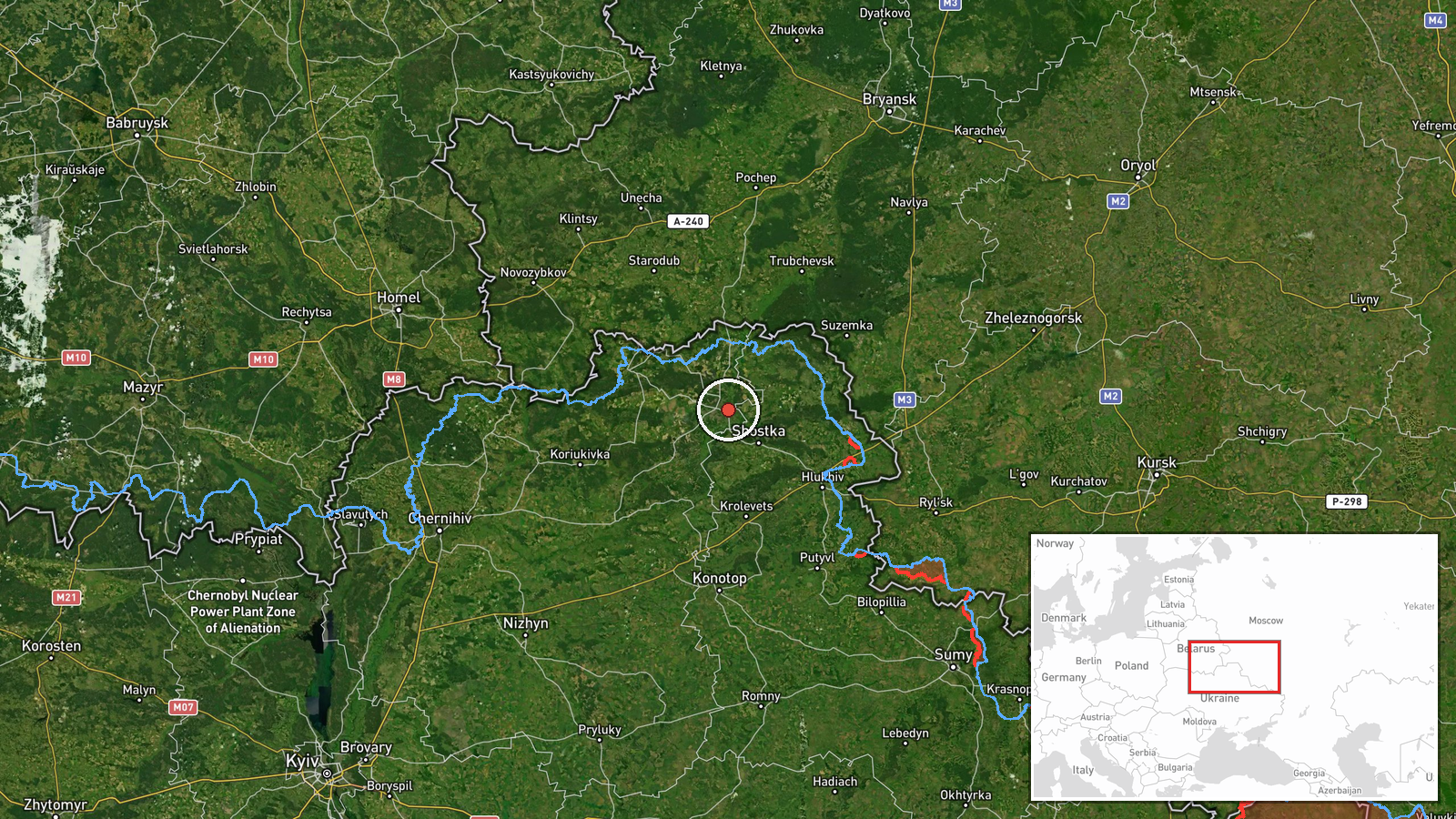
The location is recorded at settlement precision, with coordinates centered on Novhorod-Siverskyi, and the location confidence is rated high. The point corresponds to the town itself rather than a specific facility, so it marks the general target area and not a particular site. The town sits on the Desna River in a flat, wooded landscape typical of the Polissia lowlands, and it lies a short distance from the Russian frontier to the north and east. The river and surrounding floodplain are notable nearby features, along with the regional road network connecting Chernihiv and the border towns.
Related events nearby
- Ukrainian air monitoring: 2+ Russian Shahed-type drones from northern Sumy Oblast toward Hlukhiv.2026-10-17 06:46 UTC · Drone Transit · Hlukhiv, Ukraine
- Ukrainian air monitoring: 1 Russian Shahed-type drone from Sumy Oblast toward Esman.2026-10-17 15:21 UTC · Drone Transit · Esman, Ukraine
- Ukrainian General Staff reports 11 combat clashes on the North Slobozhansky axis by 22:00, including near Tovs2026-10-16 19:01 UTC · Combat · Tovstodubove, Sumy Oblast, Ukraine
- Ukrainian air monitoring: 1 Russian jet-powered Shahed (Geran-3) drone heading toward Koryukivka.2026-10-17 11:11 UTC · Drone Transit · Koryukivka, Ukraine
- Russian artillery shelled nine Sumy Oblast settlements, per Ukrainian General Staff; a Russian aviation strike2026-10-17 05:05 UTC · Artillery · Ulanove, Sumy Oblast, Ukraine
▶ View this event on the live map

Intel Mapper aggregates open-source reports from monitored Telegram and X channels, geolocates them, cross-checks duplicates across sources and assigns a confidence score. Entries are updated as new confirmations arrive. Read how we verify events.