Strike drone reported over Kamianets-Podilskyi district, heading northwest
What happened
A Ukrainian air monitoring report posted on Telegram by the channel @kpszsu states that a Russian strike drone (in the original Ukrainian, an 'udarnyi BpLA') was over Kamianets-Podilskyi district in Khmelnytskyi Oblast, western Ukraine, and was heading northwest. The timestamp is 17 October 2026 at 15:36 UTC. The post names only the district, not a settlement, and it does not describe any impact, damage, or casualties. Because the report describes a drone in transit rather than a strike that landed, the event should be read as a tracking observation of a drone's movement, not as a confirmed attack on a specific target.
Context and assessment
Kamianets-Podilskyi sits in western Khmelnytskyi Oblast on the Smotrych River and serves as a regional administrative and historic center, known for its medieval fortress. Its significance here lies less in the town itself than in its place within a short, dense sequence. Over roughly 24 hours on 16 and 17 October, related monitoring entries place single Russian Shahed-type drones over or near Dunaivtsi, Kitsman, Chortkiv, Derazhnya and Khmelnytskyi, and one jet-powered Geran-3 variant from Khmelnytskyi Oblast toward Vinkivtsi. Several of these were logged heading west, while the Kamianets-Podilskyi track is heading northwest. Taken together, the entries suggest drones moving through the Khmelnytskyi corridor on varied headings rather than a single formation. Operationally, a series of transit reports like this may indicate that drones are being routed through or around western Ukraine, or that monitoring networks are tracking several independent flights. Each entry describes a single drone, so the pattern is best read as a cluster of movements rather than evidence of an intended target in this district.
Sources and confidence
The event rests on one source: the Telegram channel @kpszsu, which is the only listed reporter. No independent outlet, official statement, or second channel appears in the provided data to corroborate the track. The assigned confidence score is 8.0, reflecting a clearly attributed monitoring post with a precise timestamp but no cross-confirmation. Confidence would rise with a second monitoring channel or an official air force statement matching the heading and time, and would fall if later reporting contradicted the direction or the drone's presence.
Location
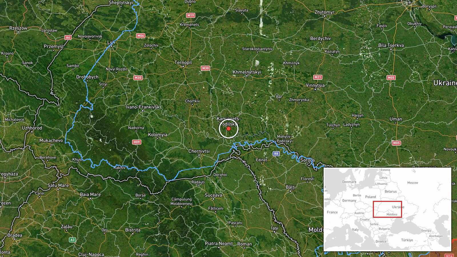
The location is approximate. The data gives only Kamianets-Podilskyi District as a whole, with a geo precision of region and no assigned location confidence, so the plotted coordinates (48.67 N, 26.58 E) mark a district-level point rather than a settlement or site. The district lies in western Khmelnytskyi Oblast, with the Smotrych River canyon and the historic old town as notable local features. The point should not be read as the drone's exact position.
Related events nearby
- Ukrainian air monitoring: 1 Russian jet-powered Shahed (Geran-3) drone from Khmelnytskyi Oblast toward Vinkivt2026-10-17 15:13 UTC · Drone Transit · Vinkivtsi, Ukraine
- Ukrainian air monitoring: 1 Russian Shahed-type drone over Kitsman.2026-10-16 22:52 UTC · Drone Transit · Kitsman, Ukraine
- Ukrainian air monitoring: 1 Russian Shahed-type drone passing Chortkiv, heading west.2026-10-16 21:03 UTC · Drone Transit · Chortkiv, Ukraine
- Ukrainian air monitoring: 1 Russian Shahed-type drone passing Derazhnya, heading toward Khmelnytskyi.2026-10-17 14:25 UTC · Drone Transit · Khmelnytskyi, Ukraine
- Ukrainian air monitoring: 1 Russian Shahed-type drone over Khmelnytskyi Oblast.2026-10-17 14:13 UTC · Drone Transit · Khmelnytskyi Oblast, Ukraine
▶ View this event on the live map

Intel Mapper aggregates open-source reports from monitored Telegram and X channels, geolocates them, cross-checks duplicates across sources and assigns a confidence score. Entries are updated as new confirmations arrive. Read how we verify events.