Jet-powered Shahed-type drone reported over Vinkivtsi, Khmelnytskyi Oblast
What happened
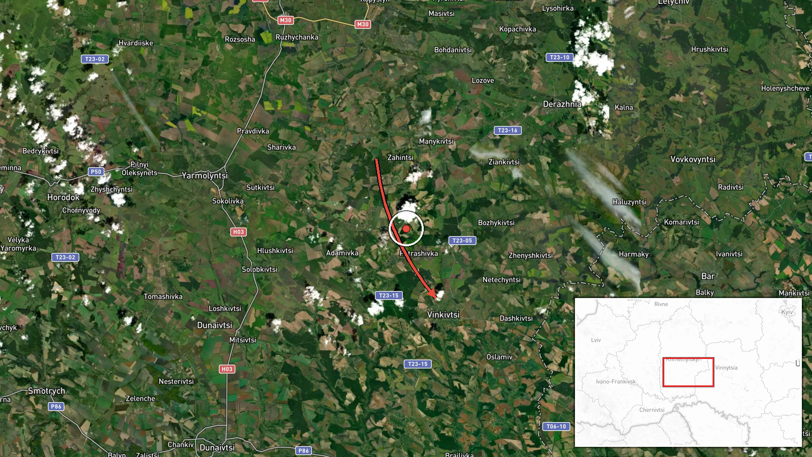
Ukrainian air monitoring reported one Russian jet-powered Shahed, identified as a Geran-3, heading toward Vinkivtsi in Khmelnytskyi Oblast at 15:13 UTC on 17 October 2026. The original post on the Telegram channel @kpszsu is terse, describing a jet-powered drone at Vinkivtsi in Khmelnytskyi Oblast without naming a target, impact point, or damage. The event is classed as a drone transit, meaning the report records a track through the area rather than a confirmed strike. The post is the only source in the dataset, so the details rest on that single monitoring message and are not independently corroborated.
Context and assessment
Khmelnytskyi Oblast sits in western-central Ukraine and has been crossed by a sequence of similar tracks in the hours before this report. Related entries show a drone over Dunaivtsi on 16 October at 16:16 UTC heading west, another passing Kopaihorod heading northwest at 03:25 UTC on 17 October, one heading toward Derazhnya at 03:27, and then a track passing Derazhnya toward Khmelnytskyi city at 14:25, followed by one over the wider oblast at 14:13. Taken together, these reports describe a single drone type moving through the oblast along several headings over roughly a day, which suggests either multiple airframes or repeated tracking of routes through the region. Vinkivtsi lies on this axis, and the 15:13 report extends the pattern of inbound and transit movements. Operationally, the sequence may indicate that drones are passing through the oblast toward targets farther west or north, or are being repositioned, but the entries do not identify destinations. Jet-powered Geran-3 variants are generally described as faster than piston-engine Shaheds, which would shorten warning windows, though that characteristic is background knowledge rather than something this post reports.
Sources and confidence
Only one channel, the Telegram account @kpszsu, carries this report in the dataset, so cross-confirmation is absent. The confidence score of 8.0 is high for a single source, reflecting the specificity of the post, its drone-type designation, and its consistency with several related tracks logged in the same oblast over the preceding day. It is nonetheless held below the top range by the lack of an independent second report. Confidence would rise if another monitoring account, a regional military administration, or a wire service confirmed the track, or if open-source flight tracking reproduced the path. It would fall if a later correction or conflicting account emerged; the record is currently uncorrected.
Location
The location is recorded at settlement precision, with coordinates of approximately 49.034 N, 27.231 E, and location confidence rated high. The point corresponds to the village of Vinkivtsi rather than a specific facility, and the post names only the settlement. Vinkivtsi lies in Khmelnytskyi Oblast in west-central Ukraine, within the Podillia region's rolling farmland and river valleys, in the wider area around Khmelnytskyi city.
Related events nearby
- Ukrainian air monitoring: 1 Russian jet-powered Shahed (Geran-3) drone heading toward Derazhnya.2026-10-17 03:27 UTC · Drone Transit · Derazhnya, Ukraine
- Ukrainian air monitoring: 1 Russian Shahed-type drone passing Kopaihorod, heading northwest.2026-10-17 03:25 UTC · Drone Transit · Kopaihorod, Ukraine
- Ukrainian air monitoring: 1 Russian Shahed-type drone passing Derazhnya, heading toward Khmelnytskyi.2026-10-17 14:25 UTC · Drone Transit · Khmelnytskyi, Ukraine
- Ukrainian air monitoring: 1 Russian Shahed-type drone over Khmelnytskyi Oblast.2026-10-17 14:13 UTC · Drone Transit · Khmelnytskyi Oblast, Ukraine
- Ukrainian air monitoring: 1 Russian Shahed-type drone heading toward Khmelnytskyi.2026-10-16 17:53 UTC · Drone Transit · Khmelnytskyi, Ukraine
▶ View this event on the live map

Intel Mapper aggregates open-source reports from monitored Telegram and X channels, geolocates them, cross-checks duplicates across sources and assigns a confidence score. Entries are updated as new confirmations arrive. Read how we verify events.