Single Russian Shahed-type drone reported heading toward Khmelnytskyi from the east
What happened
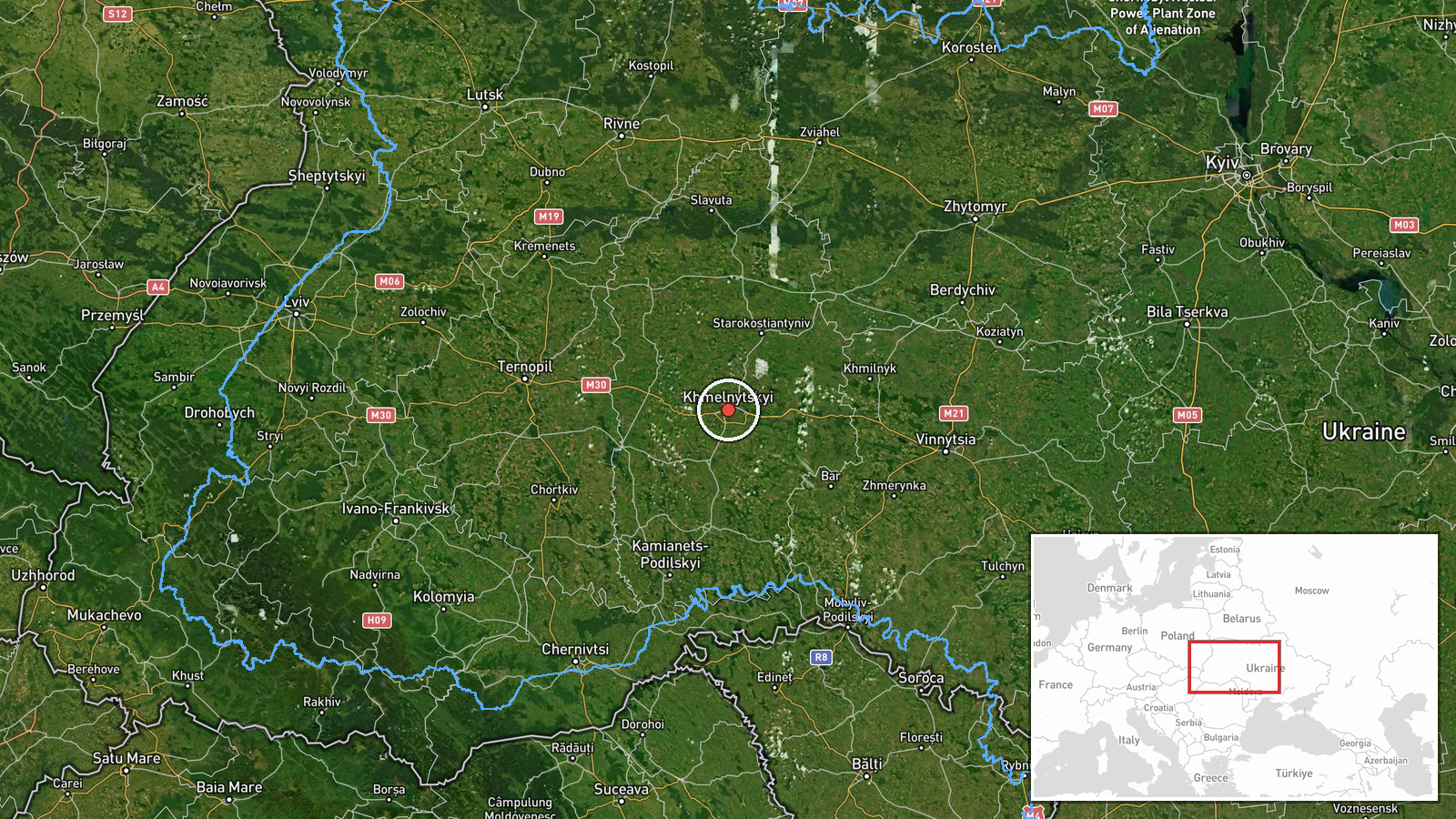
Ukrainian air monitoring posted on Telegram (@kpszsu) reported one Russian Shahed-type drone heading toward Khmelnytskyi, with the post stating the object was moving toward the city from the east. The report is dated 16 October 2026 at 17:53 UTC and is logged as a drone transit, meaning the aircraft was tracked on approach rather than confirmed to have struck anything. The original Ukrainian wording describes a UAV in the direction of Khmelnytskyi from the east, a phrasing that indicates a bearing of approach and does not describe impact, damage, or casualties. No casualty or damage figures appear in the source material. The event is recorded at settlement level for the city of Khmelnytskyi in western Ukraine.
Context and assessment
Khmelnytskyi sits in western Ukraine, a region that has seen repeated overflights as Russian long-range drones move across the country toward targets further west and north. The related events show a sustained pattern on the same day. Monitoring posts logged a drone passing north of Khmelnytskyi at 01:35 UTC, a group of two or more jet-powered Shahed (Geran-3) drones moving from western Rivne Oblast toward Khmelnytskyi Oblast at 03:05, another group toward Khmelnytskyi at 04:24, and a single drone passing Tyvriv toward the oblast at 11:46. A separate group from Vinnytsia Oblast toward Derazhnya was logged at 10:47. The repetition of reports naming the same oblast suggests either repeated sorties through the corridor or repeated tracking of the same routes as drones were re-detected. Operationally, such a sequence may indicate that the area lies on a regular transit path rather than being a single isolated target, and that drones are being tracked in stages as they cross successive air-defence zones. Because the monitoring reports describe heading and direction rather than a confirmed target, any inference about intended destination should remain provisional.
Sources and confidence
The report comes from one Telegram channel, @kpszsu, cited as the only source for this entry. No independent outlet, official statement, or second channel has been logged, so cross-confirmation is absent. The confidence score of 8.0 reflects a credible, official-style monitoring feed with a clear original-language post and a consistent pattern of related reports the same day, while single-source status limits it. Confidence would rise if a second monitoring channel, regional military administration, or local media corroborated the drone's approach, and would fall if later updates retracted or redirected the track.
Location
The coordinates are set at settlement precision for the city of Khmelnytskyi, with location confidence marked high, so the point represents the city rather than a specific street or facility. The city lies on the Southern Bug river in the historical Podillia region of west-central Ukraine. Rivne Oblast to the northwest and Vinnytsia Oblast to the southeast border the wider oblast, consistent with the approach routes named in the related reports.
Related events nearby
- Ukrainian air monitoring: 1 Russian Shahed-type drone passing Tyvriv, heading toward Khmelnytskyi Oblast.2026-10-16 11:46 UTC · Drone Transit · Khmelnytskyi Oblast, Ukraine
- Ukrainian air monitoring: 2+ Russian jet-powered Shahed (Geran-3) drones heading toward Khmelnytskyi; 1 Russia2026-10-16 04:24 UTC · Drone Transit · Khmelnytskyi, Ukraine
- Ukrainian air monitoring: 2+ Russian jet-powered Shahed (Geran-3) drones from western Rivne Oblast toward Khme2026-10-16 03:05 UTC · Drone Transit · Khmelnytskyi Oblast, Ukraine
- Ukrainian air monitoring: 1 Russian jet-powered Shahed (Geran-3) drone passing north of Khmelnytskyi, heading 2026-10-16 01:35 UTC · Drone Transit · north of Khmelnytskyi, Ukraine
- Ukrainian air monitoring: 2+ Russian jet-powered Shahed (Geran-3) drones from Vinnytsia Oblast toward Derazhny2026-10-16 10:47 UTC · Drone Transit · Derazhnya, Ukraine
▶ View this event on the live map

Intel Mapper aggregates open-source reports from monitored Telegram and X channels, geolocates them, cross-checks duplicates across sources and assigns a confidence score. Entries are updated as new confirmations arrive. Read how we verify events.