Jet-powered Geran-3 drones tracked over western Vinnytsia, heading toward Khmelnytskyi and Volyn
What happened
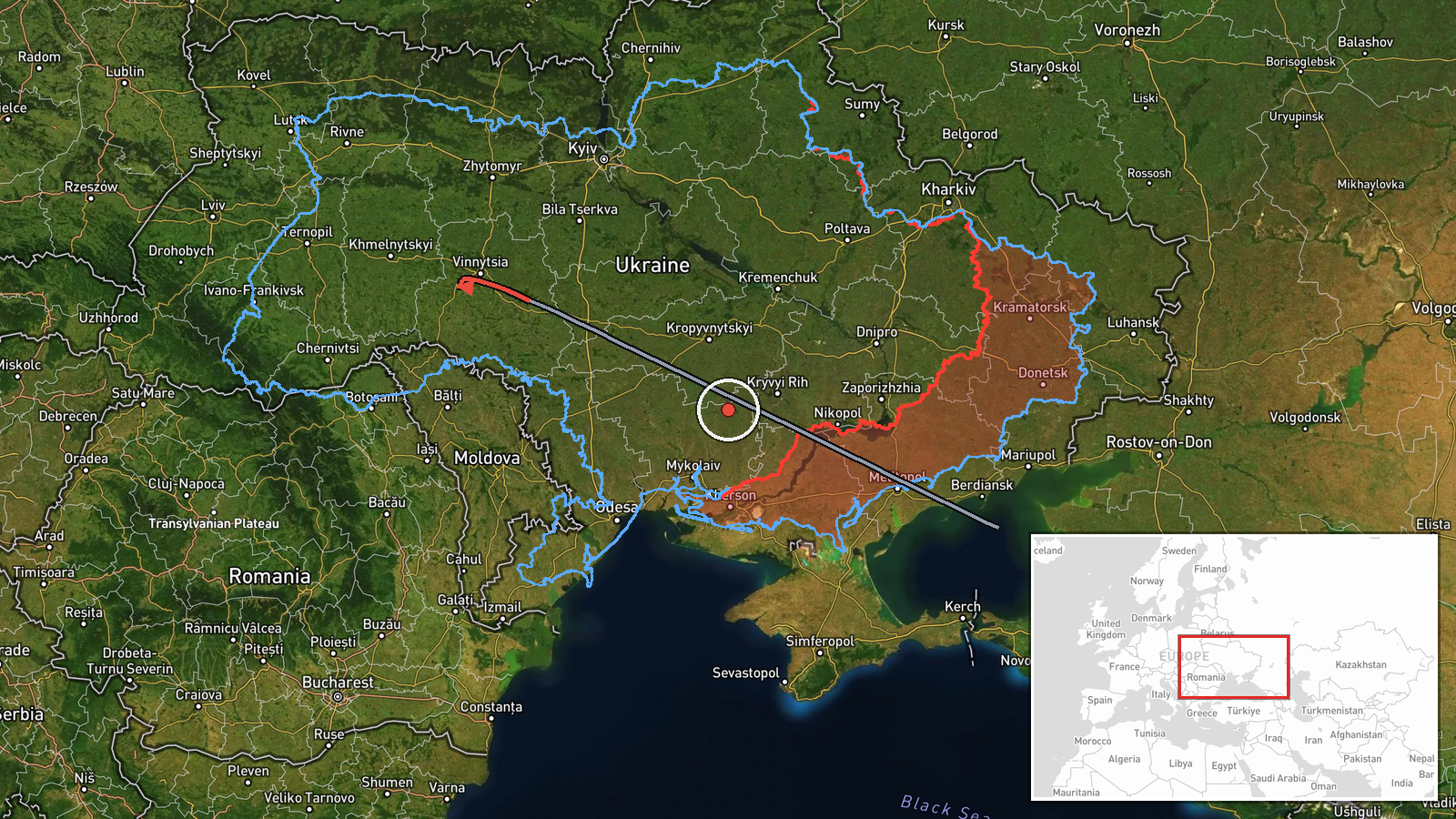
Ukraine's air monitoring channel on Telegram, @kpszsu, reported at 03:05 UTC on 16 October 2026 that jet-powered drones were tracked over western Vinnytsia Oblast. The original Ukrainian-language post said the drones were on a course toward Khmelnytskyi and western Rivne Oblast, with a heading toward Volyn. The report identifies them as Russian jet-powered Shahed, or Geran-3, type drones and uses the plural, but gives no firm count beyond that. The report describes movement only. It does not mention impacts, casualties, or damage. The event is classed as a drone transit, which records observed flight paths rather than a confirmed strike.
Context and assessment
Khmelnytskyi Oblast sits in western-central Ukraine, a region that has appeared repeatedly in recent air-monitoring reports. In the related events, single Geran-3 drones were logged over or heading toward Khmelnytskyi on the afternoon of 15 October at 16:04, 16:59 and 17:30 UTC, then again overnight at 01:07 and 01:35 UTC on 16 October. The sequence suggests a pattern of repeated transits across the oblast rather than isolated sightings. The jet-powered Geran-3 variant is generally understood to be faster than the older piston-engined Shahed design, which can shorten warning windows for air defence units. The reports point to a route that runs from the west of Vinnytsia toward the northwest, possibly to Volyn, and this may indicate either long-range strike planning or reconnaissance along western corridors. Because each entry records a transit rather than a target, the data alone does not show whether these aircraft were aimed at a specific facility or settlement.
Sources and confidence
Only one channel reported this event, the Telegram account @kpszsu, so there is no cross-confirmation from a second source in the data. The confidence score of 8.0 reflects that the channel is an official-style air monitoring feed with a consistent history in the related entries, and that the location and aircraft type are described in direct terms. It is held below the top of the scale because the report is single-sourced and the count is not stated precisely. Confidence would rise with a second independent monitoring or media report, or with an official statement giving the number of drones. It would fall if later corrections or conflicting reports described different routes or aircraft types.
Location
The coordinates, 49.42 N and 26.98 E, are assigned at regional precision, so the point marks the broader Khmelnytskyi Oblast area rather than a specific settlement or facility. The location confidence is rated high, but the data does not record a particular town for this item. The origin is given as western Vinnytsia Oblast, to the southeast of the marker. Khmelnytskyi Oblast is a largely rural, mixed farmland and forest region in western-central Ukraine, and the route described runs northwest toward the Volyn area.
Related events nearby
- Ukrainian air monitoring: 2+ Russian jet-powered Shahed (Geran-3) drones heading toward Khmelnytskyi; 1 Russia2026-10-16 04:24 UTC · Drone Transit · Khmelnytskyi, Ukraine
- Ukrainian air monitoring: 1 Russian jet-powered Shahed (Geran-3) drone over Khmelnytskyi.2026-10-16 01:35 UTC · Drone Transit · Khmelnytskyi, Ukraine
- Ukrainian air monitoring: 1 Russian jet-powered Shahed (Geran-3) drone over Khmelnytskyi Oblast; 1 Russian jet2026-10-16 01:07 UTC · Drone Transit · Khmelnytskyi Oblast, Ukraine
- Ukrainian air monitoring: 1 Russian jet-powered Shahed (Geran-3) drone heading toward Khmelnytskyi Oblast.2026-10-15 17:30 UTC · Drone Transit · Khmelnytskyi Oblast, Ukraine
- Ukrainian air monitoring: 1 Russian Shahed-type drone passing Pivdennyi, heading toward Khmelnytskyi Oblast.2026-10-15 16:59 UTC · Drone Transit · Khmelnytskyi Oblast, Ukraine
▶ View this event on the live map

Intel Mapper aggregates open-source reports from monitored Telegram and X channels, geolocates them, cross-checks duplicates across sources and assigns a confidence score. Entries are updated as new confirmations arrive. Read how we verify events.