Jet-powered Shahed drones reported heading toward Khmelnytskyi and Lutsk on 16 October
What happened
Ukrainian air monitoring, relayed through the Telegram channel @kpszsu, reported at 04:24 UTC on 16 October 2026 that at least two Russian jet-powered Shahed (Geran-3) drones were heading toward Khmelnytskyi, with the post saying they were approaching from the south. A separate jet-powered drone was reported heading toward Lutsk from the north. The original Ukrainian-language post uses the phrasing 'курсом на Хмельницький' and 'на Луцьк', which describes direction of travel rather than impact. The report does not describe strikes, damage, or casualties, and the event is classed as a drone transit. Attribution to Russia rests on the report's description of the drones rather than on independent confirmation.
Context and assessment
Khmelnytskyi sits in western Ukraine, a region that has seen repeated drone traffic as long-range strikes have moved further from the front. The related reports show a sustained pattern over roughly fifteen hours. On 15 October, a single jet-powered drone was reported heading toward Khmelnytskyi Oblast at 17:30 UTC, following an earlier report of a Shahed-type drone passing Pivdennyi. Overnight, a drone was reported over Khmelnytskyi Oblast at 01:07 with another heading toward Kor, and at 01:35 a drone was reported over Khmelnytskyi itself. At 03:05, jet-powered drones were tracked over western Vinnytsia, heading to Khmelnytskyi and western Rivne toward Volyn. The Lutsk report fits this corridor, since Volyn lies to the northwest along the same westward axis. Operationally, the pattern may indicate routing through western Ukraine toward targets in the region, or an attempt to draw air defence attention. The reports alone do not establish which of these, if either, applies. The jet-powered Geran-3 variant is generally understood to be faster than the piston-engined Geran-2, which would shorten warning times for ground teams.
Sources and confidence
This event rests on a single source, the Telegram channel @kpszsu, which carries Ukrainian air monitoring updates. No independent channel, wire service, or official statement in the data corroborates the transit. The confidence score of 8.0 reflects the channel's established role in publishing air alerts, the consistency of the post with the surrounding related reports, and the clear direction-of-travel wording. It is held below the top of the scale because there is only one source and no confirmation of track or endpoint. Confidence would rise with independent corroboration, follow-up reports of impacts or interceptions, or matching official statements. It would fall if later updates contradict the reported headings or if the drones are not identified in subsequent monitoring.
Location
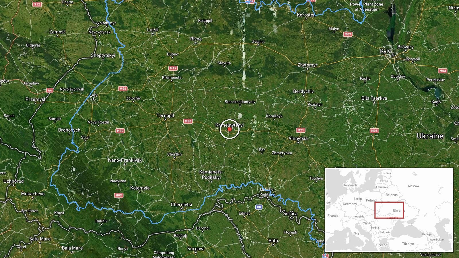
The coordinates place the event at the settlement level for Khmelnytskyi city, given as 49.42 N and 26.98 E, with high location confidence. The report names the city as the drones' heading, so the marker shows the destination area rather than any observed impact point. Khmelnytskyi lies in western Ukraine within the Podillia region on the Southern Bug and Khmelnytskyi Oblast. The Lutsk report is not geocoded in this entry and is not placed on the map from this data.
Related events nearby
- Ukrainian air monitoring: jet-powered Shahed (Geran-3) drones tracked over western Vinnytsia, heading to Khmel2026-10-16 03:05 UTC · Drone Transit · Khmelnytskyi Oblast, Ukraine
- Ukrainian air monitoring: 1 Russian jet-powered Shahed (Geran-3) drone over Khmelnytskyi.2026-10-16 01:35 UTC · Drone Transit · Khmelnytskyi, Ukraine
- Ukrainian air monitoring: 1 Russian jet-powered Shahed (Geran-3) drone over Khmelnytskyi Oblast; 1 Russian jet2026-10-16 01:07 UTC · Drone Transit · Khmelnytskyi Oblast, Ukraine
- Ukrainian air monitoring: 1 Russian jet-powered Shahed (Geran-3) drone heading toward Khmelnytskyi Oblast.2026-10-15 17:30 UTC · Drone Transit · Khmelnytskyi Oblast, Ukraine
- Ukrainian air monitoring: 1 Russian Shahed-type drone passing Pivdennyi, heading toward Khmelnytskyi Oblast.2026-10-15 16:59 UTC · Drone Transit · Khmelnytskyi Oblast, Ukraine
▶ View this event on the live map

Intel Mapper aggregates open-source reports from monitored Telegram and X channels, geolocates them, cross-checks duplicates across sources and assigns a confidence score. Entries are updated as new confirmations arrive. Read how we verify events.