Ukrainian Air Force reports one Russian Shahed-type drone transiting Vinnytsia Oblast toward the west
What happened
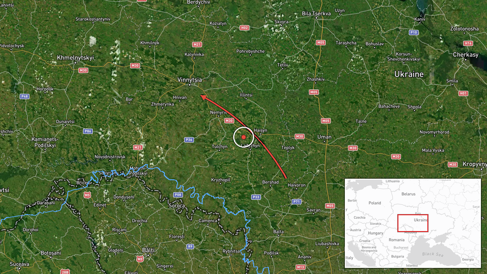
Ukraine's Air Force monitoring channel on Telegram, @kpszsu, reported on 18 October 2026 at 03:06 UTC that one strike drone was moving from Kirovohrad Oblast into Vinnytsia Oblast, passing the town of Hayvoron on a western course. The summary attributes the drone to Russia and classifies it as Shahed-type. The original post uses an arrow notation to show the track, which indicates a transit movement rather than a strike impact. The report describes no hits, casualties, or damage, and it does not name a specific target or settlement inside Vinnytsia Oblast. The event is therefore recorded as a drone transit, meaning the flight path itself as observed at that moment.
Context and assessment
Vinnytsia Oblast is a central Ukrainian region that lies between the front-adjacent south and the western border, so drones crossing it are often on routes toward western Ukraine or are being tracked along corridors that run north and west. The related events show a dense sequence of transits over the same oblast on 17 October 2026, with at least five earlier reports between 06:25 and 15:17 local reporting time. Several of these were identified as jet-powered Geran-3 variants, and one was described as coming from Odesa Oblast before heading toward Vinnytsia. Headings varied between west and northwest, which suggests multiple drones using overlapping approach paths rather than a single aim point. The repeated pattern over the same region is more consistent with sustained long-range raids routed across central Ukraine than with a focused attack on one location. Because the source gives no impact data, it is not possible to say whether any of these drones struck a target, was intercepted, or simply continued past the oblast. The cluster does indicate how the air defense network tracks and reports long-range drones in real time as they move across the country.
Sources and confidence
The event rests on a single report from the Telegram channel @kpszsu, which is associated with the Ukrainian Air Force's air monitoring updates. No independent outlet or second channel in the dataset reports this specific track, so cross-confirmation is absent. The confidence score of 8.0 reflects the official origin of the post and its consistency with a series of similar transit reports on the same day. It is held below the maximum because the report is single-source, the location is approximate, and the entry contains no imagery or independent verification. Confidence would rise with corroboration from a second monitoring channel, regional military administration statements, or a Russian defense statement acknowledging the flight. It would fall if later updates reclassified the track or identified it as a different aircraft type.
Location
The coordinates are region-level, and the location confidence is rated low, so the point on the map represents the general area of Vinnytsia Oblast rather than a precise position. The pin sits near the oblast's administrative centre, which indicates the platform defaulted to the region rather than a point along the drone's track. The reported route passes Hayvoron, a small town in neighboring Kirovohrad Oblast, and the drone is described as heading toward Vinnytsia Oblast. The surrounding terrain is largely agricultural plain with river valleys such as those of the Southern Bug and its tributaries, which offer little natural cover from low-altitude flight.
Related events nearby
- Ukrainian air monitoring: 1 Russian jet-powered Shahed (Geran-3) drone passing Vinnytsia Oblast, heading north2026-10-17 15:17 UTC · Drone Transit · Vinnytsia Oblast, Ukraine
- Ukrainian air monitoring: 1 Russian jet-powered Shahed (Geran-3) drone from Odesa Oblast toward Vinnytsia Obla2026-10-17 14:54 UTC · Drone Transit · Vinnytsia Oblast, Ukraine
- Ukrainian air monitoring: 1 Russian Shahed-type drone passing Vinnytsia Oblast, heading northwest.2026-10-17 14:52 UTC · Drone Transit · Vinnytsia Oblast, Ukraine
- Ukrainian air monitoring: 1 Russian Shahed-type drone passing Vinnytsia Oblast, heading west.2026-10-17 14:44 UTC · Drone Transit · Vinnytsia Oblast, Ukraine
- Ukrainian air monitoring: 1 Russian jet-powered Shahed (Geran-3) drone passing Vinnytsia Oblast, heading north2026-10-17 06:25 UTC · Drone Transit · Vinnytsia Oblast, Ukraine
▶ View this event on the live map

Intel Mapper aggregates open-source reports from monitored Telegram and X channels, geolocates them, cross-checks duplicates across sources and assigns a confidence score. Entries are updated as new confirmations arrive. Read how we verify events.