Single-source report places a Russian jet-powered Shahed drone transiting Vinnytsia Oblast
What happened
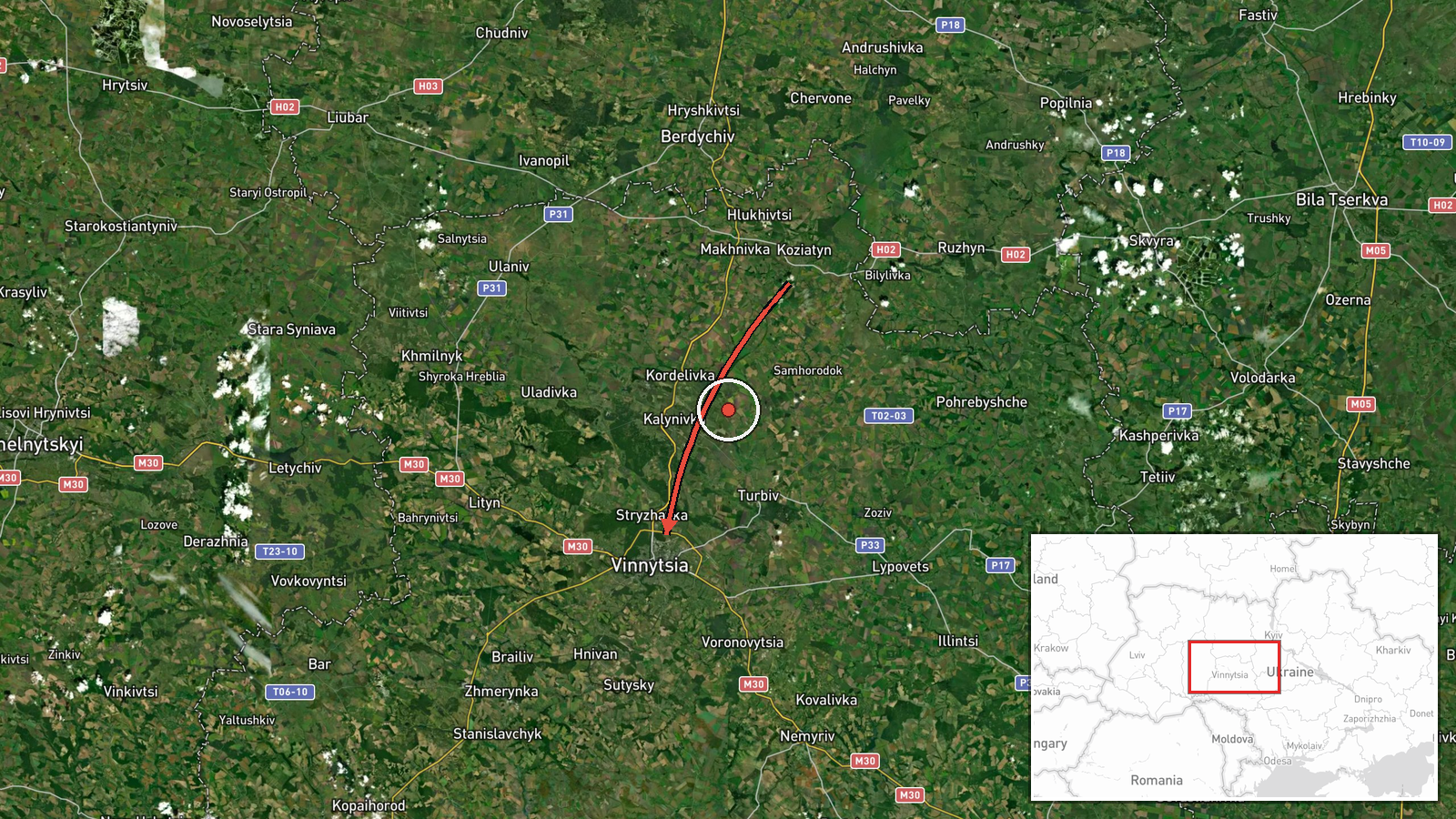
Ukrainian air monitoring reported via the Telegram channel @kpszsu that one Russian jet-powered Shahed-type drone, identified as a Geran-3, was moving across Vinnytsia Oblast on 18 October 2026 at 06:29 UTC. The original Ukrainian-language post described a reactive unmanned aerial vehicle travelling from Zhytomyr Oblast toward Vinnytsia Oblast, passing on or near Kozyatyn from the northeast. The wording reads as a transit alert rather than a strike or impact report, and it mentions no damage, casualties or intended target. The event is logged from a single source, and the Geran-3 designation comes from the summary rather than from independent verification.
Context and assessment
Vinnytsia Oblast sits in central-western Ukraine, between the capital region to the north and the Odesa and Kirovohrad areas to the south and east. It is a corridor that drones frequently cross when moving from the south toward western and northwestern Ukraine, so repeated reports there are consistent with routing rather than with a single fixed objective. This record fits a dense sequence of similar alerts. On 17 October, five transits were logged in the oblast between 14:44 and 15:17 UTC, including one described as coming from Odesa Oblast, with headings given as west, northwest and northwest again. Earlier on 18 October, a Shahed-type drone was reported passing Hayvoron before heading toward the same oblast at 03:06 UTC. Taken together, these reports suggest a sustained wave of long-range drones moving through the region over roughly sixteen hours. The jet-powered Geran-3 variant is generally understood to be faster than the piston-engine Shahed, which may complicate interception timelines for air defence along its path. Operationally, the reports may indicate a transit or decoy function, but the data does not show where any drone was headed or whether it was engaged.
Sources and confidence
The event rests on one Telegram post from @kpszsu, with no second outlet, sensor feed or official follow-up in the data set. The confidence score of 8.0 reflects an established monitoring channel and a specific, time-stamped description, but the single-source basis and the absence of cross-confirmation keep it below the top of the scale. Confidence would rise with corroboration from other Ukrainian air command reports, regional military administration statements, or independent flight-path tracking. It would fall if later reporting revised the drone type, the heading or the location of the sighting.
Location
The location is recorded as Vinnytsia Oblast at region precision with low location confidence. The pin at 49.23 north and 28.47 east is a regional approximation rather than a point on the flight path, and the named town of Kozyatyn is not geocoded directly in the record. The oblast is largely agricultural, with the Southern Bug river system and rail links running through it. Treat the marker as indicating the oblast, not a specific site.
Related events nearby
- Ukrainian air monitoring: 1 Russian Shahed-type drone passing Hayvoron, heading toward Vinnytsia Oblast.2026-10-18 03:06 UTC · Drone Transit · Vinnytsia Oblast, Ukraine
- Ukrainian air monitoring: 1 Russian jet-powered Shahed (Geran-3) drone passing Vinnytsia Oblast, heading north2026-10-17 15:17 UTC · Drone Transit · Vinnytsia Oblast, Ukraine
- Ukrainian air monitoring: 1 Russian jet-powered Shahed (Geran-3) drone from Odesa Oblast toward Vinnytsia Obla2026-10-17 14:54 UTC · Drone Transit · Vinnytsia Oblast, Ukraine
- Ukrainian air monitoring: 1 Russian Shahed-type drone passing Vinnytsia Oblast, heading northwest.2026-10-17 14:52 UTC · Drone Transit · Vinnytsia Oblast, Ukraine
- Ukrainian air monitoring: 1 Russian Shahed-type drone passing Vinnytsia Oblast, heading west.2026-10-17 14:44 UTC · Drone Transit · Vinnytsia Oblast, Ukraine
▶ View this event on the live map

Intel Mapper aggregates open-source reports from monitored Telegram and X channels, geolocates them, cross-checks duplicates across sources and assigns a confidence score. Entries are updated as new confirmations arrive. Read how we verify events.