Single Shahed-type drone reported over northern Chernihiv Oblast, heading southwest
What happened
Ukrainian air monitoring reported one Russian Shahed-type drone over northern Chernihiv Oblast on 18 October 2026 at about 06:52 UTC. The sole source is a Telegram channel, @kpszsu, which is linked to the Ukrainian Air Force's monitoring reporting. Its original post, in Ukrainian, refers to 'new UAVs' (нові БпЛА) in the plural, moving on a south-western course, with the parenthetical '(Київщина)' pointing toward Kyiv Oblast. The English summary specifies a single drone. The report gives no impact, casualties, or damage, and it does not say whether the drone was intercepted or left the area. The entry is an airspace transit notice, not a strike report.
Context and assessment
Northern Chernihiv Oblast borders Russia's Bryansk region and Belarus, so drones entering from the north-east pass over it on the way to central and northern Ukraine. The previous day, the event log records a run of similar transit reports on 17 October. One jet-powered Shahed (Geran-3) was logged leaving Bryansk toward northern Chernihiv Oblast at 07:10 UTC. Further reports placed Shahed-type drones near Snovsk at 07:12 and 12:40, near Horodnia at 13:45, and near Berezna at 14:42, with headings ranging from south to south-west. Taken together, this points to a steady stream of long-range drones following similar corridors across the oblast, rather than a single isolated sighting. Operationally, such routing may reflect flight paths chosen to approach Kyiv and its surroundings while staying away from heavier air defence concentrations, though the data cannot confirm intent. Reports of this kind are most useful as indicators of traffic patterns and air-raid risk in the area.
Sources and confidence
The event rests on one channel, @kpszsu, and no independent outlet is recorded as confirming it, so cross-confirmation is absent. The confidence score of 8.0 reflects a low-to-moderate level of trust, given that the report comes from an official-linked Ukrainian monitoring account with a consistent record of similar notices, while the single-source basis and the mismatch between plural wording and the singular summary keep it below high confidence. Confidence would rise with corroboration from Ukrainian regional military administrations, Air Force statements, or independent flight-tracking or open-source drone trackers showing a matching track. It would fall if later reports contradicted the drone count, direction, or timing, or if the sighting were attributed to a different aircraft.
Location
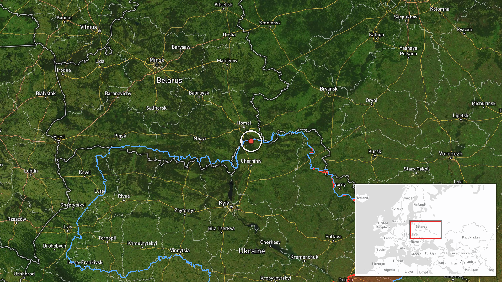
The location is recorded only at region level, as northern Chernihiv Oblast, with coordinates of 52.08459 N, 31.29 E. This means the point marks a broad area and not a settlement, facility, or precise track position, and the low location confidence reflects that. The oblast lies in north-eastern Ukraine, bordered by Belarus to the north and the Russian Bryansk region to the east and north-east. The terrain is largely flat, with forests, marshes and river valleys, including the Desna basin, that shape low-altitude flight routes.
Related events nearby
- Ukrainian air monitoring: 1 Russian Shahed-type drone passing Horodnia, heading southwest.2026-10-17 13:45 UTC · Drone Transit · Horodnia, Ukraine
- Ukrainian air monitoring: 1 Russian jet-powered Shahed (Geran-3) drone passing Snovsk, heading south.2026-10-17 12:40 UTC · Drone Transit · Snovsk, Ukraine
- Ukrainian air monitoring: 1 Russian jet-powered Shahed (Geran-3) drone heading toward Berezna.2026-10-17 14:42 UTC · Drone Transit · Berezna, Ukraine
- Ukrainian air monitoring: 2+ Russian Shahed-type drones over Chernihiv Oblast.2026-10-17 14:59 UTC · Drone Transit · Chernihiv Oblast, Ukraine
- Ukrainian air monitoring: 1 Russian jet-powered Shahed (Geran-3) drone heading toward Chernihiv.2026-10-17 13:48 UTC · Drone Transit · Chernihiv, Ukraine
▶ View this event on the live map

Intel Mapper aggregates open-source reports from monitored Telegram and X channels, geolocates them, cross-checks duplicates across sources and assigns a confidence score. Entries are updated as new confirmations arrive. Read how we verify events.