Shahed-type drone reported passing Slavutych heading south, per Ukrainian air monitoring
What happened
Ukrainian air monitoring reported on Telegram, via the channel @kpszsu, that one Russian Shahed-type drone was passing Slavutych and heading south at about 07:30 UTC on 18 October 2026. The original Ukrainian-language alert uses the term БпЛА (unmanned aerial vehicle) and labels the area as Chernihiv region (Чернігівщина), with the course given as south. The report contains no information on impact, damage, casualties, or an intended target. The event is classed as a drone transit, meaning an aircraft sighted on a track rather than a recorded strike. Because the report rests on a single channel and no follow-up reporting appears in the data, its outcome remains unknown.
Context and assessment
This sighting sits within a dense sequence of air movements over the Chernihiv area. Beginning on 17 October, related reports describe a Shahed-type drone heading toward Chernihiv at 12:16 UTC, a jet-powered Shahed (described as Geran-3) heading toward the city at 13:48, and two or more Shahed-type drones over Chernihiv Oblast at 14:59. On 18 October, a Banderol mini cruise missile was reported passing Voronizh toward Chernihiv Oblast at 07:45, and another was reported passing Berezna toward Chernihiv at 07:58. The Slavutych drone, at 07:30, is the earliest report of the 18 October cluster. Taken together, the pattern suggests repeated launches or routing of different aerial systems through the same northern corridor over roughly a day. Operationally, this could indicate attempts to probe or saturate air defenses, sustained pressure on infrastructure in the region, or aircraft routed toward targets further along the track. The data alone does not show which of these, if any, applies, and the transit reports do not establish a target.
Sources and confidence
The event rests on one source, the Telegram channel @kpszsu, which appears to relay Ukrainian air monitoring alerts, and the data records no independent cross-confirmation. The confidence score of 8.0 reflects a clearly attributed official-style alert with a precise time and settlement-level location, offset by the single-channel basis. Confidence would rise with corroboration from a second independent monitoring channel, radar-based reporting, or a subsequent statement describing the track. It would fall if the alert were corrected, retracted, or found to refer to a different location or date.
Location
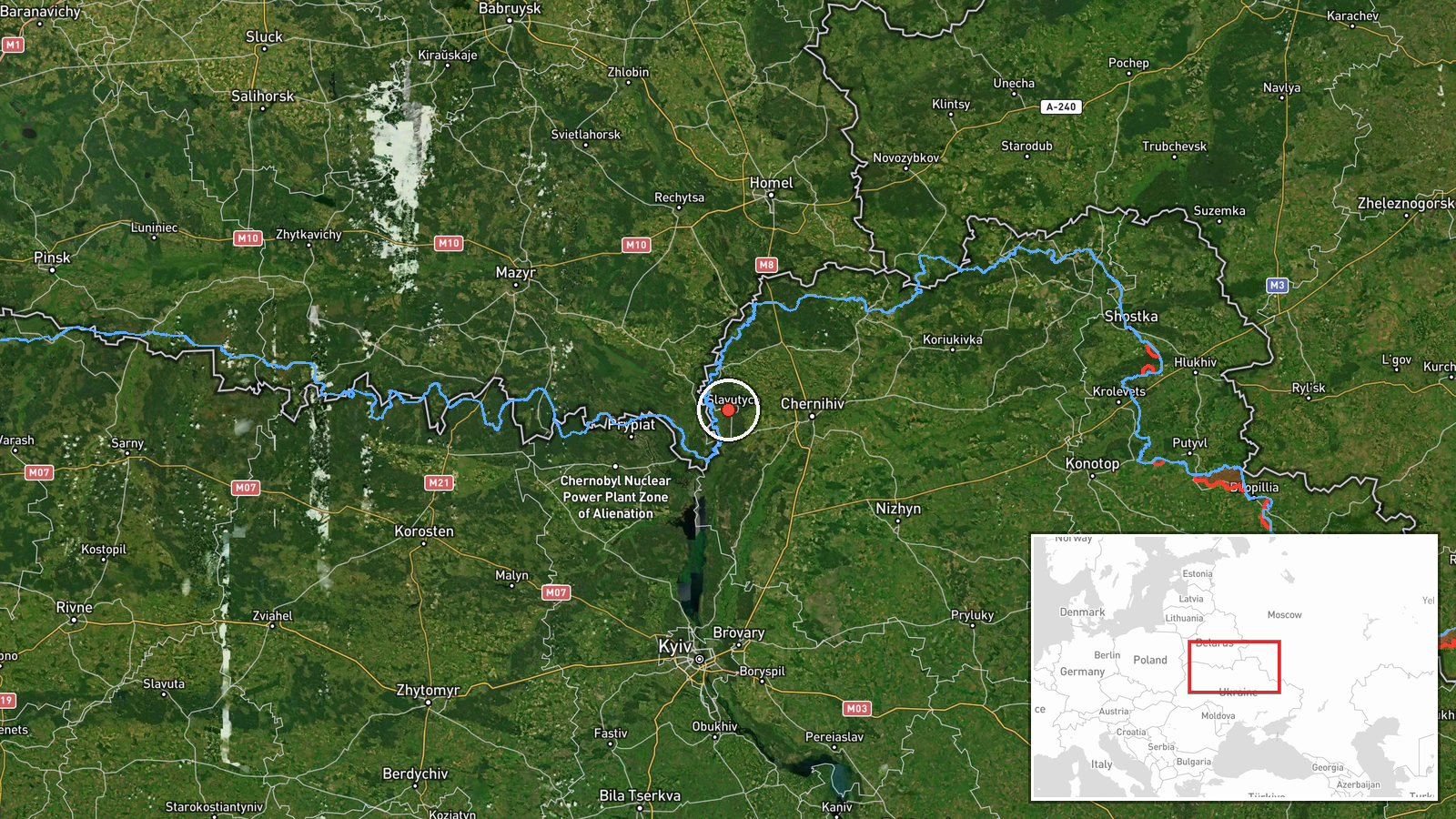
The coordinates correspond to Slavutych at settlement precision, and the location confidence is recorded as high. Slavutych is a planned city in northern Ukraine on the Desna river, near the Chornobyl exclusion zone. The alert names Chernihiv region, but Slavutych is generally placed in neighboring Kyiv Oblast near the regional border, so this label discrepancy should be noted. Because the drone was a moving transit, the point marks where it was reported, not a fixed site.
Related events nearby
- Ukrainian air monitoring: 1 Russian Banderol mini cruise missile passing Berezna, heading toward Chernihiv.2026-10-18 07:58 UTC · Cruise Missile · Chernihiv, Ukraine
- Ukrainian air monitoring: 1 Russian Banderol mini cruise missile passing Voronizh, heading toward Chernihiv Ob2026-10-18 07:45 UTC · Cruise Missile · Chernihiv Oblast, Ukraine
- Ukrainian air monitoring: 2+ Russian Shahed-type drones over Chernihiv Oblast.2026-10-17 14:59 UTC · Drone Transit · Chernihiv Oblast, Ukraine
- Ukrainian air monitoring: 1 Russian jet-powered Shahed (Geran-3) drone heading toward Chernihiv.2026-10-17 13:48 UTC · Drone Transit · Chernihiv, Ukraine
- Ukrainian air monitoring: 1 Russian Shahed-type drone heading toward Chernihiv.2026-10-17 12:16 UTC · Drone Transit · Chernihiv, Ukraine
▶ View this event on the live map

Intel Mapper aggregates open-source reports from monitored Telegram and X channels, geolocates them, cross-checks duplicates across sources and assigns a confidence score. Entries are updated as new confirmations arrive. Read how we verify events.