Jet-powered Geran-3 drone reported moving toward Ichnia in Chernihiv Oblast
What happened
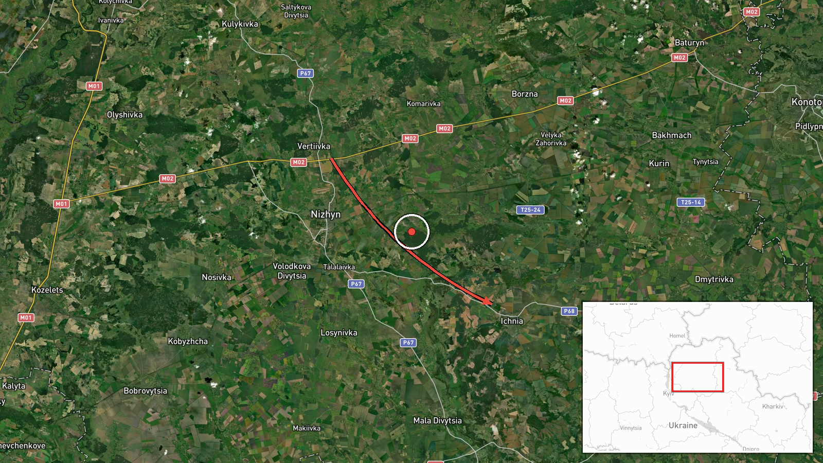
Ukrainian air monitoring reported one Russian jet-powered Shahed-type drone, identified in the report as a Geran-3, moving from Chernihiv Oblast toward the settlement of Ichnia at about 02:42 UTC on 19 October 2026. The original post, written in Ukrainian, describes a jet-powered drone (БпЛА) arriving at Ichnia from the north in Chernihiv region. The English summary's wording is a paraphrase of that line. The report gives no information on damage, casualties, or whether the drone was intercepted or struck anything. The event is classed as a drone transit, so it documents the object's movement rather than a confirmed impact. Ichnia is the only arrival point named in this entry.
Context and assessment
This entry sits within a cluster of overnight and evening activity across northern Ukraine. Earlier on 18 October, a Banderol mini cruise missile was logged over Mena, and another was reported passing Romny toward Pryluky at 19:19 local-reference time, followed by two Banderol missiles over Pryluky at 19:34. Early on 19 October, a Shahed-type drone was tracked from northern Poltava Oblast toward Pyryatyn at 02:41, and a drone was then tracked north of Pryluky at 02:43, heading northwest. Pryluky recurs in several reports, which may point to a target cluster, a routing corridor, or simply heavier monitoring in that area. Ichnia lies north of Pryluky along roughly the same meridian, so the drone reported there may belong to the same overnight movement rather than a separate strike effort. Drones of this type are often launched in waves and can be used to saturate air defenses or to probe routes, and a single transit report does not establish which of these applies. Without independent confirmation of the drone's endpoint, the most cautious reading is that it was one element of a wider pattern of long-range activity over the Chernihiv and Poltava corridor.
Sources and confidence
All information comes from one Telegram channel, @kpszsu, which is widely associated with Ukrainian Air Force air-monitoring alerts. No other channel, outlet, or official statement in the dataset reports the same drone at Ichnia, so cross-confirmation is absent. The confidence score of 8.0 reflects the official-style origin of the post, its specific timing, and the link to a mapped settlement. It is held below the top range because the report is single-source and does not describe an outcome. Confidence would rise with corroboration from regional military administration statements, later official updates, or local reports of debris or impact. It would fall if the channel issued a correction, if the timing or direction were contradicted, or if other monitoring sources failed to register the track.
Location
Coordinates correspond to the settlement of Ichnia, so the location is settlement-level with high location confidence. The point marks the town rather than any specific facility or street. Ichnia is a small town in Chernihiv Oblast in northern Ukraine. The surrounding terrain is low, flat lowland typical of the region, with agricultural land, rivers, and road and rail links connecting it to Pryluky and other towns nearby. The area lies close to the broader northern frontier with Poltava and Chernihiv oblasts.
Related events nearby
- Ukrainian air monitoring: one Russian jet-powered Shahed (Geran-3) drone tracked north of Pryluky, heading nor2026-10-19 02:43 UTC · Drone Transit · North of Pryluky, Chernihiv Oblast, Ukraine
- Ukrainian air monitoring: 2 Russian Banderol mini cruise missiles over Pryluky.2026-10-18 19:34 UTC · Cruise Missile · Pryluky, Ukraine
- Ukrainian air monitoring: 1 Russian Banderol mini cruise missile passing Romny, heading toward Pryluky.2026-10-18 19:19 UTC · Cruise Missile · Pryluky, Ukraine
- Ukrainian air monitoring: 1 Russian Shahed-type drone from northern Poltava Oblast toward Pyryatyn.2026-10-19 02:41 UTC · Drone Transit · Pyryatyn, Ukraine
- Ukrainian air monitoring: 1 Russian cruise missile passing eastern Chernihiv Oblast, heading west.2026-10-19 03:38 UTC · Cruise Missile · eastern Chernihiv Oblast, Ukraine
▶ View this event on the live map

Intel Mapper aggregates open-source reports from monitored Telegram and X channels, geolocates them, cross-checks duplicates across sources and assigns a confidence score. Entries are updated as new confirmations arrive. Read how we verify events.