Russian Shahed-type drones tracked in transit across Chernihiv and Poltava oblasts, Ukraine
What happened
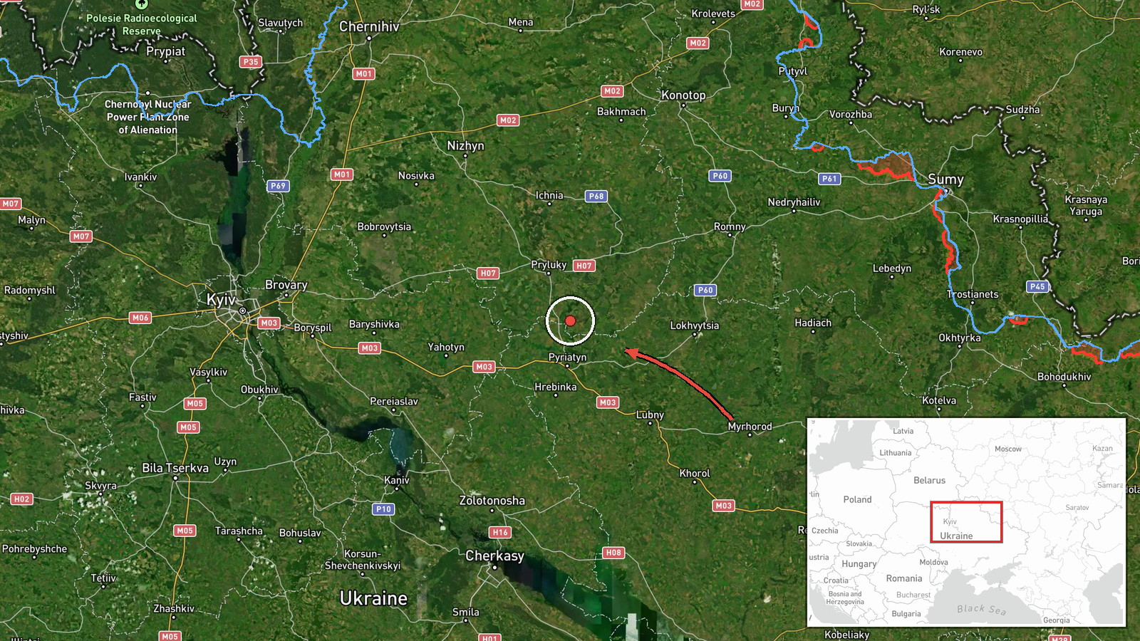
Ukraine's Air Force monitoring channel on Telegram reported on 19 October 2026, at about 02:43 UTC, that one Russian Shahed-type drone was passing through the north of Poltava Oblast and the south of Chernihiv Oblast on a westward course. A second message in the same post described a jet-powered Shahed-series drone, identified as Geran-3, moving toward Chornukhy in Poltava Oblast from Chernihiv Oblast. The original Ukrainian wording describes the drones' courses rather than any strike, and no impact, casualties, or damage are mentioned. The event is logged as a drone transit, with Russia named as the actor on the basis of the report's identification of the drones.
Context and assessment
Chornukhy sits in Poltava Oblast, a region between the Kyiv and Kharkiv axes that contains rail, road and energy infrastructure which has been intermittently targeted during the wider campaign against Ukraine. Its appearance in an air-monitoring report matters less for what it contains than for its position along the flight path. The related events in the feed show a sustained sequence of Geran-3 transits over northern Kyiv Oblast on 18 October, with further tracks reported toward Brovary, Kulykivka and Velyka Dymerka. Taken together, these entries suggest multiple jet-powered drones moving across the north-central corridor over roughly a day, with several tracks shifting course rather than holding a single line. Operationally, this may indicate routing around air defense concentrations near Kyiv, or a pattern of decoy or saturation tasking, but the open data cannot confirm intent. A transit report alone does not establish a target. Analysts would typically look for a subsequent impact report, a cluster of entries converging on one settlement, or an official statement before drawing firmer conclusions about destination.
Sources and confidence
The report rests on a single Telegram channel, @kpszsu, which publishes Ukrainian air monitoring alerts and is widely treated as an official primary channel for such notices. No independent outlet, second monitoring source, or Russian statement appears in the data, so cross-confirmation is absent. The confidence score of 8.0 reflects an official, specific and timestamped source, offset by single-channel sourcing and the transit-only nature of the report. Confidence would rise with corroboration from regional military administrations, impact reports, or wreckage findings. It would fall if the track were revised, retracted, or shown to refer to a different date or drone count.
Location
The location is approximate. The feed assigns region-level precision to southern Chernihiv Oblast, and the coordinates (about 50.90 N, 31.29 E) mark a general area rather than a settlement, so the point should not be read as a fixed flight position. Chornukhy, the stated destination, is a settlement in Poltava Oblast, and the drone's path between the two regions is not pinned. The terrain is mainly forest-steppe, with the Desna and Sula river basins and scattered woodland and farmland.
Related events nearby
- Ukrainian air monitoring: 1 Russian cruise missile heading toward Kozelets.2026-10-19 03:43 UTC · Cruise Missile · Kozelets, Ukraine
- Ukrainian air monitoring: 1 Russian jet-powered Shahed (Geran-3) drone heading toward Velyka Dymerka.2026-10-18 06:04 UTC · Drone Transit · Velyka Dymerka, Ukraine
- Ukrainian air monitoring: 1 Russian jet-powered Shahed (Geran-3) drone passing northern Kyiv Oblast, heading w2026-10-19 02:45 UTC · Drone Transit · northern Kyiv Oblast, Ukraine
- Ukrainian air monitoring: 2+ Russian jet-powered Shahed (Geran-3) drones passing northern Kyiv Oblast, heading2026-10-18 05:57 UTC · Drone Transit · northern Kyiv Oblast, Ukraine
- Ukrainian air monitoring: 1 Russian Shahed-type drone heading toward Brovary.2026-10-18 07:15 UTC · Drone Transit · Brovary, Ukraine
▶ View this event on the live map

Intel Mapper aggregates open-source reports from monitored Telegram and X channels, geolocates them, cross-checks duplicates across sources and assigns a confidence score. Entries are updated as new confirmations arrive. Read how we verify events.