Ukrainian monitoring reports one Shahed-type drone heading toward Aviatorske
What happened
Ukrainian air monitoring reported on Telegram (@kpszsu) that one Russian Shahed-type drone was heading toward the settlement of Aviatorske, Ukraine, at about 02:43 UTC on 19 October 2026. The original Ukrainian wording, 'В напрямку н.п.Авіаторське', translates roughly as 'in the direction of the settlement Aviatorske', and it describes a heading rather than a confirmed impact. The report contains no information on damage, casualties, or whether the drone was intercepted. The event is recorded as a Drone Transit, attributed to Russia, with settlement-level location precision and a confidence score of 8.0. It rests on a single channel and has not been independently confirmed.
Context and assessment
Aviatorske sits in central-eastern Ukraine, in the broader Dnipro area, a region that has seen repeated Russian long-range strikes. The surrounding timeline shows a dense sequence over roughly 24 hours. On 18 October, two or more Banderol mini cruise missiles were reported heading toward or over Dnipro, and a jet-powered Geran-3 drone was reported moving from Dnipropetrovsk Oblast toward Krynychky. Early on 19 October, another Geran-3 was reported passing northern Zaporizhzhia heading west, and a guided glide bomb was reported heading toward southern Dnipropetrovsk Oblast at 02:42 UTC, roughly a minute before the Aviatorske report. Taken together, these reports suggest a multi-axis pattern in which drones and standoff weapons are tracked across several oblasts at once. A single drone heading toward a settlement may be part of a broader salvo, a decoy or reconnaissance element, or simply one track among many. Because the related reports come from the same type of air monitoring feed, the pattern is best read as an indication of sustained activity in the region rather than evidence of a specific target at Aviatorske.
Sources and confidence
The report comes from one Telegram channel, the Ukrainian Air Force monitoring account (@kpszsu), and no second outlet is listed as reporting it. The confidence score of 8.0 is relatively high for a single-source report because the channel is an official air-monitoring feed that routinely posts real-time track updates, and the location and time fields are internally consistent. It is not higher because the feed reports headings rather than confirmed impacts, and no independent sensor, wire service or local official confirms the track. Confidence would rise if a second official source, local authority, or post-event damage report referenced Aviatorske, or if the track was logged as intercepted or impacted. It would fall if later updates revised the heading or reassigned the track.
Location
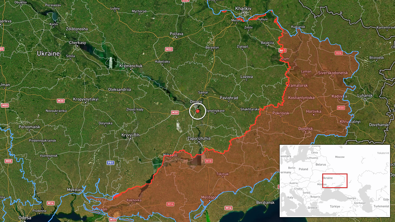
The location is recorded at settlement level, meaning the coordinates identify the populated place of Aviatorske rather than a specific facility, and the location confidence is rated high. The coordinates, roughly 48.37 N and 35.08 E, place the settlement in the Dnipro area of central-eastern Ukraine, on the steppe that covers much of the region. The terrain is largely open agricultural land, with the Dnipro River system and its reservoirs and industrial corridors a short distance to the west. Aviatorske is a small place, so the settlement point is a reasonable proxy for the reported heading, though the track itself does not specify an endpoint.
Related events nearby
- Ukrainian air monitoring: 2 Russian Banderol mini cruise missiles over Dnipro.2026-10-18 09:25 UTC · Cruise Missile · Dnipro, Ukraine
- Ukrainian air monitoring: 2+ Russian Banderol mini cruise missiles heading toward Dnipro.2026-10-18 09:18 UTC · Cruise Missile · Dnipro, Ukraine
- Ukrainian air monitoring: 1 Russian jet-powered Shahed (Geran-3) drone from Dnipropetrovsk Oblast toward Kryny2026-10-18 04:42 UTC · Drone Transit · Krynychky, Ukraine
- Ukrainian air monitoring: 1 Russian jet-powered Shahed (Geran-3) drone passing northern Zaporizhzhia, heading 2026-10-19 02:44 UTC · Drone Transit · northern Zaporizhzhia, Ukraine
- Ukrainian air monitoring: 1 Russian guided glide bomb (KAB) heading toward southern Dnipropetrovsk Oblast.2026-10-19 02:42 UTC · Airstrike · southern Dnipropetrovsk Oblast, Ukraine
▶ View this event on the live map

Intel Mapper aggregates open-source reports from monitored Telegram and X channels, geolocates them, cross-checks duplicates across sources and assigns a confidence score. Entries are updated as new confirmations arrive. Read how we verify events.