Two Russian Shahed-type drones reported over western Chernihiv and southern Kirovohrad oblasts
What happened
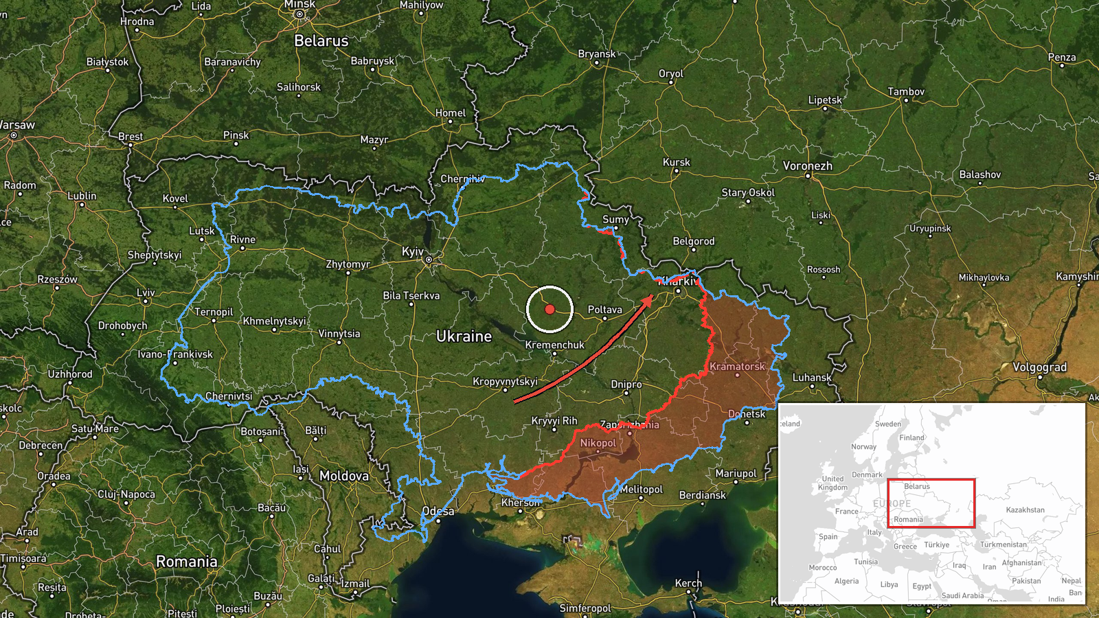
Ukraine's air monitoring channel on Telegram (@kpszsu) reported on 19 October 2026 at 03:57 UTC that a Russian Shahed-type drone was passing western Chernihiv Oblast and heading south. A second Shahed-type drone was reported coming from southern Kirovohrad Oblast toward Kharkiv. The original post lists a wider picture of several reported tracks: one in central Volyn heading west, one across northern Kyiv and Zhytomyr oblasts heading west, one in western Chernihiv heading south, one in southern Kirovohrad heading west, and one approaching Kharkiv from the north. The summary here condenses that post, and it does not give a location for the Kirovohrad track beyond the oblast name. No impacts, casualties or damage are described in the report.
Context and assessment
The Chernihiv track fits a pattern visible in the related reports. Earlier on 19 October, at 02:44 UTC, two or more jet-powered Geran-3 drones were logged passing western Chernihiv Oblast heading south, and a Shahed-type drone was reported moving from Sumy Oblast toward Chernihiv. On 18 October, drones were reported near Slavutych and across northern Kyiv Oblast, mostly heading west. Taken together, these reports suggest a sustained stream of drones using the northern corridor, which runs close to the Belarusian border, and then turning either south or west across the north and centre of the country. Operationally, such routing can be consistent with reconnaissance, with saturating air defences over a wide area, or with approaching targets in several directions at once. Transit reports alone do not reveal the intended target, and a track heading south or west does not establish a strike. The overlap of several tracks in a short window is the more notable signal here.
Sources and confidence
The report rests on one Telegram channel, the official Ukrainian Air Force account, which is the usual public source for real-time drone tracking. No independent outlet or second channel in the data confirms the individual tracks. The score of 8.0 reflects a credible official source and an unusually specific timestamp, offset by the single-source status and the lack of an independent check on the drone types or positions. Confidence would rise with corroboration from a second monitoring source, radar-based reporting from regional authorities, or wreckage or impact reports. It would fall if later updates revised the tracks or if the post were withdrawn or corrected.
Location
The coordinates are an approximate regional point for western Chernihiv Oblast, not a settlement or facility. The location is classed as region-level precision with low location confidence, so the marker should be read as a broad area. The terrain is the flat, forested Polissia lowland in northern Ukraine, cut by rivers such as the Desna and its tributaries. The Belarusian border lies only a short distance to the north, and Slavutych and the Kyiv Oblast border area are to the south-east.
Related events nearby
- Ukrainian air monitoring: 2+ Russian jet-powered Shahed (Geran-3) drones passing western Chernihiv Oblast, hea2026-10-19 02:44 UTC · Drone Transit · western Chernihiv Oblast, Ukraine
- Ukrainian air monitoring: 1 Russian Shahed-type drone passing Slavutych, heading south.2026-10-18 07:30 UTC · Drone Transit · Slavutych, Ukraine
- Ukrainian air monitoring: 1 Russian jet-powered Shahed (Geran-3) drone passing northern Kyiv Oblast, heading w2026-10-19 02:45 UTC · Drone Transit · northern Kyiv Oblast, Ukraine
- Ukrainian air monitoring: 2+ Russian jet-powered Shahed (Geran-3) drones passing northern Kyiv Oblast, heading2026-10-18 05:57 UTC · Drone Transit · northern Kyiv Oblast, Ukraine
- Ukrainian air monitoring: 1 Russian Shahed-type drone from Sumy Oblast toward Chernihiv Oblast.2026-10-19 02:44 UTC · Drone Transit · Chernihiv Oblast, Ukraine
▶ View this event on the live map

Intel Mapper aggregates open-source reports from monitored Telegram and X channels, geolocates them, cross-checks duplicates across sources and assigns a confidence score. Entries are updated as new confirmations arrive. Read how we verify events.