Single Russian jet-powered Shahed drone reported moving from Chernihiv into Kyiv Oblast
What happened
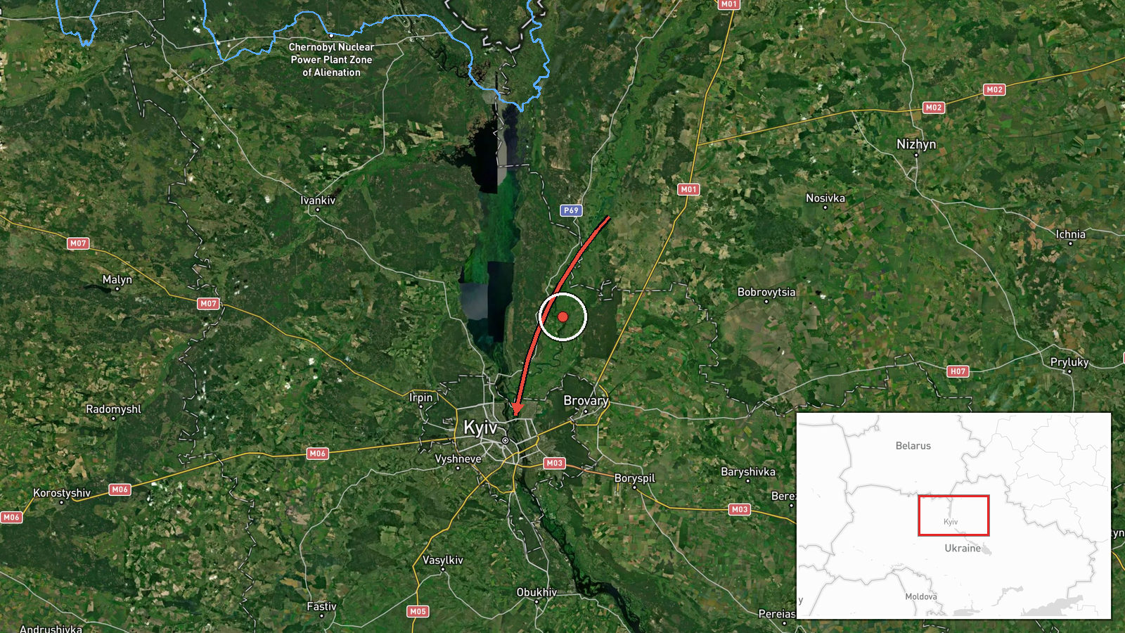
Ukrainian air monitoring reported one Russian jet-powered Shahed (Geran-3) drone travelling from Chernihiv Oblast toward Kyiv Oblast on 19 October 2026, with the report logged at 23:04 UTC. The information was posted on Telegram by the channel @kpszsu, which carries Ukrainian air force monitoring updates. The source wording is brief and describes the drone as 'реактивний БпЛА' (jet-powered unmanned aerial vehicle) moving 'з Чернігівщини на Київщину' (from Chernihiv region to Kyiv region). The post does not state a target, a point of impact, or any damage. The event is classed as a drone transit rather than a confirmed strike, and it reflects a track in progress rather than a completed attack.
Context and assessment
This report belongs to a cluster of drone transit alerts over Kyiv Oblast on the same day. Earlier alerts from 14:01 and 14:10 UTC placed single Geran-3 drones passing Kozelets and Kulykivka on routes toward Kyiv Oblast, followed by a single drone heading toward Kyiv at 15:33 and another from Cherkasy Oblast at 16:07. A later alert at 20:55 described three or more drones from northern Chernihiv Oblast moving toward the same area. The pattern suggests repeated launches or waves using corridors through the north and centre of the country, with Kyiv Oblast serving as a recurring line of approach. Jet-powered Shahed variants are generally faster and harder to intercept than earlier piston-engined versions, so their use may point to an effort to stretch air defence and complicate warning timelines. Taken together, the sequence may indicate sustained pressure on the capital region rather than a single isolated sortie. The available data does not show intended targets, so these readings remain tentative.
Sources and confidence
The report rests on one Telegram channel, @kpszsu, which is listed as the sole source with a source count of one. Nothing in the data shows independent cross-confirmation from another outlet, official statement, or imagery. The confidence score of 8.0 is low, reflecting single-channel sourcing, a brief unverified track, and the absence of impact or location detail. Confidence would rise if the air force issued a confirmed statement, if regional military administrations reported the track, or if independent monitoring or geolocated evidence matched the route. It would fall if later updates revised the drone count, direction, or classification, or if the track was attributed to another airspace event.
Location
The event is coded to Kyiv Oblast at approximate coordinates of 50.45 N, 30.52 E, which correspond to the Kyiv city area. The precision is regional rather than point-specific, and location confidence is low, because the source describes a flight path between oblasts rather than a fixed site. The coordinates should be read as a general anchor for the oblast, not as a target or impact location. Kyiv Oblast surrounds the capital and includes flat farmland, river valleys, and the Dnipro basin to the east. Chernihiv Oblast lies to the north, bordering Belarus, so drones entering from that direction would cross low-lying forest and farmland before reaching the Kyiv approaches.
Related events nearby
- Ukrainian air monitoring: 1 Russian jet-powered Shahed (Geran-3) drone passing Vyshhorod, heading toward Kyiv.2026-10-19 23:55 UTC · Drone Transit · Kyiv, Ukraine
- Ukrainian air monitoring: 1 Russian jet-powered Shahed (Geran-3) drone heading toward Kyiv Oblast.2026-10-19 23:36 UTC · Drone Transit · Kyiv Oblast, Ukraine
- Ukrainian air monitoring: 3+ Russian jet-powered Shahed (Geran-3) drones from northern Chernihiv Oblast toward2026-10-19 20:55 UTC · Drone Transit · Kyiv Oblast, Ukraine
- Ukrainian air monitoring: 1 Russian jet-powered Shahed (Geran-3) drone from Cherkasy Oblast toward Kyiv Oblast2026-10-19 16:07 UTC · Drone Transit · Kyiv Oblast, Ukraine
- Ukrainian air monitoring: 1 Russian jet-powered Shahed (Geran-3) drone heading toward Kyiv.2026-10-19 15:33 UTC · Drone Transit · Kyiv, Ukraine
▶ View this event on the live map

Intel Mapper aggregates open-source reports from monitored Telegram and X channels, geolocates them, cross-checks duplicates across sources and assigns a confidence score. Entries are updated as new confirmations arrive. Read how we verify events.