Single jet-powered Shahed (Geran-3) drone reported heading toward Kyiv Oblast from Chernihiv region
What happened
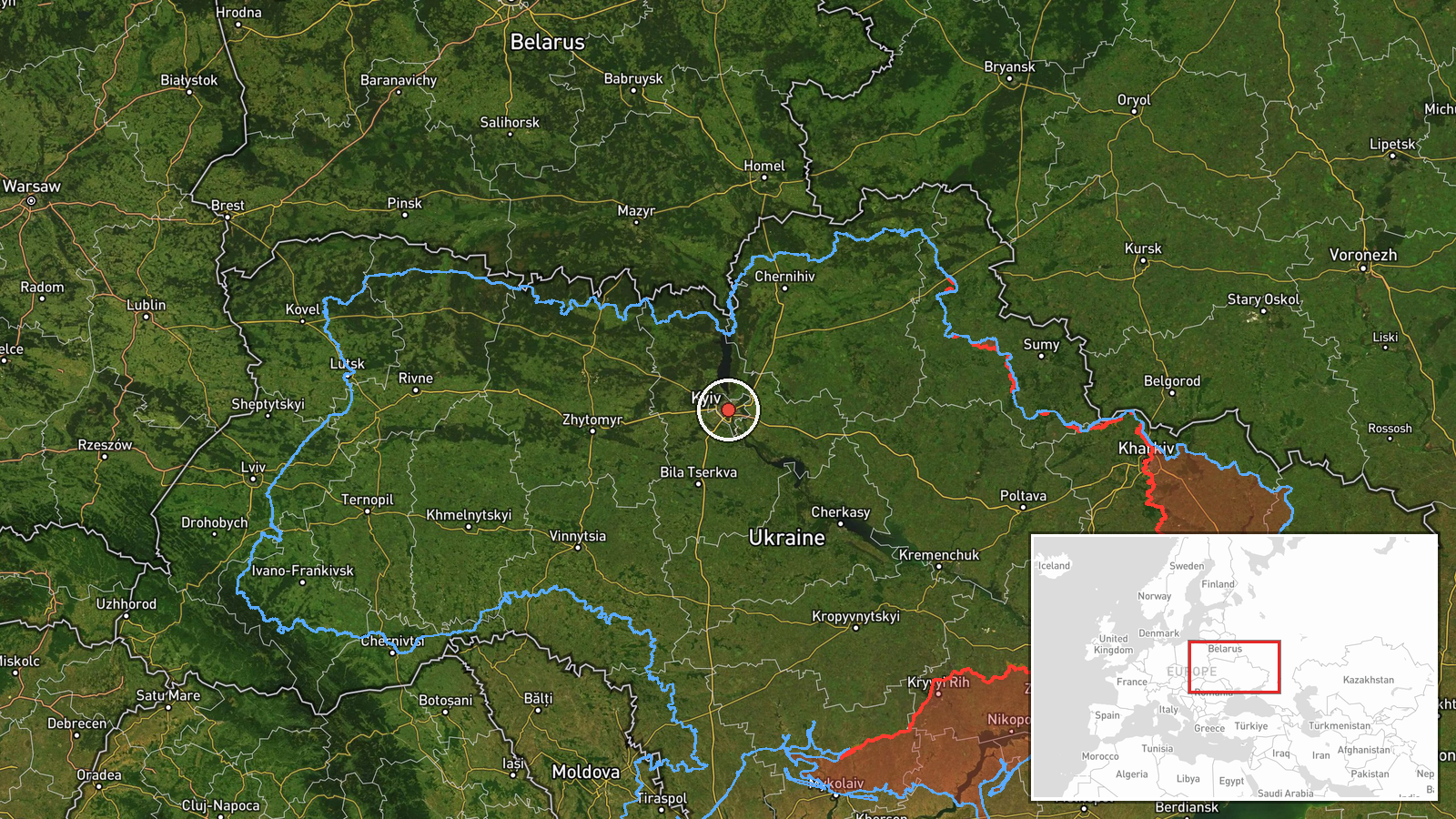
Ukrainian air monitoring channel @kpszsu reported on Telegram on 19 October 2026, at about 23:36 UTC, that one Russian jet-powered Shahed (Geran-3) drone was flying in the Slavutych area of Chernihiv Oblast in the direction of Kyiv Oblast. The original post, written in Ukrainian, describes it as a reactive UAV ("Реактивний БпЛА") moving toward the Kyiv region. The report concerns a drone in transit only; it does not describe any impact, damage, or casualties. The event is recorded as a single-source report with no independent confirmation attached to this entry. Because the post names a broad area rather than a precise point, the map position is approximate and placed at the Kyiv Oblast regional level.
Context and assessment
Kyiv and its surrounding oblast have been a recurring target of long-range drone activity, and the sequence of related entries on the same evening shows a steady stream of single and small-group Geran-3 tracks moving from northern and central Ukraine toward the capital. Reports from 15:33 through 23:55 UTC pass through Cherkasy, northern Chernihiv and Kyiv Oblast, then Vyshhorod and the city itself, suggesting repeated approach corridors rather than isolated launches. The jet-powered variant is notable because it is generally assessed to be faster than the propeller-driven Shahed design, which would shorten warning times for air defense crews. Operationally, a rolling pattern of individual drones can be read as an attempt to saturate or probe radar and interceptor coverage over the capital, to force air defense to commit resources, or to keep the population under alert. The clustering of tracks in one evening is consistent with that reading, though the data alone cannot establish intent or the target of any individual drone.
Sources and confidence
All reporting in this entry comes from one Telegram channel, @kpszsu, which is the Ukrainian Air Force's official account and is generally regarded as a primary source for air-threat warnings. Related entries on the same evening draw on similar air-monitoring wording, but they do not independently verify this specific track. The confidence score of 8.0 reflects a credible official source with a clear, time-stamped message, offset by the single-channel basis and the absence of any corroborating or outcome reporting. Confidence would rise with confirmation from additional air-monitoring or official channels, or with a matching track in regional administration updates. It would fall if the track was later revised, reclassified, or shown to be a different object.
Location
The location is recorded at the Kyiv Oblast regional level, with coordinates near the centre of the oblast, because the source only names the Slavutych area of neighbouring Chernihiv Oblast and the heading toward Kyiv Oblast. The point is therefore approximate and does not indicate a specific settlement or facility. Slavutych lies in the north of Ukraine near the Belarusian border and the Chornobyl exclusion zone, while the Kyiv region extends south and east of it along the Dnipro corridor. The area is largely flat, wooded and river-influenced, with the Desna and Dnipro rivers forming notable features along the route.
Related events nearby
- Ukrainian air monitoring: 1 Russian jet-powered Shahed (Geran-3) drone passing Vyshhorod, heading toward Kyiv.2026-10-19 23:55 UTC · Drone Transit · Kyiv, Ukraine
- Ukrainian air monitoring: 1 Russian jet-powered Shahed (Geran-3) drone from Chernihiv Oblast toward Kyiv Oblas2026-10-19 23:04 UTC · Drone Transit · Kyiv Oblast, Ukraine
- Ukrainian air monitoring: 3+ Russian jet-powered Shahed (Geran-3) drones from northern Chernihiv Oblast toward2026-10-19 20:55 UTC · Drone Transit · Kyiv Oblast, Ukraine
- Ukrainian air monitoring: 1 Russian jet-powered Shahed (Geran-3) drone from Cherkasy Oblast toward Kyiv Oblast2026-10-19 16:07 UTC · Drone Transit · Kyiv Oblast, Ukraine
- Ukrainian air monitoring: 1 Russian jet-powered Shahed (Geran-3) drone heading toward Kyiv.2026-10-19 15:33 UTC · Drone Transit · Kyiv, Ukraine
▶ View this event on the live map

Intel Mapper aggregates open-source reports from monitored Telegram and X channels, geolocates them, cross-checks duplicates across sources and assigns a confidence score. Entries are updated as new confirmations arrive. Read how we verify events.