Russian jet-powered Shahed drone reported heading toward Ternopil Oblast, western Ukraine
What happened
Ukrainian air monitoring reported one Russian jet-powered Shahed drone, described in the report as a Geran-3, moving north of Kamianets-Podilskyi on a heading toward Ternopil Oblast in western Ukraine. The dataset timestamp is 19 October 2026 at 23:33 UTC. The original Ukrainian-language post uses the term 'Реактивний БпЛА', meaning jet-powered unmanned aerial vehicle, and gives only a direction of travel. It does not describe a strike, impact point, casualties, or damage, and it does not say whether the drone was intercepted, lost contact, or continued beyond the region. The item was posted to a single Telegram channel, @kpszsu, and is classified here as a drone transit rather than a confirmed attack.
Context and assessment
The report fits a sequence of drone transit reports across central and western Ukraine on the same day. Earlier entries place single and multiple Geran-3 drones near Vynnyky at 05:20 UTC, then from Vinnytsia Oblast toward Khmelnytskyi Oblast at 07:57, over or toward Khmelnytskyi at 14:01, and again from southern Vinnytsia Oblast toward Khmelnytskyi Oblast at 23:23, roughly ten minutes before this item. Taken together, the pattern suggests repeated routing of jet-powered drones westward through a corridor that runs from the Vinnytsia area toward the Podolia region. Ternopil is a regional centre with transport and energy infrastructure, so a heading in that direction may point toward targets further west, or it may reflect saturation or decoy routing. The dataset cannot confirm which. The jet-powered variant is faster than the older piston-engine Shahed, which generally shortens warning time for air defence units. Because the report gives no target, these inferences should be treated as possibilities rather than conclusions.
Sources and confidence
All information comes from one Telegram channel, @kpszsu, which carries Ukrainian air monitoring alerts. The dataset shows no independent outlet, official statement, or second channel reporting the same drone, so cross-confirmation is absent. The confidence score of 8.0 reflects a direct, timestamped monitoring post with a specific drone type, offset by the single-source basis and the transit-only nature of the report. Confidence would rise with corroboration from other Ukrainian air force reports, regional military administration statements, or later reports of interception or impact in the area. It would fall if a later update contradicted the heading or indicated a different drone count. The record is not marked as corrected.
Location
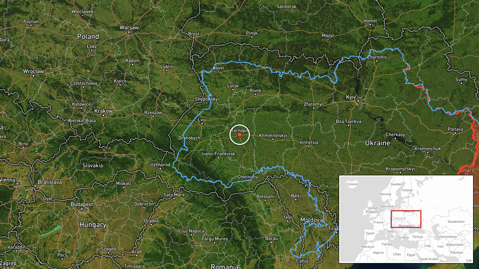
Location precision is region-level and the confidence is low. The coordinates, 49.55 N and 25.59 E, approximate the centre of Ternopil Oblast rather than any settlement or facility. The only named reference point, Kamianets-Podilskyi, lies in neighbouring Khmelnytskyi Oblast close to the regional border, so the drone's position was north of that city. The area is western Ukrainian forest-steppe and rolling farmland, with the Dniester valley to the south and the Carpathian foothills further southwest.
Related events nearby
- Ukrainian air monitoring: 1 Russian Shahed-type drone passing Horodok, heading northwest.2026-10-20 00:17 UTC · Drone Transit · Horodok, Ukraine
- Ukrainian air monitoring: 1 Russian jet-powered Shahed (Geran-3) drone from Rivne Oblast toward Dubno.2026-10-20 00:27 UTC · Drone Transit · Dubno, Ukraine
- Ukrainian air monitoring: 1 Russian jet-powered Shahed (Geran-3) drone heading toward Khmelnytskyi.2026-10-20 00:21 UTC · Drone Transit · Khmelnytskyi, Ukraine
- Ukrainian air monitoring: 2+ Russian jet-powered Shahed (Geran-3) drones passing Murovani Kurylivtsi, heading 2026-10-20 00:05 UTC · Drone Transit · Khmelnytskyi Oblast, Ukraine
- Ukrainian air monitoring: 2+ Russian jet-powered Shahed (Geran-3) drones from southern Vinnytsia Oblast toward2026-10-19 23:23 UTC · Drone Transit · Khmelnytskyi Oblast, Ukraine
▶ View this event on the live map

Intel Mapper aggregates open-source reports from monitored Telegram and X channels, geolocates them, cross-checks duplicates across sources and assigns a confidence score. Entries are updated as new confirmations arrive. Read how we verify events.