One Shahed-type drone reported passing Horodok in Khmelnytskyi Oblast, heading northwest
What happened
Ukraine's air monitoring channel on Telegram, @kpszsu, reported that one Russian Shahed-type drone was passing Horodok, a town in Khmelnytskyi Oblast, and heading in a northwest direction. The original Ukrainian post names the region as Khmelnytskyi and says the drone was passing Horodok and Vinkivtsi, while the event summary frames it as a single drone. The report was timestamped 00:17 UTC on 20 October 2026. It describes track and heading only and does not report impacts, damage, casualties, or interception. As a brief monitoring update, it reflects the drone's reported position at the time of posting rather than any confirmed outcome.
Context and assessment
Horodok lies in Khmelnytskyi Oblast in western-central Ukraine, a region that appeared repeatedly in recent air-monitoring traffic. The related events in this cluster are almost all drone transits centred on Khmelnytskyi city or its approaches. A single jet-powered Geran-3 was reported over Khmelnytskyi on 19 October, and a group of two or more drones was reported moving from southern Vinnytsia Oblast toward Khmelnytskyi Oblast at 23:23 UTC that day. Later, two or more drones were reported near Murovani Kurylivtsi, heading toward the oblast, at 00:05 UTC on 20 October, followed by a single drone heading toward Khmelnytskyi at 00:21 UTC. Taken together, the sequence suggests several aircraft moving across the region over a few hours, and the Horodok report fits that corridor. Geran-3 is a jet-powered variant of the Shahed family, generally used as a long-range one-way attack drone. In transit reports like these, the most common reading is that aircraft are being tracked along a route, and their final targets are often unknown. A northwest heading from Horodok may not match the city-directed reports, so analysts should treat individual headings cautiously. Because no impact is recorded, the report is best read as evidence of continued air activity over the oblast rather than a strike on a specific site.
Sources and confidence
The report comes from a single channel, the Telegram account @kpszsu, which carries Ukrainian air-monitoring alerts. No other outlet in the dataset reports this specific track, so cross-confirmation is absent. The confidence score of 8.0 reflects an official-style monitoring feed with a precise timestamp and a named settlement, tempered by the lack of independent corroboration and the brevity of the message. Confidence would rise with a second monitoring source, a regional military administration statement, or a flight-path report from another channel. It would fall if a correction altered the heading or drone count. The corrected flag is currently false.
Location
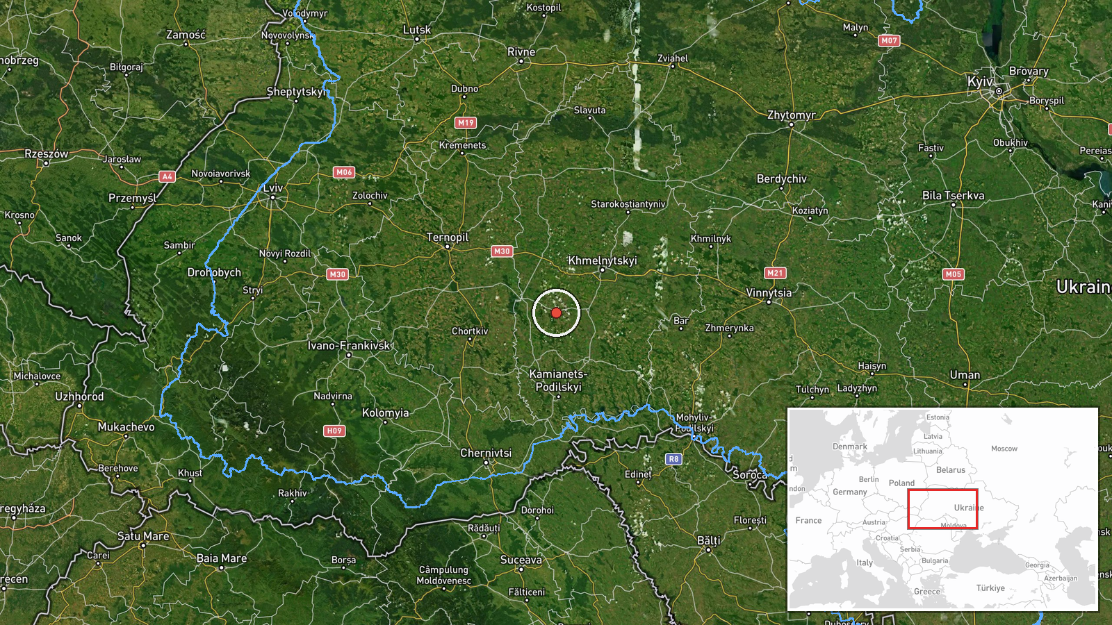
Coordinates place the event at Horodok, a settlement in Khmelnytskyi Oblast, at 49.17209 N, 26.56357 E. Settlement-level precision and high location confidence indicate the point marks the town rather than an exact track position, since the report names a place passed rather than a grid reference. The area lies within the Podillia upland of western-central Ukraine, a mostly agricultural landscape of rolling hills and river valleys. Vinkivtsi, named in the original post, is in the same general zone.
Related events nearby
- Ukrainian air monitoring: 1 Russian jet-powered Shahed (Geran-3) drone heading toward Khmelnytskyi.2026-10-20 00:21 UTC · Drone Transit · Khmelnytskyi, Ukraine
- Ukrainian air monitoring: 2+ Russian jet-powered Shahed (Geran-3) drones passing Murovani Kurylivtsi, heading 2026-10-20 00:05 UTC · Drone Transit · Khmelnytskyi Oblast, Ukraine
- Ukrainian air monitoring: 2+ Russian jet-powered Shahed (Geran-3) drones from southern Vinnytsia Oblast toward2026-10-19 23:23 UTC · Drone Transit · Khmelnytskyi Oblast, Ukraine
- Ukrainian air monitoring: 1 Russian jet-powered Shahed (Geran-3) drone heading toward Khmelnytskyi.2026-10-19 14:01 UTC · Drone Transit · Khmelnytskyi, Ukraine
- Ukrainian air monitoring: 1 Russian jet-powered Shahed (Geran-3) drone over Khmelnytskyi.2026-10-19 14:01 UTC · Drone Transit · Khmelnytskyi, Ukraine
▶ View this event on the live map

Intel Mapper aggregates open-source reports from monitored Telegram and X channels, geolocates them, cross-checks duplicates across sources and assigns a confidence score. Entries are updated as new confirmations arrive. Read how we verify events.