Ukraine reports 2+ Geran-3 jet drones moving from Vinnytsia Oblast toward Khmelnytskyi Oblast
What happened
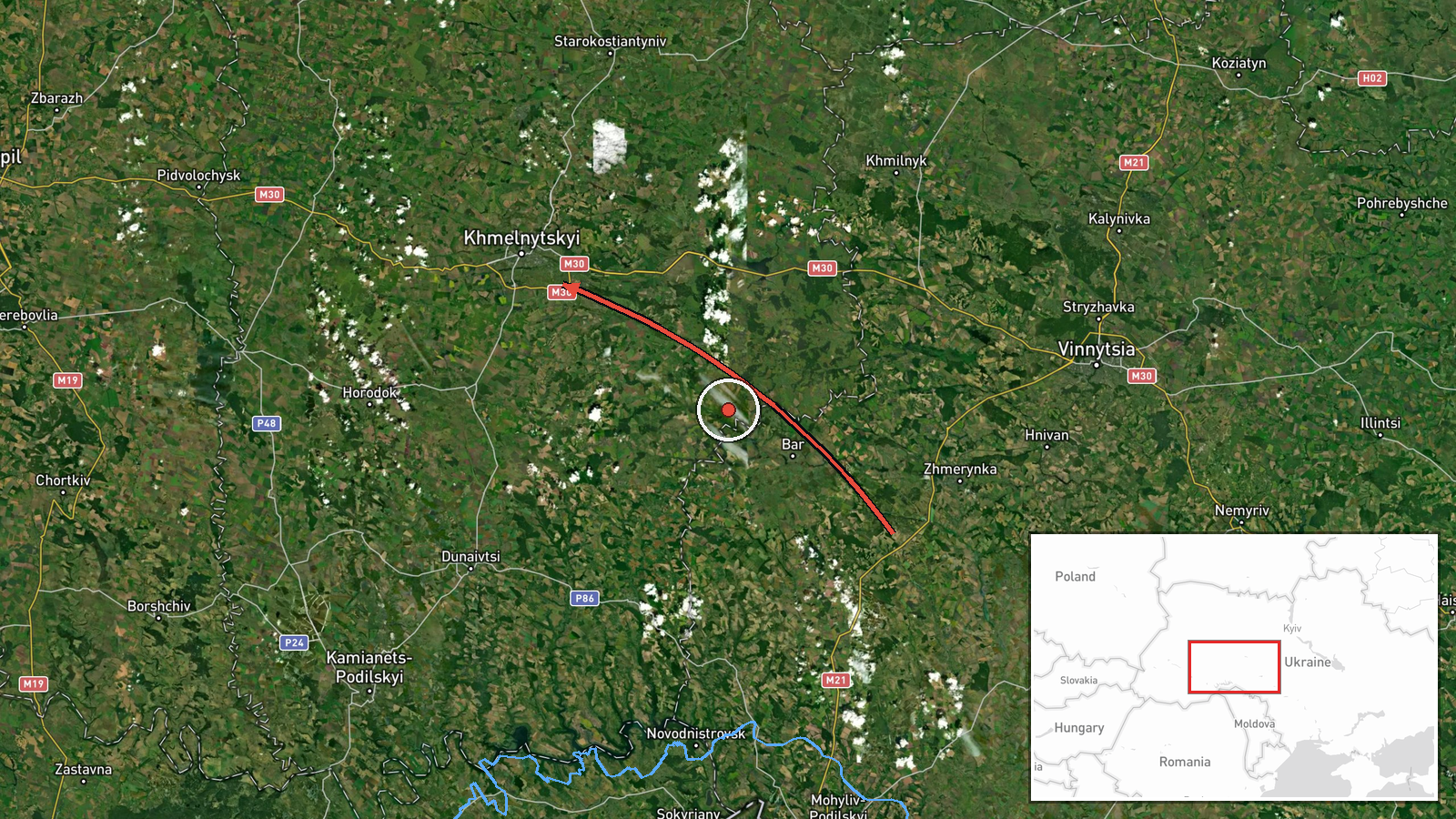
Ukrainian air monitoring, as relayed by the Telegram channel @kpszsu, reported two or more Russian jet-powered Shahed (Geran-3) drones in southern Vinnytsia Oblast on a course toward Khmelnytskyi Oblast. The original Ukrainian wording, which translates roughly as jet-type unmanned aerial vehicles in southern Vinnytsia heading toward Khmelnytskyi, describes a transit rather than a confirmed strike or impact. The post is timed 19 October 2026 at 23:23 UTC. No casualties, damage, or interceptions are mentioned in the report, and the wording does not state a final destination within the oblast. The attribution to Russia reflects the drone type named in the post rather than any independent confirmation of launch.
Context and assessment
The event forms part of a sustained pattern on 19 October 2026 in which Ukrainian monitoring repeatedly logged Geran-3 drones moving through Khmelnytskyi Oblast. Earlier reports from 07:57 UTC described a group of two or more drones travelling from Vinnytsia Oblast toward Khmelnytskyi Oblast, the same corridor as this report. Later entries placed single drones over or heading toward Khmelnytskyi city at 14:01 and over or toward Starokostyantyniv at 18:44 and 21:36. This suggests a long, multi-hour movement of drones across west-central Ukraine rather than a single short raid. Khmelnytskyi hosts military infrastructure, so the repeated routing may point to surveillance, route-probing, or an effort to stretch air defence coverage across several locations. The jet-powered variant is faster than earlier piston-engine Shaheds and can be harder for some low-altitude systems to engage, which may partly explain the tracking emphasis. These interpretations remain tentative because the reports do not state targets or intent.
Sources and confidence
All related reports, including this one, come from a single Telegram channel, so there is no cross-confirmation from a second outlet, official statement, or independent sensor feed in the dataset. The confidence score of 8.0 reflects that single-source status together with the consistent format and repeated timing of the monitoring posts. Confidence would rise if the Ukrainian Air Force or regional administrations issued matching statements, or if independent outlets reported the same movements or subsequent debris and impacts. It would fall if later updates contradicted the routing, if the channel corrected its posts, or if no corroborating reports emerged for the same window.
Location
The location is recorded at region level, with coordinates roughly at the centre of Khmelnytskyi Oblast, not at a specific settlement or facility, which is why the location confidence is low. The reported routing begins in southern Vinnytsia Oblast and moves into the western-central part of Ukraine. Khmelnytskyi Oblast is largely agricultural and lies in the Podolia upland, with the Southern Bug river running through the region. Neighbouring areas include Vinnytsia, Ternopil, and Zhytomyr oblasts.
Related events nearby
- Ukrainian air monitoring: 1 Russian jet-powered Shahed (Geran-3) drone heading toward Khmelnytskyi.2026-10-19 14:01 UTC · Drone Transit · Khmelnytskyi, Ukraine
- Ukrainian air monitoring: 1 Russian jet-powered Shahed (Geran-3) drone over Khmelnytskyi.2026-10-19 14:01 UTC · Drone Transit · Khmelnytskyi, Ukraine
- Ukrainian air monitoring: 2+ Russian jet-powered Shahed (Geran-3) drones from Vinnytsia Oblast toward Khmelnyt2026-10-19 07:57 UTC · Drone Transit · Khmelnytskyi Oblast, Ukraine
- Ukrainian air monitoring: 1 Russian jet-powered Shahed (Geran-3) drone heading toward Starokostyantyniv.2026-10-19 21:36 UTC · Drone Transit · Starokostyantyniv, Ukraine
- Ukrainian air monitoring: 1 Russian jet-powered Shahed (Geran-3) drone over Starokostyantyniv.2026-10-19 18:44 UTC · Drone Transit · Starokostyantyniv, Ukraine
▶ View this event on the live map

Intel Mapper aggregates open-source reports from monitored Telegram and X channels, geolocates them, cross-checks duplicates across sources and assigns a confidence score. Entries are updated as new confirmations arrive. Read how we verify events.