Single jet-powered Shahed (Geran-3) drone reported heading toward Khmelnytskyi from the south
What happened
Ukraine's air monitoring channel on Telegram (@kpszsu) reported at 00:21 UTC on 20 October 2026 that one Russian jet-powered Shahed, identified as a Geran-3, was heading toward the city of Khmelnytskyi from the south. The original post, written in Ukrainian with a jet-drone emoji, used the phrase 'Реактивний БпЛА на Хмельницький з півдня', which translates roughly as 'jet UAV toward Khmelnytskyi from the south.' The report is a short air-alert style notice and does not describe impact, damage, or casualties. It is a single-source report, and the attribution to Russia reflects the channel's own identification of the drone type.
Context and assessment
Khmelnytskyi sits in western-central Ukraine, well behind the front line, and it lies on routes that Russian long-range drones have frequently used to reach western and central regions. This event belongs to a cluster of drone transit reports for the same area on 19 and 20 October 2026. Earlier that day, the monitoring channel reported groups of two or more Geran-3 drones moving from Vinnytsia Oblast toward Khmelnytskyi Oblast at 07:57 and again at 23:23 UTC, and a single drone was logged over the city itself at 14:01 UTC. A further report at 00:05 UTC placed two or more drones near Murovani Kurylivtsi, heading toward the oblast. The repeated pattern of northward or northwestward tracks through Vinnytsia and into Khmelnytskyi suggests sustained use of this corridor rather than a one-off incursion. Jet-powered variants are generally faster and harder to intercept than the older piston-engine Shahed design, which is one reason air monitoring channels flag them separately. Taken together, the sequence may indicate ongoing long-range strike activity, reconnaissance, or decoy tasking across the region, though the reports alone do not establish which purpose applies.
Sources and confidence
The report comes from one channel, Telegram @kpszsu, which is the Ukrainian Air Force's official monitoring account, and no independent outlet has yet reported it. Confidence is scored at 8.0 because the channel is authoritative for air-threat notices and the drone type and heading are stated explicitly. It is held below the maximum because there is only a single source, the post gives no time of detection or track confirmation beyond the heading, and the notice does not indicate whether the drone was intercepted or lost. Confidence would rise with corroboration from regional military administrations, a Ukrainian Air Force statement, or reports of interception or impact in Khmelnytskyi. It would fall if later updates retracted the drone's heading or identified it as a different type.
Location
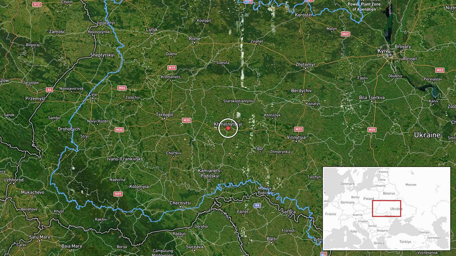
The location is coded at settlement level, placing the point on the city of Khmelnytskyi at approximately 49.42 N, 26.98 E, which is the administrative centre of Khmelnytskyi Oblast. Because the source names only the city and a bearing from the south, the marker reflects the city rather than a specific track position, and the drone's actual position may be elsewhere in the oblast. Khmelnytskyi lies on the Southern Bug river plain in the Podillia region, with rolling farmland, forests, and the Khmelnytskyi air base area to the north of the city. The Southern Bug and nearby river valleys are notable features of the wider corridor used by drone traffic.
Related events nearby
- Ukrainian air monitoring: 2+ Russian jet-powered Shahed (Geran-3) drones passing Murovani Kurylivtsi, heading 2026-10-20 00:05 UTC · Drone Transit · Khmelnytskyi Oblast, Ukraine
- Ukrainian air monitoring: 2+ Russian jet-powered Shahed (Geran-3) drones from southern Vinnytsia Oblast toward2026-10-19 23:23 UTC · Drone Transit · Khmelnytskyi Oblast, Ukraine
- Ukrainian air monitoring: 1 Russian jet-powered Shahed (Geran-3) drone heading toward Khmelnytskyi.2026-10-19 14:01 UTC · Drone Transit · Khmelnytskyi, Ukraine
- Ukrainian air monitoring: 1 Russian jet-powered Shahed (Geran-3) drone over Khmelnytskyi.2026-10-19 14:01 UTC · Drone Transit · Khmelnytskyi, Ukraine
- Ukrainian air monitoring: 2+ Russian jet-powered Shahed (Geran-3) drones from Vinnytsia Oblast toward Khmelnyt2026-10-19 07:57 UTC · Drone Transit · Khmelnytskyi Oblast, Ukraine
▶ View this event on the live map

Intel Mapper aggregates open-source reports from monitored Telegram and X channels, geolocates them, cross-checks duplicates across sources and assigns a confidence score. Entries are updated as new confirmations arrive. Read how we verify events.