Jet-powered Shahed drones reported moving from Kirovohrad into Vinnytsia Oblast, Ukraine
What happened
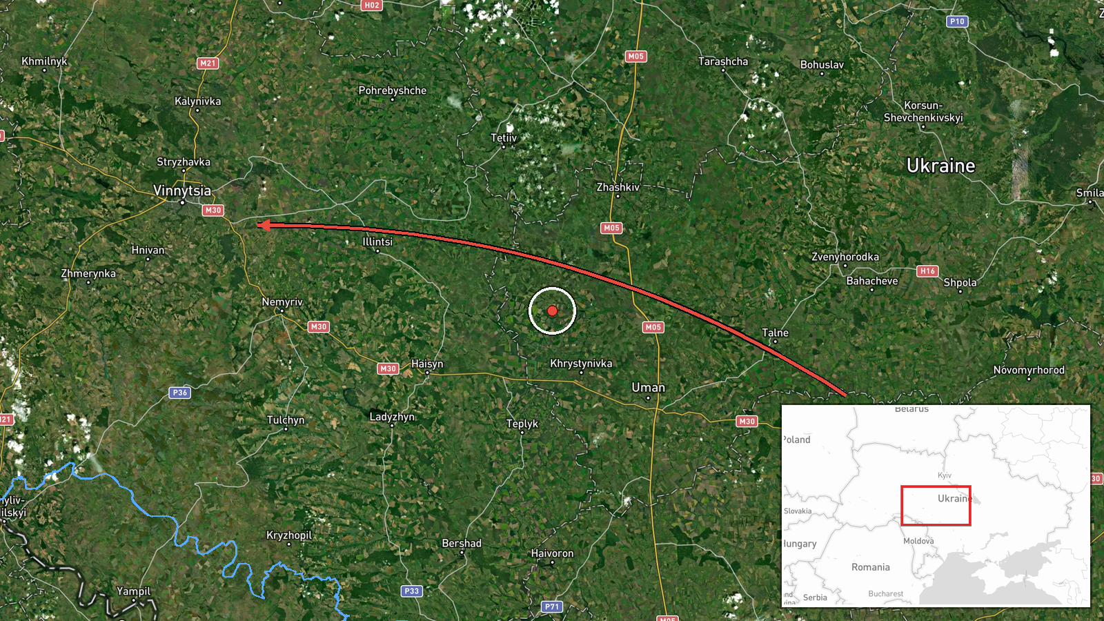
A Ukrainian air monitoring report posted to the Telegram channel @kpszsu states that two or more jet-powered Russian Shahed-type drones, identified as Geran-3, were moving from Kirovohrad Oblast into Vinnytsia Oblast on a western heading. The original Ukrainian-language message describes jet-powered UAVs entering Vinnytsia region from Kirovohrad region on a western course. The report is dated 19 October 2026 at 23:35 UTC and names no specific settlement, impact point or damage. The wording describes airspace movement rather than a strike, so the item is recorded as a drone transit. Attribution to Russia reflects the drone type named in the report, not an independent identification of the launch site.
Context and assessment
Vinnytsia Oblast lies in west-central Ukraine, between the central regions and the western border area, and it contains rail, energy and logistics infrastructure that air defence reports often mention when drones pass overhead. Its position makes it a plausible transit zone for long-range drones travelling west from launch areas in the south and east. The related reports from the same day show a sustained pattern. At 05:22 UTC a single drone was reported heading toward Vinnytsia city. At 14:04 two or more were reported from Odesa Oblast toward the oblast, and at 17:50 further drones from Odesa Oblast were logged on the same route. At 23:06 two or more came from northern Odesa Oblast. A separate 07:45 entry describes drones leaving Vinnytsia Oblast toward Tyvriv. The repeated Odesa-to-Vinnytsia routing and the Kirovohrad origin here suggest that operators may be using varied corridors to spread the load on air defences. Transit reports alone cannot establish whether Vinnytsia itself is being targeted, because the data records no impacts. Follow-on strike reporting in the oblast would be the key indicator to watch.
Sources and confidence
The item rests on a single Telegram channel, @kpszsu, and carries a confidence score of 8.0 with a source count of one. The score is high for a monitoring channel posting in near real time, but it is not higher because no second outlet, official statement or independent observer is logged for this report, and the message describes only airspace movement. Confidence would rise with cross-confirmation from another Ukrainian air force or regional military administration post, or from a wire service. It would fall if the same-day related reports were found to be duplicates or retractions. The record is not marked as corrected.
Location
The location was assigned at region level, so the coordinates (49.23, 28.47) sit approximately at the centre of Vinnytsia Oblast rather than at a settlement or facility. The precision is marked region and the confidence low. Vinnytsia Oblast is largely rolling farmland and river valleys, with the Southern Bug river running through the region. The report names no nearby town, so the exact track of the drones cannot be placed from this record.
Related events nearby
- Ukrainian air monitoring: 2+ Russian jet-powered Shahed (Geran-3) drones from northern Odesa Oblast toward Vin2026-10-19 23:06 UTC · Drone Transit · Vinnytsia Oblast, Ukraine
- Ukrainian air monitoring: 1 Russian jet-powered Shahed (Geran-3) drone from Odesa Oblast toward Vinnytsia Obla2026-10-19 17:50 UTC · Drone Transit · Vinnytsia Oblast, Ukraine
- Ukrainian air monitoring: 2+ Russian jet-powered Shahed (Geran-3) drones from Odesa Oblast toward Vinnytsia Ob2026-10-19 14:04 UTC · Drone Transit · Vinnytsia Oblast, Ukraine
- Ukrainian air monitoring: 1 Russian jet-powered Shahed (Geran-3) drone heading toward Vinnytsia.2026-10-19 05:22 UTC · Drone Transit · Vinnytsia, Ukraine
- Ukrainian air monitoring: 2+ Russian jet-powered Shahed (Geran-3) drones from Vinnytsia Oblast toward Tyvriv.2026-10-19 07:45 UTC · Drone Transit · Tyvriv, Ukraine
▶ View this event on the live map

Intel Mapper aggregates open-source reports from monitored Telegram and X channels, geolocates them, cross-checks duplicates across sources and assigns a confidence score. Entries are updated as new confirmations arrive. Read how we verify events.