Single jet-powered Shahed-type drone reported transiting Ternopil Oblast, heading northwest
What happened
Ukrainian air monitoring reported one Russian jet-powered Shahed-type drone, described as a Geran-3, passing near Vyshnivets in Ternopil Oblast in western Ukraine and moving northwest. The event is timestamped 20 October 2026 at 00:33 UTC. The original Ukrainian-language post, published on the Telegram channel @kpszsu, calls the object a 'jet-powered UAV' (Реактивний БпЛА) passing Vyshnivets and heading northwest. The post does not mention impact, detonation, or casualties, so the record is classed as a drone transit rather than a strike. The location is held at regional level for Ternopil Oblast, so the settlement named in the post is the most specific place reference available. Related entries from the same hour place similar drones further east and south, in Rivne and Khmelnytskyi areas, but the sources do not link them directly to this track.
Context and assessment
Ternopil Oblast lies well west of the front line, so reports of drones crossing it are usually about transit rather than immediate ground impact. Its importance comes from the route. Long-range Shahed-type drones have repeatedly been reported crossing western and central Ukraine on the way to targets elsewhere, and monitoring channels track them as they pass through regional airspace. The related events are a useful sequence. A drone heading toward Ternopil Oblast was logged at 23:33, followed by a report of a Shahed-type drone passing Horodok at 00:17. Two or more drones were logged passing Murovani Kurylivtsi toward Khmelnytskyi Oblast at 00:05, another was reported heading toward Khmelnytskyi at 00:21, and one was reported from Rivne Oblast toward Dubno at 00:27. Taken together, these entries suggest several drones moving through western Ukraine over roughly an hour, with some tracks running northwest. Operationally, this may point to multiple launches routed along a western corridor, with the jet-powered Geran-3 variant noted for higher speed than piston-engine models. These are hedged inferences. The reports show airspace movement, not targeting, and the sources do not state the drones' final destinations.
Sources and confidence
The event rests on one source, the Telegram channel @kpszsu, which is widely understood to belong to Ukraine's Air Force and is a frequent publisher of air alerts. No independent outlet in the record reports this specific track. The confidence score of 8.0 reflects the official-style origin of the channel and its consistency with the nearby sequence of related drone transit reports. It is held below the maximum because there is no cross-confirmation, the location is region-level, and the post names a settlement without precise coordinates. Confidence would rise with independent monitoring, Ukrainian Air Force follow-up confirming the track, or geolocated debris or impact reports tied to the route. It would fall if a correction were issued, if the track were later attributed to a different system, or if it could not be reconciled with the related reports.
Location
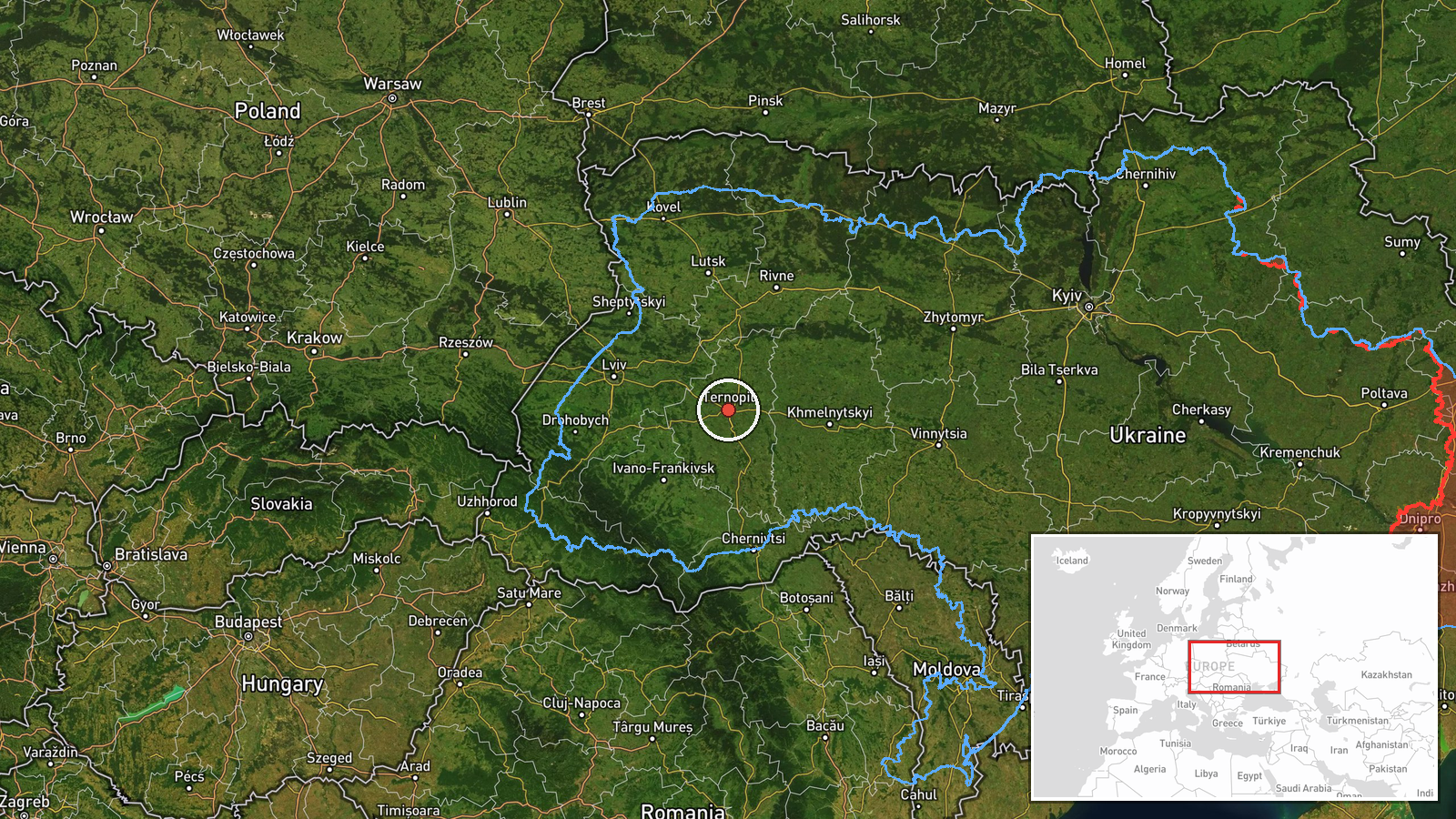
The location is approximate. Coordinates of 49.55 and 25.59 sit at regional level for Ternopil Oblast and do not mark the exact position of Vyshnivets or the drone's track. The settlement name in the source text was the basis for the regional placement. Ternopil Oblast is in western Ukraine, in the Podillia upland region of mixed farmland and woodland, with Rivne and Khmelnytskyi oblasts to the north and east. Its location means the event is best read as an airspace transit in the western part of the country, rather than as a precise point.
Related events nearby
- Ukrainian air monitoring: 1 Russian jet-powered Shahed (Geran-3) drone heading toward Ternopil Oblast.2026-10-19 23:33 UTC · Drone Transit · Ternopil Oblast, Ukraine
- Ukrainian air monitoring: 1 Russian Shahed-type drone passing Horodok, heading northwest.2026-10-20 00:17 UTC · Drone Transit · Horodok, Ukraine
- Ukrainian air monitoring: 1 Russian jet-powered Shahed (Geran-3) drone from Rivne Oblast toward Dubno.2026-10-20 00:27 UTC · Drone Transit · Dubno, Ukraine
- Ukrainian air monitoring: 1 Russian jet-powered Shahed (Geran-3) drone heading toward Khmelnytskyi.2026-10-20 00:21 UTC · Drone Transit · Khmelnytskyi, Ukraine
- Ukrainian air monitoring: 2+ Russian jet-powered Shahed (Geran-3) drones passing Murovani Kurylivtsi, heading 2026-10-20 00:05 UTC · Drone Transit · Khmelnytskyi Oblast, Ukraine
▶ View this event on the live map

Intel Mapper aggregates open-source reports from monitored Telegram and X channels, geolocates them, cross-checks duplicates across sources and assigns a confidence score. Entries are updated as new confirmations arrive. Read how we verify events.