Single jet-powered Shahed (Geran-3) drone reported moving from Zhytomyr to Khmelnytskyi Oblast
What happened
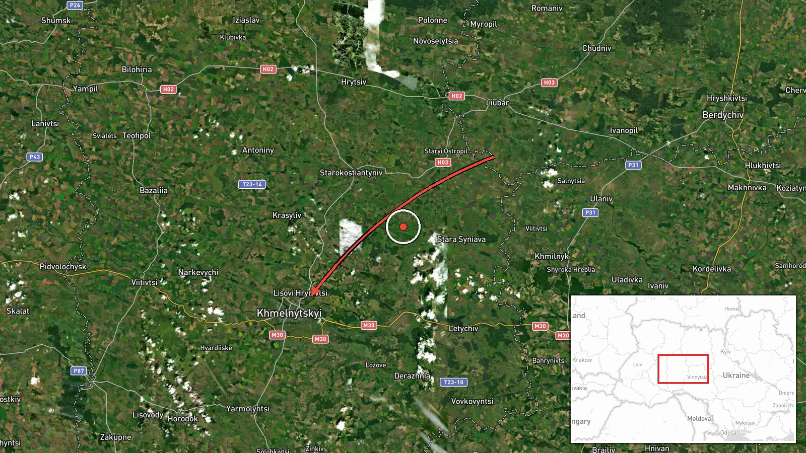
Ukrainian air monitoring channel @kpszsu reported on Telegram that one Russian jet-powered Shahed, identified as a Geran-3, was passing near Baranivka in Zhytomyr Oblast and heading toward Khmelnytskyi Oblast. The post, timestamped 20 October 2026 at 01:45 UTC, is written as a transit alert rather than a strike report, and the original Ukrainian wording describes the drone as 'реактивний БпЛА' moving 'повз Баранівку' toward the neighbouring region. The report does not state any impact, damage, or casualties. The event is logged as a drone transit, meaning the drone was tracked in flight rather than confirmed to have struck a target. Its position is recorded at regional level for Khmelnytskyi Oblast, not at a specific settlement.
Context and assessment
Khmelnytskyi Oblast sits in western Ukraine, a corridor that Russian long-range drones have repeatedly crossed on routes from the north, east and south toward western and central targets. The related events in this feed show a sustained pattern over roughly 24 hours on 19 and 20 October 2026: groups of two or more Geran-3 drones were logged from southern Vinnytsia Oblast, passing Murovani Kurylivtsi, and later near Derazhnya, all heading toward Khmelnytskyi. Several single-drone entries also appear, which suggests the monitoring system is registering individual airframes as they move through the region, sometimes in staggered waves. Operationally, a sequence of this kind may indicate a continuing campaign of long-range drone launches against western Ukraine, with individual drones either serving as decoys, sensor probes, or elements of larger salvos that are split across routes. The jet-powered Geran-3 variant is generally assessed to be faster and harder to intercept than the older piston-engined Shahed, though the feed alone cannot confirm the drone's intended target or whether any of these airframes were engaged.
Sources and confidence
Only one channel is attached to this entry: the Telegram account @kpszsu, which is associated with the Ukrainian Air Force's public air-alert and monitoring reporting. No independent outlet or second monitoring channel in the data confirms this specific drone's track. The related events, however, come from the same type of Ukrainian air monitoring reporting and describe a consistent route, which gives partial internal coherence. The confidence score of 8.0 reflects a single-source origin, a transit rather than impact report, and the absence of a precise location. Confidence would rise with corroboration from a second monitoring source, an official Air Force statement naming the oblast, or subsequent reports of an impact or interception. It would fall if later updates contradicted the trajectory or if the track proved to be a misidentification.
Location
The location is recorded at oblast level for Khmelnytskyi Oblast, with coordinates near 49.42 N, 26.98 E, which place the point at the regional centre area rather than a precise settlement. The source names Baranivka in Zhytomyr Oblast as a waypoint, but the geocoded point reflects the destination region, and the location confidence is marked as low. Khmelnytskyi Oblast is a largely agricultural region of rolling plains and river valleys in western Ukraine, with the Southern Bug and its tributaries crossing the territory. Nearby settlements referenced in the related events include Derazhnya and Murovani Kurylivtsi, which lie along the transit corridor.
Related events nearby
- Ukrainian air monitoring: 2+ Russian jet-powered Shahed (Geran-3) drones passing Murovani Kurylivtsi, heading 2026-10-20 02:55 UTC · Drone Transit · Khmelnytskyi Oblast, Ukraine
- Ukrainian air monitoring: 1 Russian jet-powered Shahed (Geran-3) drone passing Derazhnya, heading toward Khmel2026-10-20 02:19 UTC · Drone Transit · Khmelnytskyi, Ukraine
- Ukrainian air monitoring: 1 Russian jet-powered Shahed (Geran-3) drone heading toward Khmelnytskyi.2026-10-20 00:21 UTC · Drone Transit · Khmelnytskyi, Ukraine
- Ukrainian air monitoring: 2+ Russian jet-powered Shahed (Geran-3) drones passing Murovani Kurylivtsi, heading 2026-10-20 00:05 UTC · Drone Transit · Khmelnytskyi Oblast, Ukraine
- Ukrainian air monitoring: 2+ Russian jet-powered Shahed (Geran-3) drones from southern Vinnytsia Oblast toward2026-10-19 23:23 UTC · Drone Transit · Khmelnytskyi Oblast, Ukraine
▶ View this event on the live map

Intel Mapper aggregates open-source reports from monitored Telegram and X channels, geolocates them, cross-checks duplicates across sources and assigns a confidence score. Entries are updated as new confirmations arrive. Read how we verify events.