Jet-powered Shahed-type drones reported passing Solone in Dnipropetrovsk Oblast, heading west
What happened
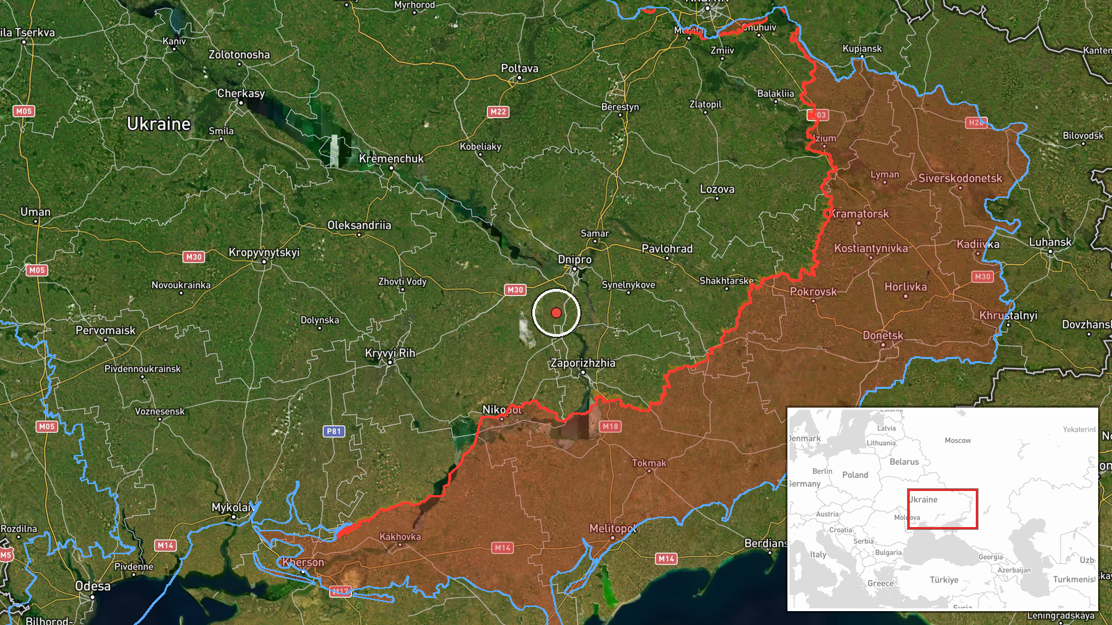
Ukraine's Air Force, reporting through its official Telegram channel @kpszsu, said at about 01:52 UTC on 20 October 2026 that two or more jet-powered Shahed-type drones, identified as Geran-3, were passing Solone in Dnipropetrovsk Oblast and moving in a western direction. The original Ukrainian-language post lists the flight as passing Solone, Synelnykove and Vasylkivka and describes the aircraft as reactive UAVs. The wording indicates a transit track rather than a reported strike, and the post contains no statement of impact, damage or casualties at any of the three settlements. The attribution to Russia reflects the standard framing of Shahed-series platforms used in the war against Ukraine. Because this is a single official alert issued in near-real time, the flight path and altitude are not specified beyond the settlements named.
Context and assessment
Solone lies in the Dnipropetrovsk region, a corridor that has repeatedly seen Russian long-range drone and glide-bomb activity moving toward industrial and population centres further west. The Dnipro area and the wider oblast have appeared often in the recent sequence on this map. Earlier on 19 October, a single Shahed-type drone was tracked toward Aviatorske at 02:43 UTC, and at 06:49 a jet-powered Geran-3 was logged passing Dnipropetrovsk Oblast heading west. At 07:42 two or more jet-powered drones were reported heading toward Dnipro itself, followed by a guided glide bomb toward the oblast at 17:09 and tactical aviation toward the oblast at 17:54. Taken together, the pattern suggests a sustained day-long series of air activity across the oblast rather than an isolated flight. Western-heading transits that pass several settlements in sequence are often consistent with drones routed along a corridor toward targets beyond the monitored point, although the event data does not confirm an intended target. The combination of jet-powered drones, glide bombs and manned aircraft within a single period may indicate a coordinated multi-axis effort, but that inference remains tentative.
Sources and confidence
The event rests on one channel, the official Telegram account of Ukraine's Air Force, which has served as a primary public source for national air alerts. No second outlet, radar-based feed or independent monitoring service in the data corroborates the sighting, so cross-confirmation is absent. The confidence score of 8.0 is relatively high because the originator is the official air monitoring authority and the wording is specific about aircraft type and direction, but it stops short of the top range because this is a single transit notice without imagery or follow-up. Confidence would rise with corroboration from a second source, such as regional military administration statements or reports of debris or impacts. It would fall if later updates revised the drone count, type or direction.
Location
The location is recorded at settlement precision with high location confidence, with Solone as the named point. The coordinates correspond to the village of Solone in Dnipropetrovsk Oblast, placed at the settlement centre rather than an exact flight position, since the alert names the village as a waypoint. The surrounding area is largely open agricultural steppe in the eastern part of the oblast. Synelnykove, named in the same alert, lies nearby as a regional hub, and the Dnipro valley lies to the west along the reported heading.
Related events nearby
- Ukrainian air monitoring: Russian tactical aircraft (tac. aviation) heading toward Dnipropetrovsk Oblast.2026-10-19 17:54 UTC · Combat Aircraft · Dnipropetrovsk Oblast, Ukraine
- Ukrainian air monitoring: 1 Russian guided glide bomb (KAB) heading toward Dnipropetrovsk Oblast.2026-10-19 17:09 UTC · Airstrike · Dnipropetrovsk Oblast, Ukraine
- Ukrainian air monitoring: 2+ Russian jet-powered Shahed (Geran-3) drones heading toward Dnipro.2026-10-19 07:42 UTC · Drone Transit · Dnipro, Ukraine
- Ukrainian air monitoring: 1 Russian jet-powered Shahed (Geran-3) drone passing Dnipropetrovsk Oblast, heading 2026-10-19 06:49 UTC · Drone Transit · Dnipropetrovsk Oblast, Ukraine
- Ukrainian air monitoring reports Russian drone(s) inbound toward Dnipro from the southeast.2026-10-20 02:04 UTC · Drone Transit · Dnipro, Dnipropetrovsk Oblast, Ukraine
▶ View this event on the live map

Intel Mapper aggregates open-source reports from monitored Telegram and X channels, geolocates them, cross-checks duplicates across sources and assigns a confidence score. Entries are updated as new confirmations arrive. Read how we verify events.