One jet-powered Shahed (Geran-3) reported in eastern Volyn Oblast, heading toward Manevychi
What happened
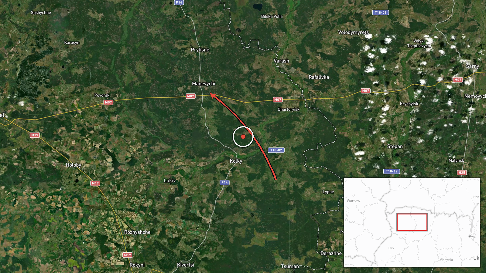
Ukrainian air monitoring, relayed through the Telegram channel @kpszsu, reported at 13:55 UTC on 20 October 2026 a single Russian jet-powered Shahed drone, identified in the post as a Geran-3, in eastern Volyn Oblast on a course toward the settlement of Manevychi. The original Ukrainian-language post is brief and describes only a jet-type UAV in eastern Volyn with a heading toward Manevychi. It does not report impact, casualties, damage, or local air-raid action, and no follow-up update appears in the data. The report describes a transit rather than a confirmed strike. It is one of a series of drone transit alerts logged across Zhytomyr and Rivne oblasts earlier the same day, which the feed records as generally heading west. The wording does not state altitude, speed, or whether the drone was tracked to a specific target.
Context and assessment
Manevychi is a small settlement in Volyn Oblast in northwestern Ukraine, in the Polissia lowlands close to the boundary with Rivne Oblast. Its significance in this event is more likely its position along a transit path than its role as a named target. The related events form a clear pattern of Geran-3 movements on 20 October. At 23:34 UTC on 19 October a single drone was reported moving from Zhytomyr Oblast into northern Rivne Oblast. This was followed by repeated reports of one or more drones at 00:08, 02:11, 07:29 and 12:24 UTC, the last describing two or more drones passing northern Rivne westward. The present report, placed in eastern Volyn about an hour after that, suggests the same or a related flight track continuing west or northwest. Repeated single-drone and small-group transits over a corridor of several oblasts are consistent with routes passing through Ukrainian airspace toward western targets, or with tactics that probe air defenses. The data cannot confirm which. A drone reported heading toward a settlement does not by itself indicate that the settlement was the intended target.
Sources and confidence
The report comes from a single Telegram channel, @kpszsu, which is used for Ukrainian air-monitoring alerts and is widely cited for drone warnings. No independent second channel in the data corroborates it, so the source count is one. The confidence score of 8.0 reflects a clear, timestamped report from an official-style monitoring channel that names a settlement and a heading, offset by its single-source status and the absence of any impact or follow-up confirmation. Confidence would rise with corroboration from another monitoring source, regional military administration statements, or independent radar-based reporting. It would fall if later updates revised the heading, drone count, or classification.
Location
The location is listed at settlement precision, so the marker sits on Manevychi itself, which is the named heading rather than a confirmed impact site. The coordinates reflect a town-level centroid, not a facility. Manevychi lies in the flat Polissia lowlands of northwestern Ukraine, a region of wetlands, forest and farmland. Treat the pin as an approximate reference point on the flight path, not a precise position of the drone.
Related events nearby
- Ukrainian air monitoring: 2+ Russian jet-powered Shahed (Geran-3) drones passing northern Rivne Oblast, headin2026-10-20 12:24 UTC · Drone Transit · northern Rivne Oblast, Ukraine
- Ukrainian air monitoring: 1 Russian jet-powered Shahed (Geran-3) drone passing northern Rivne Oblast, heading 2026-10-20 07:29 UTC · Drone Transit · northern Rivne Oblast, Ukraine
- Ukrainian air monitoring: 1 Russian jet-powered Shahed (Geran-3) drone from northern Zhytomyr Oblast toward no2026-10-20 02:11 UTC · Drone Transit · northern Rivne Oblast, Ukraine
- Ukrainian air monitoring: 2+ Russian jet-powered Shahed (Geran-3) drones from Zhytomyr Oblast toward northern 2026-10-20 00:08 UTC · Drone Transit · northern Rivne Oblast, Ukraine
- Ukrainian air monitoring: 1 Russian jet-powered Shahed (Geran-3) drone from Zhytomyr Oblast toward northern Ri2026-10-19 23:34 UTC · Drone Transit · northern Rivne Oblast, Ukraine
▶ View this event on the live map

Intel Mapper aggregates open-source reports from monitored Telegram and X channels, geolocates them, cross-checks duplicates across sources and assigns a confidence score. Entries are updated as new confirmations arrive. Read how we verify events.