Jet-powered Shahed (Geran-3) drone reported moving through Vinnytsia Oblast, Ukraine
What happened
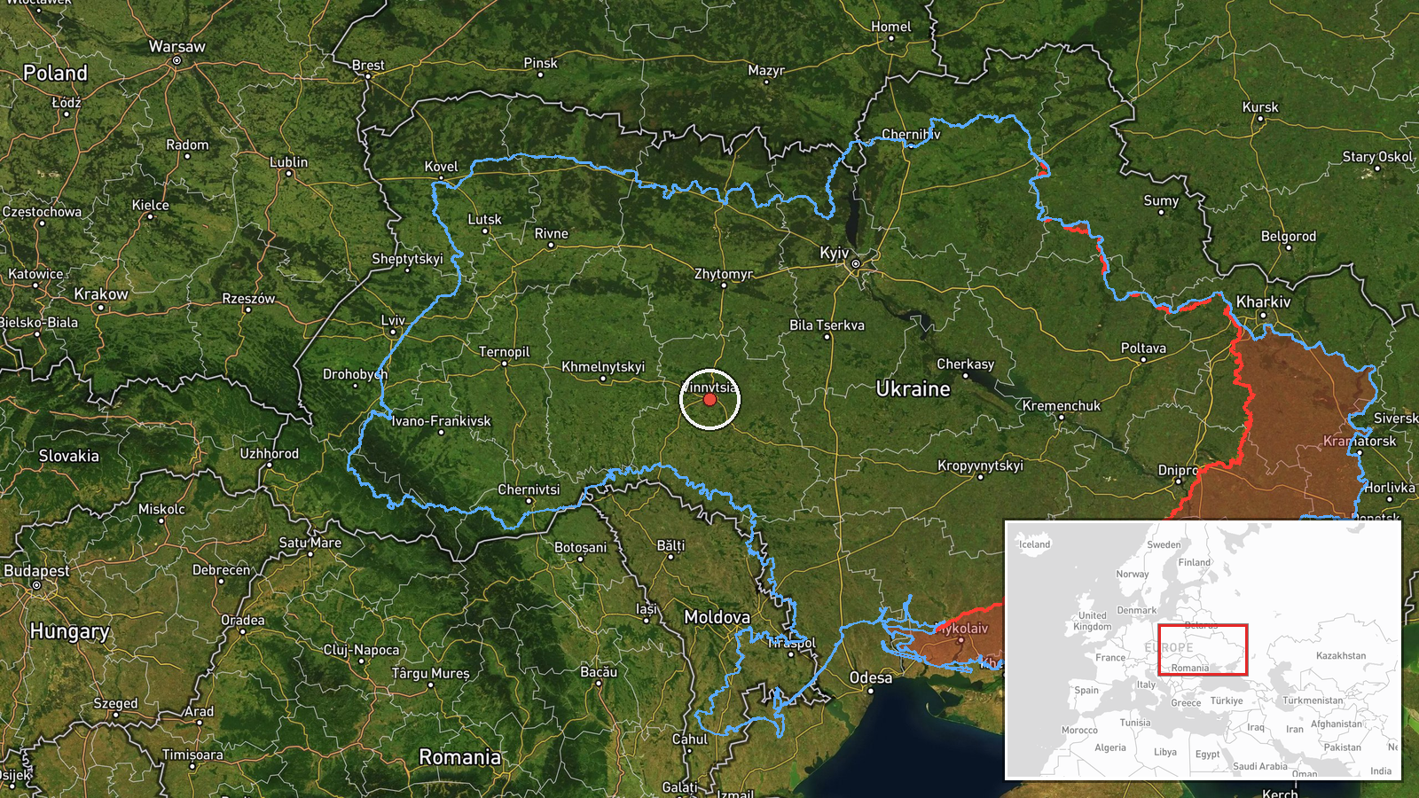
Ukrainian air monitoring reported on 21 October 2026 at 08:33 UTC that one Russian jet-powered Shahed, designated Geran-3, was moving near the settlement of Shyriaieve, in the Odesa area, on a heading toward Vinnytsia Oblast. The original Ukrainian-language post describes a jet-type unmanned aerial vehicle moving in the direction of Vinnytsia region. The report does not mention any impact, detonation or casualties. It is one of five drone-transit entries logged for Vinnytsia Oblast between 20 and 21 October 2026, and it is the latest in that set. The wording is an air-alert style update rather than a confirmed strike report.
Context and assessment
Vinnytsia Oblast lies in west-central Ukraine, between the Odesa region in the south and the Kyiv and central regions to the north and east. It contains road and rail corridors, including the Zhmerynka junction, which is a significant node on lines linking the south with the centre and west of the country, so repeated drone tracks over it are a point of interest for air defence planners. The related events show a sustained pattern rather than a single sighting. On 20 October the drone was logged passing Tyvriv and heading toward Vinnytsia, then approaching Zhmerynka. Early on 21 October it was reported moving from Vinnytsia Oblast toward Berezivka, and later that day it was reported again heading toward Vinnytsia. Operationally, a long sequence of single-drone transits across the same oblast may suggest a route being flown through the region toward targets further west or north, or the use of the area to probe and draw air defence responses. The Geran-3 variant is jet-powered, which generally means higher speed and different flight profiles than piston-engined Shaheds. These inferences remain tentative because the data does not show intended targets or the drone's final position.
Sources and confidence
The event rests on a single channel, Telegram @kpszsu, which is listed as the only source. The data contains no cross-confirmation from other channels, wire services, regional officials or independent tracking. The score of 8.0 reflects a credible single official-style channel with a specific, timestamped report, but also the absence of corroboration and the lack of any outcome confirmation. Confidence would rise with matching air force statements, regional administration notices, radar-based track data or reports of debris or impact. It would fall if the channel later retracted or revised the report, or if other monitoring sources failed to show the same track. The corrected flag is false.
Location
The location is recorded at region level, not settlement level. The coordinates are approximate and placed within Vinnytsia Oblast rather than at any specific town or facility, so the location confidence is low. The original post names Shyriaieve as the drone's position in Odesa Oblast, which marks the point of transit rather than the mapped point. Vinnytsia Oblast is a largely agricultural, landlocked territory in west-central Ukraine. The Southern Bug River crosses it, and the oblast contains the regional centre of Vinnytsia along with the rail junction at Zhmerynka.
Related events nearby
- Ukrainian air monitoring: 1 Russian jet-powered Shahed (Geran-3) drone from northern Odesa Oblast toward Vinny2026-10-21 09:29 UTC · Drone Transit · Vinnytsia Oblast, Ukraine
- Ukrainian air monitoring: 1 Russian jet-powered Shahed (Geran-3) drone heading toward Vinnytsia Oblast.2026-10-21 07:07 UTC · Drone Transit · Vinnytsia Oblast, Ukraine
- Ukrainian air monitoring: 1 Russian jet-powered Shahed (Geran-3) drone from Odesa Oblast toward Vinnytsia Obla2026-10-21 02:45 UTC · Drone Transit · Vinnytsia Oblast, Ukraine
- Ukrainian air monitoring: 1 Russian jet-powered Shahed (Geran-3) drone passing Tyvriv, heading toward Vinnytsi2026-10-20 12:15 UTC · Drone Transit · Vinnytsia, Ukraine
- Ukrainian air monitoring: 1 Russian jet-powered Shahed (Geran-3) drone heading toward Zhmerynka.2026-10-20 13:41 UTC · Drone Transit · Zhmerynka, Ukraine
▶ View this event on the live map

Intel Mapper aggregates open-source reports from monitored Telegram and X channels, geolocates them, cross-checks duplicates across sources and assigns a confidence score. Entries are updated as new confirmations arrive. Read how we verify events.