Shahed-type drone reported heading west over eastern Dnipropetrovsk Oblast
What happened
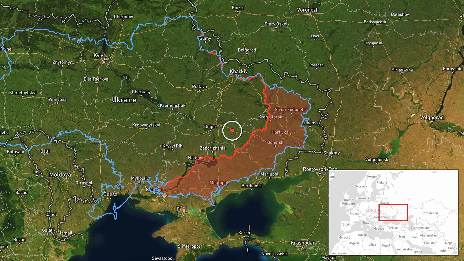
Ukraine's Air Force Telegram channel (@kpszsu) reported one Russian Shahed-type drone moving through eastern Dnipropetrovsk Oblast on a westward course. The post, published at 09:47 UTC on 21 October 2026, is brief and tracking-style. It gives no specific settlement, altitude, or speed, and it does not say which town the drone was over. The source describes a transit rather than an impact, and it reports no casualties, damage, or interception. The original Ukrainian wording simply notes an unmanned aerial vehicle in the east of the oblast heading west. The event record attributes the drone to Russia, which matches standard Ukrainian attribution for Shahed-type platforms.
Context and assessment
Eastern Dnipropetrovsk Oblast sits along a corridor of towns and rail and road links that Russian long-range strikes have repeatedly crossed in recent months. In the preceding roughly 17 hours, the event record logs a Geran-3 jet-powered drone heading toward Pavlohrad, another heading toward Lozova, a group of at least two drones passing Dnipropetrovsk Oblast on a northwestward path, a group of Banderol mini cruise missiles passing Solone toward Dnipro, and a guided glide bomb heading toward the oblast. Taken together, these reports suggest a sustained, multi-axis pressure pattern rather than a single isolated flight. The westward heading of this drone may indicate routing toward targets farther west, or it may reflect a route adjusted around air defence coverage. Because the record shows no target, the drone's purpose cannot be confirmed from this report alone. It may have been part of reconnaissance, saturation, or simply transit.
Sources and confidence
The event rests on a single channel, the Ukrainian Air Force's official Telegram account, and no independent outlet in the record corroborates it. The confidence score of 8.0 reflects that the post is specific, timestamped, and issued by an established official monitoring source with a consistent reporting style. It is held back from higher confidence by the single-source basis and the lack of location detail. Confidence would rise with corroboration from other Ukrainian channels, regional military administrations, or follow-up reporting of impacts or interceptions along the stated path. It would fall if the channel corrected or retracted the report, or if later updates contradicted the reported heading.
Location
The coordinates (48.46, 35.94) were assigned at regional precision, so the point represents eastern Dnipropetrovsk Oblast in general rather than a specific settlement, and location confidence is recorded as low. The source names no town. The setting is largely flat steppe and agricultural land in central-eastern Ukraine, drained by the Dnipro river system. The oblast borders Donetsk Oblast to the east, and its road and rail lines are important to regional logistics.
Related events nearby
- Ukrainian air monitoring: 2+ Russian jet-powered Shahed (Geran-3) drones heading toward Pavlohrad.2026-10-20 16:14 UTC · Drone Transit · Pavlohrad, Ukraine
- Ukrainian air monitoring: 1 Russian jet-powered Shahed (Geran-3) drone heading toward Lozova.2026-10-21 04:27 UTC · Drone Transit · Lozova, Ukraine
- Ukrainian air monitoring: 2+ Russian Banderol mini cruise missiles heading toward Dnipro.2026-10-21 10:18 UTC · Cruise Missile · Dnipro, Ukraine
- Ukrainian air monitoring: 1 Russian Banderol mini cruise missile from northern Dnipropetrovsk Oblast toward Dn2026-10-21 10:13 UTC · Cruise Missile · Dnipro, Ukraine
- Ukrainian air monitoring: 2+ Russian Banderol mini cruise missiles passing Solone, heading toward Dnipro.2026-10-21 06:08 UTC · Cruise Missile · Dnipro, Ukraine
▶ View this event on the live map

Intel Mapper aggregates open-source reports from monitored Telegram and X channels, geolocates them, cross-checks duplicates across sources and assigns a confidence score. Entries are updated as new confirmations arrive. Read how we verify events.