Single jet-powered Shahed (Geran-3) drone reportedly tracked toward Vinnytsia, Ukraine, on October 21, 2026
What happened
Ukrainian air monitoring channel @kpszsu reported on Telegram at 15:33 UTC on 21 October 2026 that one Russian jet-powered Shahed (Geran-3) drone was heading toward Vinnytsia, citing its position in the Voronovytsia area. The original Ukrainian-language post describes a jet-type UAV in the Voronovytsia district moving on a course toward Vinnytsia. The report is a short air-monitoring alert rather than a description of impact, and it does not mention any strike, casualties or damage. The event is categorised as a drone transit, meaning a track passing through or toward the area rather than a confirmed attack on a target. Only one channel carried the report at the time of compilation.
Context and assessment
Vinnytsia Oblast, in central-west Ukraine, has been a recurring corridor for long-range drones in this data set. Five related alerts logged the same day between 08:33 and 15:09 UTC describe Geran-3 jet drones moving toward the oblast from Odesa, northern Odesa and western Kirovohrad, with counts ranging from one to two or more. The repetition suggests a sustained flow of drones routed northwest through central Ukraine rather than isolated launches. Such routing is consistent with Russian long-range strike campaigns that use the territory between southern launch areas and western or central targets as a transit path, and the jet-powered variant is generally associated with higher speed than piston-engine Shaheds. Operationally, these tracks may indicate efforts to saturate or probe air defences along the route, or to strike infrastructure in the oblast, but the alert itself does not establish intent or target. Later alerts or official confirmations would be needed to link individual tracks to specific outcomes.
Sources and confidence
The report rests on a single Telegram channel, @kpszsu, which relays Ukrainian air-force style monitoring messages. No independent outlet, official statement or second channel had confirmed this specific track when the entry was compiled, so cross-confirmation is absent. The confidence score of 8.0 reflects a credible, routinely used warning channel with a precise timestamp and a consistent pattern with related alerts, offset by the single-source basis. Confidence would rise with corroboration from other monitoring channels, local military administration statements or reports of interceptions or impacts. It would fall if subsequent updates contradicted the track or if the channel later corrected the report.
Location
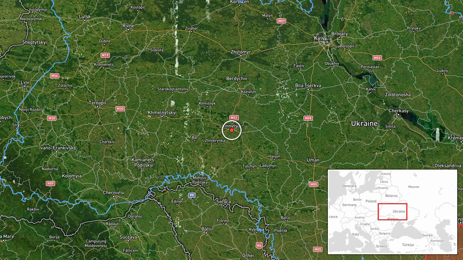
The location is recorded at settlement precision for Vinnytsia, Ukraine, with coordinates of about 49.23 N and 28.47 E and high location confidence. The reference point is the Voronovytsia area, which the original text names as the district where the drone was seen, and the entry is placed in relation to Vinnytsia city. Vinnytsia lies on the Southern Bug River in the Podillia upland of west-central Ukraine. The surrounding terrain is rolling farmland, forest belts and river valleys, with the Southern Bug as a prominent natural feature.
Related events nearby
- Ukrainian air monitoring: 2+ Russian jet-powered Shahed (Geran-3) drones heading toward Vinnytsia Oblast.2026-10-21 15:09 UTC · Drone Transit · Vinnytsia Oblast, Ukraine
- Ukrainian air monitoring: 1 Russian jet-powered Shahed (Geran-3) drone from western Kirovohrad Oblast toward V2026-10-21 14:06 UTC · Drone Transit · Vinnytsia Oblast, Ukraine
- Ukrainian air monitoring: 2+ Russian jet-powered Shahed (Geran-3) drones from Odesa Oblast toward Vinnytsia Ob2026-10-21 11:42 UTC · Drone Transit · Vinnytsia Oblast, Ukraine
- Ukrainian air monitoring: 1 Russian jet-powered Shahed (Geran-3) drone from northern Odesa Oblast toward Vinny2026-10-21 09:29 UTC · Drone Transit · Vinnytsia Oblast, Ukraine
- Ukrainian air monitoring: 1 Russian jet-powered Shahed (Geran-3) drone heading toward Vinnytsia Oblast.2026-10-21 08:33 UTC · Drone Transit · Vinnytsia Oblast, Ukraine
▶ View this event on the live map

Intel Mapper aggregates open-source reports from monitored Telegram and X channels, geolocates them, cross-checks duplicates across sources and assigns a confidence score. Entries are updated as new confirmations arrive. Read how we verify events.