Russian tactical aircraft reportedly launch guided bombs toward Zaporizhzhia Oblast
What happened
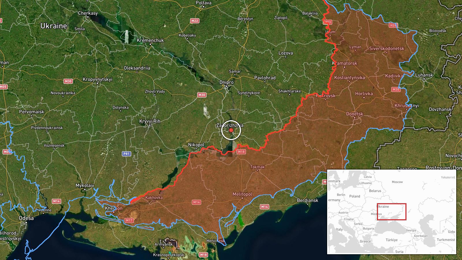
Ukrainian air monitoring posted on the Telegram channel @kpszsu, the official account of Ukraine's Air Force, on 23 October 2026 at about 01:50 UTC. The post reported launches of guided aviation bombs by Russian tactical aviation toward Zaporizhzhia Oblast. The original Ukrainian-language text describes launches of guided aerial bombs by enemy tactical aviation at the oblast. The post does not name a town, a target, the number of aircraft or munitions, or any impact. It is therefore a warning about launches in the direction of the oblast rather than a confirmed strike location. The map point is set at the city of Zaporizhzhia, a settlement-level approximation for an oblast-wide report. No casualty or damage figures appear in the source.
Context and assessment
Zaporizhzhia city matters for several reasons. It is the largest urban centre in the oblast, hosts industrial and transport infrastructure, and lies within a relatively short distance of active front sectors to the south and southwest, notably the Orikhiv axis. The related events from 22 October show a dense pattern in the same area. A Shahed-type drone was reported over Zaporizhzhia at 16:59 UTC, and another was reported heading toward the city at 17:01. Separately, two or more jet-powered Geran-3 drones were reported passing Slavhorod and heading west. Later that evening, the Ukrainian General Staff reported two Russian combat clashes on the Orikhiv axis near Lukianivske and Pavlivka, one of which remained unfinished at the time of reporting. Earlier, on 21 to 22 October, Ukrainian forces reportedly struck a Russian command-observation post near Vyshneve. Taken together, the sequence suggests sustained activity around the city and the adjacent frontline. Guided aerial bombs are typically released by aircraft at standoff distance against front-line positions and logistics, so launches aimed at the oblast may indicate support for ground operations rather than a deep strike on the city. That reading remains tentative, because the post gives no target and aircraft launch alerts are often issued before any impact is known.
Sources and confidence
Only one channel is recorded for this event, the official Telegram account of Ukraine's Air Force, so there is no independent cross-confirmation. The confidence score of 8.0 reflects that channel's institutional standing and its routine role in issuing air-threat alerts. It is offset by the brevity of the post and the absence of corroboration from radar-based reporting, impact footage, or regional military administration statements. Confidence would rise if a regional authority named a location or reported explosions, and would fall if later updates retracted or reclassified the warning.
Location
The location was assigned at settlement precision, with the map point placed on the city of Zaporizhzhia, the regional capital, while the source refers only to the wider oblast. The city sits on the Dnipro River, a large industrial centre with rail and road links. The Zaporizhzhia nuclear power plant and the town of Enerhodar lie to the southwest across the reservoir area, and the Orikhiv frontline sector lies to the south and southwest.
Related events nearby
- Ukrainian air monitoring: 1 Russian Shahed-type drone heading toward Zaporizhzhia.2026-10-22 17:01 UTC · Drone Transit · Zaporizhzhia, Ukraine
- Ukrainian air monitoring: 1 Russian Shahed-type drone over Zaporizhzhia.2026-10-22 16:59 UTC · Drone Transit · Zaporizhzhia, Ukraine
- Ukrainian General Staff reports two Russian combat clashes on the Orikhiv axis near Lukianivske and Pavlivka a2026-10-22 19:05 UTC · Combat · Lukianivske, Orikhiv Raion, Zaporizhzhia Oblast, U
- Ukrainian air monitoring: 2+ Russian jet-powered Shahed (Geran-3) drones passing Slavhorod, heading west.2026-10-22 17:01 UTC · Drone Transit · Slavhorod, Ukraine
- Ukrainian Defense Forces struck a Russian command-observation post near Vyshneve, Zaporizhzhia Oblast, on Octo2026-10-22 12:23 UTC · Combat · Vyshneve, Zaporizhzhia, Ukraine
▶ View this event on the live map

Intel Mapper aggregates open-source reports from monitored Telegram and X channels, geolocates them, cross-checks duplicates across sources and assigns a confidence score. Entries are updated as new confirmations arrive. Read how we verify events.