Single Russian jet-powered Shahed reported heading toward Dunayivtsi, Khmelnytskyi Oblast
What happened
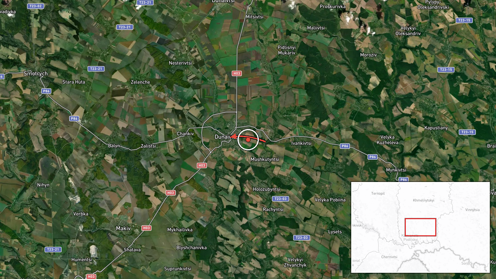
Ukrainian air monitoring reports that one Russian jet-powered Shahed, designated Geran-3, was tracked in the south of Khmelnytskyi Oblast on a course toward the town of Dunayivtsi. The event was logged at 03:02 UTC on 23 October 2026. The only source is the Telegram channel @kpszsu, which posted the alert in Ukrainian, describing a jet-powered UAV in the south of Khmelnytskyi region heading to Dunaivtsi from the east. The English summary describes the drone as coming from southern Khmelnytskyi Oblast, while the original wording points to an approach from the east, so the exact direction of travel is not fully settled. The report describes a transit rather than a confirmed impact, and the data records no damage, casualties or interception.
Context and assessment
Dunayivtsi sits in western Ukraine, in a corridor that Russian long-range drones have repeatedly crossed on their way toward the west and southwest of the country. The event is part of a visible sequence. Earlier on 22 October, single Geran-3 drones were reported near Vendychany at 09:28 UTC, then near Zhmerynka at 16:59 and 17:02, and then heading toward Khmelnytskyi at 17:24. A further track was logged near Kopychyntsi in Ternopil Oblast at 03:11 on 23 October, heading west, shortly before the Dunayivtsi alert. Taken together, these reports suggest one or a small number of jet-powered drones moving along a broadly westward axis across central and western oblasts over roughly eighteen hours. Operationally, such transits are commonly read as route-finding, air defence stress testing, or attacks on distant targets, but the data does not show which target, if any, the drone was intended for. Because each report involves a single drone, the pattern looks more like a sustained stream of individual launches than a coordinated mass raid. Analysts would typically look for follow-on reports of impacts, debris or air alerts in neighboring oblasts to judge whether the track ended in a strike.
Sources and confidence
Only one channel, Telegram @kpszsu, reported this event, so the source count is 1 and there is no independent cross-confirmation at the time of writing. The channel carries Ukrainian air monitoring messages and is generally treated as an authoritative early warning, but single-channel alerts can be revised as tracks change. The confidence score of 8.0 reflects a specific, official-style report with a settlement-level location and a consistent sequence of related alerts, offset by the lack of independent confirmation and the wording discrepancy about direction. Confidence would rise with corroboration from other Ukrainian air force posts or regional administration statements. It would fall if later updates change the track or the approach direction, or show the drone was not in the area.
Location
The coordinates correspond to the settlement of Dunayivtsi, recorded at settlement precision with high location confidence, so the point marks the town rather than a specific facility. Dunayivtsi lies in western Khmelnytskyi Oblast within the Podillia region, an area of rolling farmland and small river valleys. Ternopil Oblast lies immediately to the west, and the Kopychyntsi track places the wider corridor close to that boundary.
Related events nearby
- Ukrainian air monitoring: 1 Russian jet-powered Shahed (Geran-3) drone heading toward Khmelnytskyi.2026-10-22 17:24 UTC · Drone Transit · Khmelnytskyi, Ukraine
- Ukrainian air monitoring: 1 Russian jet-powered Shahed (Geran-3) drone passing Zhmerynka, heading toward Khmel2026-10-22 16:59 UTC · Drone Transit · Khmelnytskyi Oblast, Ukraine
- Ukrainian air monitoring: one Russian jet-powered Shahed (Geran-3) drone tracked near Kopychyntsi, Ternopil Ob2026-10-23 03:11 UTC · Drone Transit · Kopychyntsi, Ternopil Oblast, Ukraine
- Ukrainian air monitoring: 1 Russian jet-powered Shahed (Geran-3) drone heading toward Vendychany.2026-10-22 09:28 UTC · Drone Transit · Vendychany, Ukraine
- Ukrainian air monitoring: 1 Russian jet-powered Shahed (Geran-3) drone heading toward Zhmerynka.2026-10-22 17:02 UTC · Drone Transit · Zhmerynka, Ukraine
▶ View this event on the live map

Intel Mapper aggregates open-source reports from monitored Telegram and X channels, geolocates them, cross-checks duplicates across sources and assigns a confidence score. Entries are updated as new confirmations arrive. Read how we verify events.