Single Geran-3 jet-powered drone tracked near Kopychyntsi, Ternopil Oblast, heading west
What happened
Ukrainian air monitoring reported at about 03:11 UTC on 23 October 2026 that one Russian jet-powered Shahed, designated Geran-3, was tracked in the Kopychyntsi area of Ternopil Oblast in western Ukraine, on a westerly course. The report was posted on the Telegram channel @kpszsu, which is attributed to Ukrainian air monitoring, and its wording is brief: a jet drone in the Kopychyntsi district, heading west. The message does not mention impact, damage, casualties, or whether the drone was intercepted or left the area. The event is logged as a transit rather than a strike. It was one of several Geran-3 tracks reported over the preceding day as a drone moved from the south-east through Khmelnytskyi Oblast toward the Ternopil area.
Context and assessment
Ternopil Oblast lies west of Khmelnytskyi Oblast and is part of the wider western Ukrainian corridor that drones and missiles have crossed on the way to targets further west and north, as well as to targets across the country's interior. Kopychyntsi itself is a small settlement, so the report is more significant for the route it marks than for the place. The related events give a clearer picture. Between 09:28 and 17:24 UTC on 22 October, the same drone type was logged near Vendychany, Shepetivka, Zhmerynka and Khmelnytskyi, moving generally westward. A further report at 03:02 UTC on 23 October placed a Geran-3 near Dunayivtsi, followed by this track near Kopychyntsi about nine minutes later. The sequence is consistent with a single airframe or a succession of drones following a similar path. The data does not establish which, and each report may describe a different aircraft. Operationally, the pattern may suggest drones moving along a long westward axis, possibly toward distant targets, or being tracked as they approach air defence coverage boundaries. Such an interpretation is provisional and rests on a sequence of single-source reports rather than on confirmed flight paths.
Sources and confidence
The event rests on one Telegram channel, @kpszsu, and the source count is one. The channel is attributed to Ukrainian air monitoring and has posted a consistent format across the related events, which supports the reliability of the track itself. No independent outlet, official statement or second monitoring channel in the data corroborates this specific report, which keeps the score below the maximum. The confidence score of 8.0 reflects a credible official-style channel with a steady reporting pattern, offset by the lack of cross-confirmation and the absence of any stated outcome. Confidence would rise with corroboration from a second official source, a regional military administration statement, or a subsequent report describing the drone's fate. It would fall if the channel corrected or retracted the report, or if other monitoring sources described a different route or aircraft.
Location
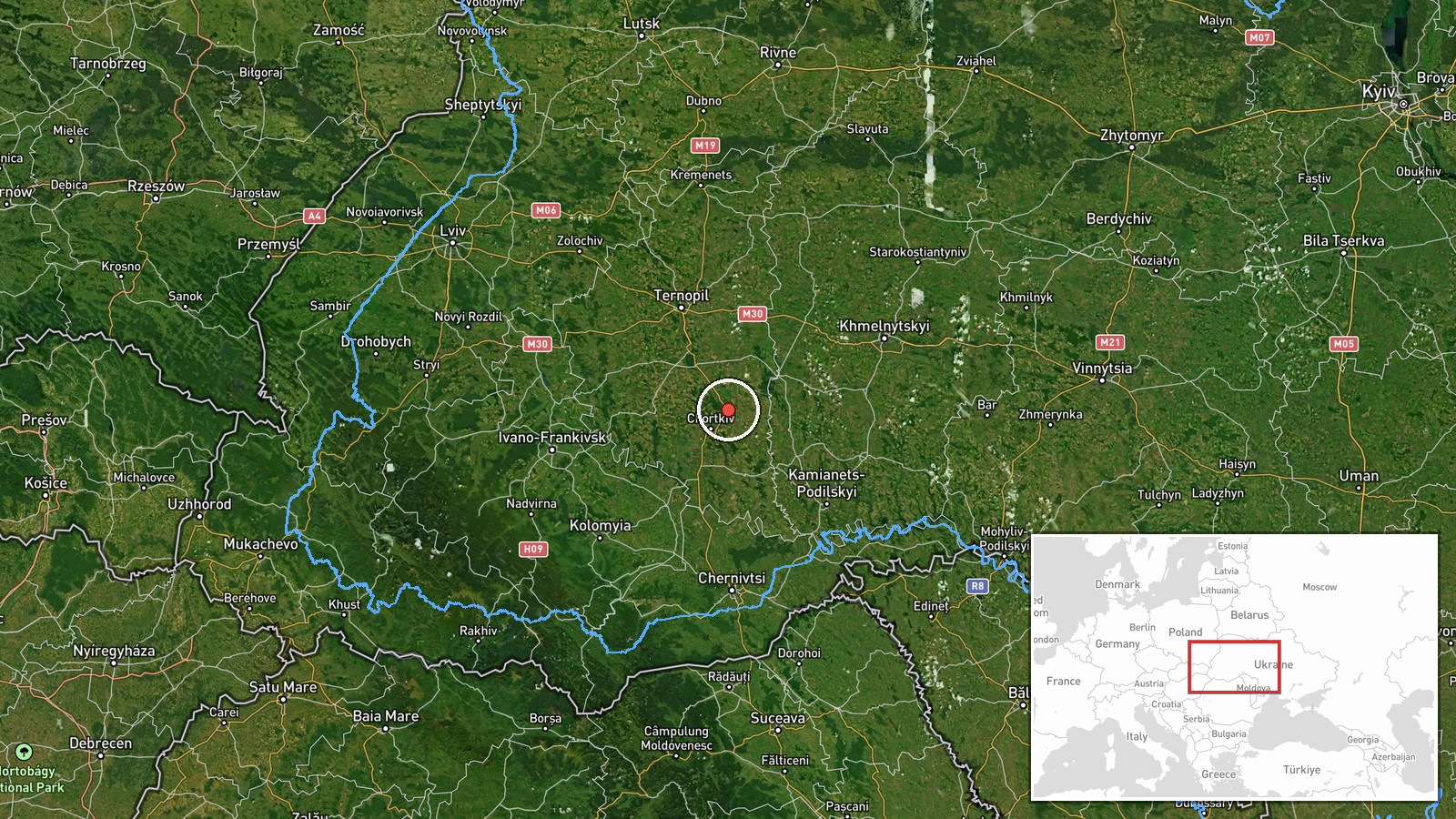
The location is geocoded at settlement level to Kopychyntsi in Ternopil Oblast, at roughly 49.103 N, 25.912 E, and the location confidence is recorded as high. The point marks the settlement rather than a precise flight position, so the drone could have been several kilometres from the coordinates. The setting is gently rolling farmland of the Podolia uplands, with river valleys of the Dniester basin and the Zbruch region to the south and east.
Related events nearby
- Ukrainian air monitoring: 1 Russian jet-powered Shahed (Geran-3) drone from southern Khmelnytskyi Oblast towar2026-10-23 03:02 UTC · Drone Transit · Dunayivtsi, Ukraine
- Ukrainian air monitoring: 1 Russian jet-powered Shahed (Geran-3) drone heading toward Khmelnytskyi.2026-10-22 17:24 UTC · Drone Transit · Khmelnytskyi, Ukraine
- Ukrainian air monitoring: 1 Russian jet-powered Shahed (Geran-3) drone passing Zhmerynka, heading toward Khmel2026-10-22 16:59 UTC · Drone Transit · Khmelnytskyi Oblast, Ukraine
- Ukrainian air monitoring: 1 Russian jet-powered Shahed (Geran-3) drone passing Khodoriv, heading west.2026-10-23 03:30 UTC · Drone Transit · Khodoriv, Ukraine
- Ukrainian air monitoring: 1 Russian jet-powered Shahed (Geran-3) drone from northern Khmelnytskyi Oblast towar2026-10-22 16:57 UTC · Drone Transit · Shepetivka, Ukraine
▶ View this event on the live map

Intel Mapper aggregates open-source reports from monitored Telegram and X channels, geolocates them, cross-checks duplicates across sources and assigns a confidence score. Entries are updated as new confirmations arrive. Read how we verify events.