Russia launches 176 drones at Ukraine overnight; Ukraine reports 140 downed or suppressed
What happened
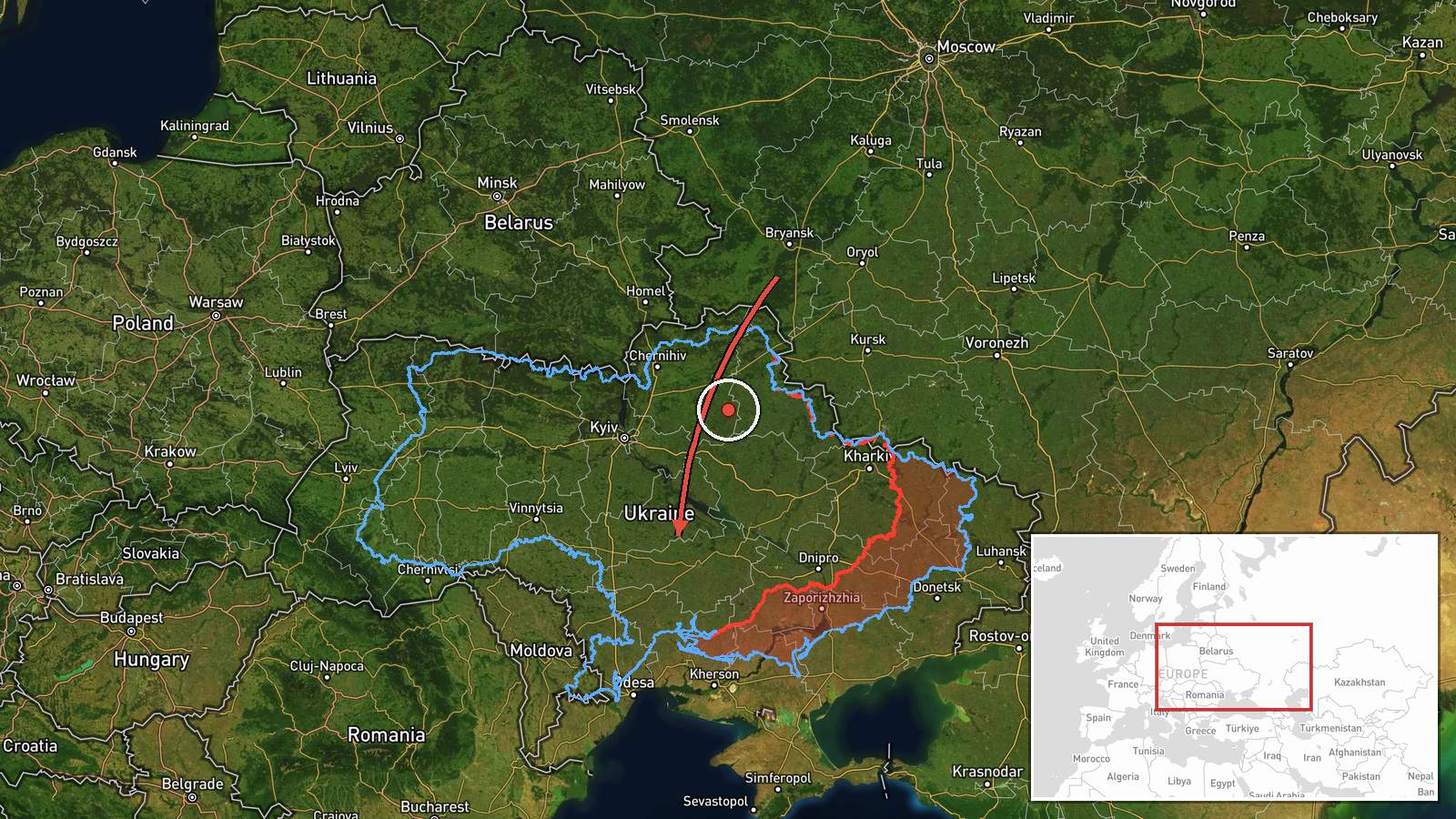
Ukraine's armed forces Telegram channel @kpszsu reported that Russia launched 176 attack drones overnight on 23 October, counting from 18:00 on 22 October. The post lists 92 jet-powered Shahed-type drones, Gerbera drones and decoys described as 'Parody' imitators. Launch directions were given as Bryansk, Shatalovo, Oryol, Kursk and Primorsko-Akhtarsk in Russia, plus Russian-occupied Donetsk and Crimea (Hvardiiske). As of 08:00 local time, air defence, aviation, mobile fire groups and electronic warfare units reportedly downed or suppressed 140 drones, with 10 still airborne. The Ukrainian-language post is cut off before its final line. The event record also summarises impacts at 19 locations and debris at 13, but those details do not appear in the excerpt itself.
Context and assessment
The report describes a large, mixed salvo rather than a single strike. Shahed-type drones are long-range loitering munitions, and the Gerbera and decoy types are generally understood to be used to saturate and confuse air defences, which helps explain why a high share of the launches were stopped or suppressed. The launch areas span Russia's border regions and occupied territory in the south and east, consistent with a pattern in which drones are fired from several directions at once. The related Intel Mapper records show the same overnight activity moving across central and southern Ukraine. Single jet-powered Shahed transits were logged near Zvenyhorodka and Domanivka, and multiple drones were tracked across southern Kirovohrad Oblast heading west, with another heading from Kirovohrad toward Cherkasy Oblast. These tracks suggest that the drones were routed across a broad corridor and not aimed at a single city. An earlier nationwide alert for a ballistic missile threat ended at 10:41 on 22 October, so the period has involved several threat types. Operationally, the mix may point to an effort to exhaust interceptors and overload radar tracking, but the available data cannot show intent or whether the attack was aimed at a particular target set.
Sources and confidence
The event rests on a single Telegram channel, @kpszsu, which is listed as the only source. The record shows a source count of one, so the report has not been independently cross-confirmed by a second outlet or by imagery in the data provided. The confidence score of 8.1 reflects that the post is an official-style military update with specific figures, timings and launch directions, but it is still unverified by other sources. The reported timing is consistent with the 05:06 UTC event time, since 08:00 local time in Ukraine in late October equals about 05:00 UTC. Confidence would rise with confirmation from the Ukrainian Air Force, independent monitoring, or reporting of specific impact sites. It would fall if later updates revise the interception figures or if the 19-impact and 13-debris figures cannot be traced to a source.
Location
The location is recorded only at regional level as Ukraine, with coordinates of 48.5 north and 31.5 east. These coordinates are an approximate centroid for a wide area of central-southern Ukraine, not a settlement, facility or confirmed impact site. The geographic setting is largely flat steppe drained by the Dnipro and Southern Bug river systems, with the Black Sea coast lying to the south. Because the drones were tracked across several oblasts, the point marker should be read as a general reference only.
Related events nearby
- Ukrainian air monitoring issued an all-clear, ending a ballistic missile threat alert.2026-10-22 10:41 UTC · Siren · Ukraine (nationwide)
- Ukrainian air monitoring: 1 Russian jet-powered Shahed (Geran-3) drone heading toward Zvenyhorodka.2026-10-22 07:18 UTC · Drone Transit · Zvenyhorodka, Ukraine
- Ukrainian air monitoring: 2+ Russian jet-powered Shahed (Geran-3) drones passing southern Kirovohrad Oblast, h2026-10-22 16:58 UTC · Drone Transit · southern Kirovohrad Oblast, Ukraine
- Ukrainian air monitoring: 1 Russian jet-powered Shahed (Geran-3) drone heading toward Domanivka.2026-10-23 04:29 UTC · Drone Transit · Domanivka, Ukraine
- Ukrainian air monitoring: 1 Russian jet-powered Shahed (Geran-3) drone from Kirovohrad Oblast toward Cherkasy 2026-10-22 07:17 UTC · Drone Transit · Cherkasy Oblast, Ukraine
▶ View this event on the live map

Intel Mapper aggregates open-source reports from monitored Telegram and X channels, geolocates them, cross-checks duplicates across sources and assigns a confidence score. Entries are updated as new confirmations arrive. Read how we verify events.