Single jet-powered Geran-3 drone reported heading toward Domanivka in Mykolaiv Oblast
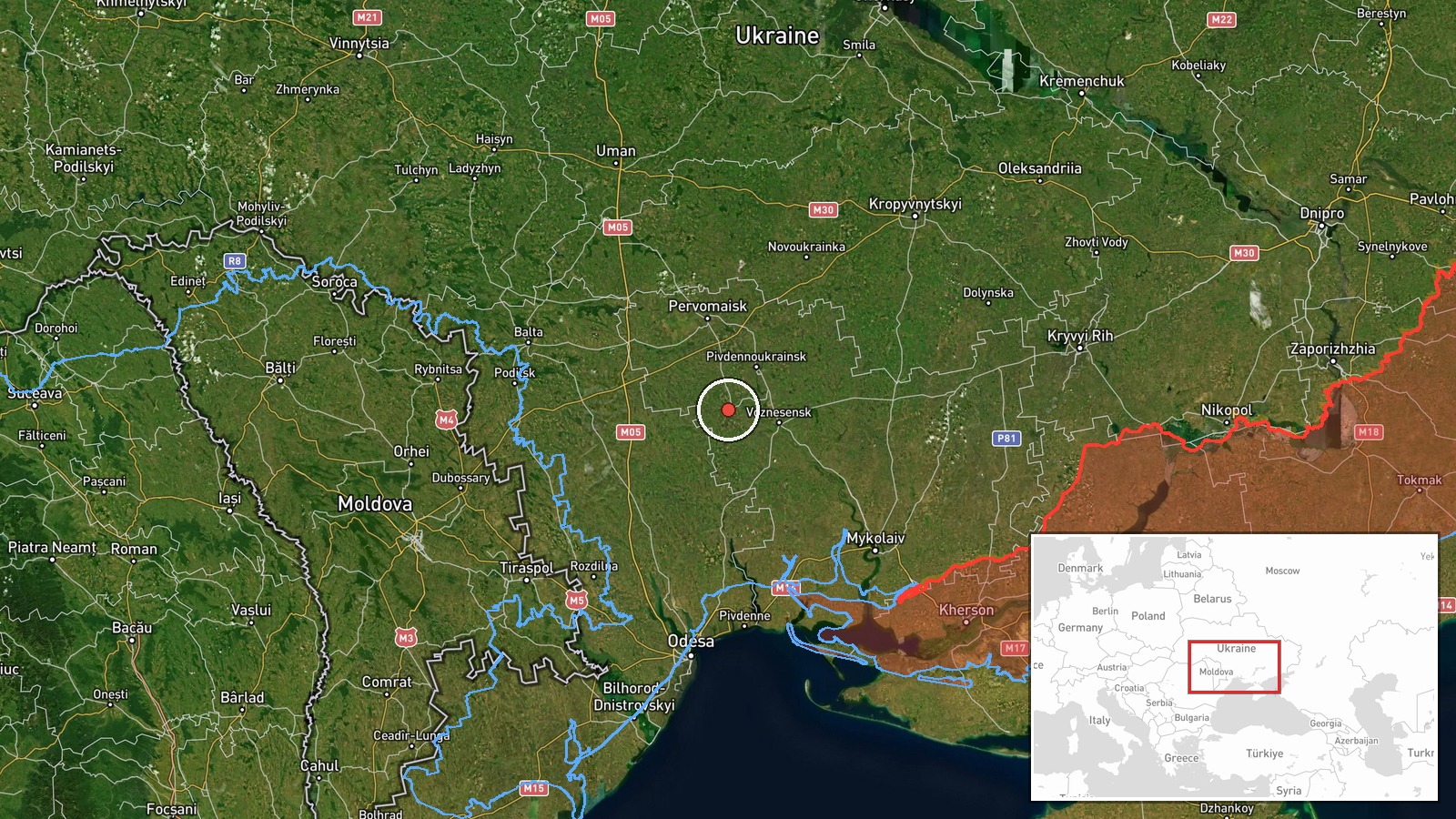
What happened
Ukrainian air monitoring reported at 04:29 UTC on 23 October 2026 that one jet-powered Russian Shahed-type drone, identified as a Geran-3, was heading toward Domanivka in Mykolaiv Oblast, southern Ukraine. The original Ukrainian-language post, published on the Telegram channel @kpszsu, described a jet-type unmanned aerial vehicle moving on a course toward the settlement, using a directional arrow rather than describing an impact. The report does not mention strikes, casualties, damage, or interceptions at Domanivka. Because the post describes a drone in transit, the event is best read as an alert about an aircraft on a path over the area rather than a record of harm. Follow-up updates from local authorities or the Air Force would be needed to establish whether the drone reached the settlement or was shot down.
Context and assessment
Domanivka sits in the agricultural lowlands of Mykolaiv Oblast, an area that lies along recurring flight corridors for Russian long-range drones moving from the Black Sea coast and southern Ukraine toward Mykolaiv city, its port and industrial sites, and inland targets. The related events show a dense sequence over roughly 24 hours on 22 October. A single Geran-3 was logged near Ananyiv in Odesa Oblast in the morning, another was tracked passing Berezanka while heading northwest in the afternoon, and at least two more were seen crossing southern Kirovohrad Oblast heading west at the same time. Additional single drones were reported passing the Mykolaiv district heading north and then heading toward Mykolaiv city that evening. Taken together, this suggests multiple drones operating across several oblasts at once rather than a single isolated flight. Operationally, such dispersed tracks may reflect efforts to route drones around air defense concentrations, to saturate warning networks, or to probe for gaps, though the data alone cannot confirm intent. The Domanivka track fits the same pattern, with a drone moving through the Mykolaiv region shortly after the earlier reports, and it may represent a continuation of the same routing rather than a separate target.
Sources and confidence
The report comes from a single channel, Telegram @kpszsu, which is associated with the Ukrainian Air Force's air monitoring messages and is generally regarded as an official, time-stamped source. No independent outlet or second channel has been found in the provided data to repeat the Domanivka track. The confidence score of 8.0 reflects the institutional nature of the channel and its consistent use in similar reports, offset by the lack of cross-confirmation and the brief, non-specific wording. Confidence would rise with corroboration from regional military administrations, the Air Force's own website, or reports of an explosion, interception, or debris. It would fall if later messages revise the track or if the drone is reported to have left the area without incident.
Location
The location is recorded as Domanivka in Ukraine, at settlement-level precision with high location confidence, based on the coordinates 47.629 N, 30.986 E. The settlement is in Mykolaiv Oblast, on the flat steppe terrain typical of the lower Southern Bug region. The area is largely agricultural, with few tall obstacles. Mykolaiv city lies to the southwest and the Black Sea coast is to the south, making the settlement part of the approach zone toward the regional center.
Related events nearby
- Ukrainian air monitoring: 1 Russian jet-powered Shahed (Geran-3) drone heading toward Ananyiv.2026-10-22 08:55 UTC · Drone Transit · Ananyiv, Ukraine
- Ukrainian air monitoring: 1 Russian jet-powered Shahed (Geran-3) drone passing Berezanka, heading northwest.2026-10-22 16:58 UTC · Drone Transit · Berezanka, Ukraine
- Ukrainian air monitoring: 2+ Russian jet-powered Shahed (Geran-3) drones passing southern Kirovohrad Oblast, h2026-10-22 16:58 UTC · Drone Transit · southern Kirovohrad Oblast, Ukraine
- Ukrainian air monitoring: 1 Russian jet-powered Shahed (Geran-3) drone passing Mykolaiv district, heading nort2026-10-22 07:15 UTC · Drone Transit · Mykolaiv district, Ukraine
- Ukrainian air monitoring: 1 Russian jet-powered Shahed (Geran-3) drone heading toward Mykolaiv.2026-10-22 17:01 UTC · Drone Transit · Mykolaiv, Ukraine
▶ View this event on the live map

Intel Mapper aggregates open-source reports from monitored Telegram and X channels, geolocates them, cross-checks duplicates across sources and assigns a confidence score. Entries are updated as new confirmations arrive. Read how we verify events.