Russian jet-powered Shahed-type drone reported transiting Ternopil Oblast on a northwesterly heading
What happened
Ukraine's Air Force monitoring channel on Telegram, @kpszsu, reported one Russian jet-powered drone passing Chortkiv in Ternopil Oblast in a northwesterly direction. The post is timestamped 23 October 2026 at 06:40 UTC. The original Ukrainian wording describes a 'jet-powered UAV' (Реактивний БпЛА) and does not name a model. The English summary's Geran-3 designation is therefore an interpretation of the report rather than a quoted detail. The report describes no impact, damage, or casualties, and gives no altitude or speed. It forms part of a series of single-drone transit alerts across western and central Ukraine during the preceding and following hours.
Context and assessment
Chortkiv lies in the south of Ternopil Oblast, in the western Ukrainian region that has seen repeated drone transits toward Lviv, Ivano-Frankivsk and the Polish and Romanian frontiers. The related events show a consistent pattern. Earlier on 22 October, a drone was tracked near Zhmerynka heading toward Khmelnytskyi Oblast, then over Khmelnytskyi itself. Overnight into 23 October, drones were reported near Kopychyntsi and Khodoriv, both heading west. This event follows at 06:40, and a further report places a Shahed-type drone heading toward Burshtyn in Ivano-Frankivsk Oblast at 06:53. The sequence suggests one or more airframes moving west and northwest across the country over roughly fourteen hours, tracked by radar and reported individually. Operationally, such routing may indicate a deliberate corridor toward western targets, a diversion, or drones that were simply crossing the region. Transit alerts alone do not establish the intended target, and the data does not show what, if anything, the drone struck.
Sources and confidence
All information derives from one Telegram channel, @kpszsu, which is run by Ukraine's Air Force and is the usual official source for real-time air alerts. The data contains no independent confirmation from another outlet, wire service, local authority, or imagery. The confidence score of 8.0 reflects the official nature of the channel, the specific timestamp, and the consistency with other same-day alerts from that channel. It is held below the top range because the claim rests on a single channel, cannot be independently verified, and the model identification is not stated in the original text. Confidence would rise with corroboration from radar sources, local officials, or wreckage reports, and would fall if the channel corrected or withdrew the alert.
Location
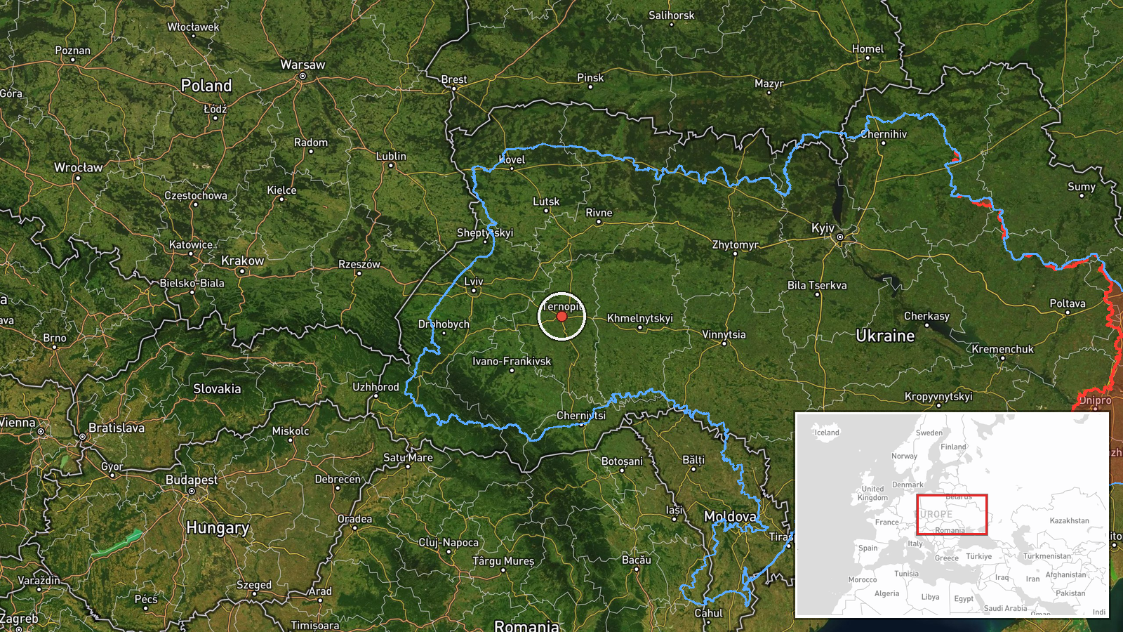
The location is recorded at region level, and the event was not placed at a settlement or facility. The listed coordinates, 49.55 N and 25.59 E, match Ternopil city, the oblast capital, rather than Chortkiv, so the point is a regional placeholder and not a tracked drone position. Chortkiv is roughly 60 km south-southeast of that point. The surrounding terrain is the rolling Podolian Upland, with agricultural land, river valleys draining toward the Dniester, and scattered small towns and forest tracts.
Related events nearby
- Ukrainian air monitoring: one Russian jet-powered Shahed (Geran-3) drone tracked near Kopychyntsi, Ternopil Ob2026-10-23 03:11 UTC · Drone Transit · Kopychyntsi, Ternopil Oblast, Ukraine
- Ukrainian air monitoring reports a Russian Shahed-type drone heading toward Burshtyn, Ivano-Frankivsk Oblast.2026-10-23 06:53 UTC · Drone Transit · Burshtyn, Ivano-Frankivsk Oblast, Ukraine
- Ukrainian air monitoring: 1 Russian jet-powered Shahed (Geran-3) drone passing Khodoriv, heading west.2026-10-23 03:30 UTC · Drone Transit · Khodoriv, Ukraine
- Ukrainian air monitoring: 1 Russian jet-powered Shahed (Geran-3) drone heading toward Khmelnytskyi.2026-10-22 17:24 UTC · Drone Transit · Khmelnytskyi, Ukraine
- Ukrainian air monitoring: 1 Russian jet-powered Shahed (Geran-3) drone passing Zhmerynka, heading toward Khmel2026-10-22 16:59 UTC · Drone Transit · Khmelnytskyi Oblast, Ukraine
▶ View this event on the live map

Intel Mapper aggregates open-source reports from monitored Telegram and X channels, geolocates them, cross-checks duplicates across sources and assigns a confidence score. Entries are updated as new confirmations arrive. Read how we verify events.