Ukrainian Air Force reports one Russian Geran-3 jet drone transiting Khmelnytskyi Oblast
What happened
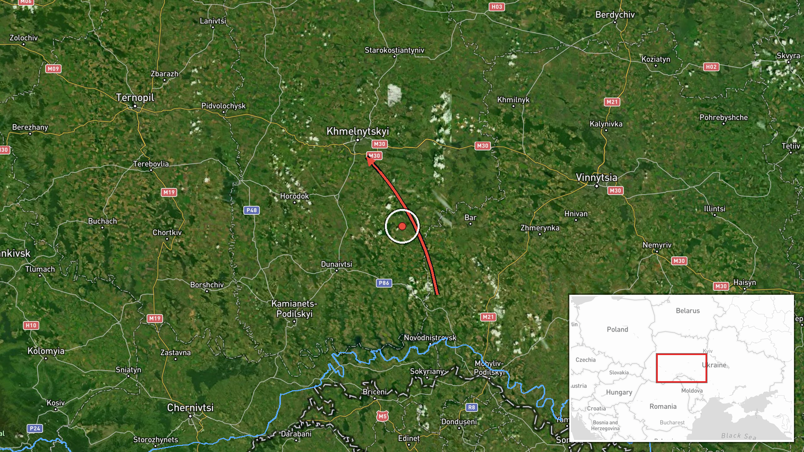
Ukrainian air monitoring reported one Russian jet-powered Shahed, designated Geran-3, passing the area of Murovani Kurylivtsi at about 07:36 UTC on 23 October 2026 and heading toward Khmelnytskyi Oblast in western Ukraine. The report was posted to a Telegram channel listed as @kpszsu. Its original Ukrainian wording describes a jet-type UAV moving past Murovani Kurylivtsi toward the Khmelnytskyi region. The text does not describe impact, damage, casualties or any detonation, and the event is classified as a drone transit, meaning a monitored airborne track rather than a confirmed strike. The attribution to Russia rests on the drone type named in the warning. Earlier warnings on 22 and 23 October describe similar Geran-3 tracks across the same oblast.
Context and assessment
Khmelnytskyi Oblast lies in western-central Ukraine and includes the city of Khmelnytskyi and the Shepetivka rail and road junction, which makes it logistically significant even though it is far from the front line. Russia's long-range drone campaign has repeatedly routed Shahed-type drones across western and central oblasts toward energy, industrial and transport targets. The related events show a cluster of at least five tracks between 16:57 on 22 October and 03:11 on 23 October. Warnings described drones approaching Shepetivka from the north of the oblast, passing Zhmerynka toward the oblast, heading toward Khmelnytskyi, moving from the south toward Dunayivtsi, and tracked near Kopychyntsi in Ternopil Oblast heading west. The multiple directions suggest either several separate drones or repeated launches using different routes across the region. Operationally, such patterns may indicate route probing, saturation of air defence attention, decoy activity, or drones continuing toward targets further west. The westward track toward Ternopil suggests that at least one drone was leaving or crossing the region rather than ending its flight there. These readings remain tentative because the reports give transit positions, not intended targets.
Sources and confidence
The only listed source is the Telegram channel @kpszsu, and no independent outlet, wire service, radar dataset or second channel appears in the event data to cross-confirm this specific track. The confidence score of 8.0 reflects that the channel is an official-style military air warning, that the report is specific about drone type and direction, and that related events from the same channel form a consistent pattern over the preceding day. It is held below the top range because the entry rests on a single channel and carries no corrections or follow-up. Confidence would rise with independent confirmation, reports from multiple channels, or an official statement describing outcomes. It would fall if the channel retracted or revised the warning, if the track were inconsistent with other monitoring, or if no further reporting emerged.
Location
The location is recorded at regional level with low location confidence. The settlement name Murovani Kurylivtsi appears in the source text, but the coordinates, 49.42 N and 26.98 E, sit at oblast scale rather than on the settlement itself, so the point should be read as approximate. The area lies in western Ukraine, characterised by rolling farmland and river valleys within the Southern Bug basin. Notable nearby features include the city of Khmelnytskyi, the Shepetivka transport junction to the north, and the administrative boundary with Ternopil Oblast to the west.
Related events nearby
- Ukrainian air monitoring: 1 Russian jet-powered Shahed (Geran-3) drone heading toward Khmelnytskyi.2026-10-22 17:24 UTC · Drone Transit · Khmelnytskyi, Ukraine
- Ukrainian air monitoring: 1 Russian jet-powered Shahed (Geran-3) drone passing Zhmerynka, heading toward Khmel2026-10-22 16:59 UTC · Drone Transit · Khmelnytskyi Oblast, Ukraine
- Ukrainian air monitoring: 1 Russian jet-powered Shahed (Geran-3) drone from southern Khmelnytskyi Oblast towar2026-10-23 03:02 UTC · Drone Transit · Dunayivtsi, Ukraine
- Ukrainian air monitoring: 1 Russian jet-powered Shahed (Geran-3) drone from northern Khmelnytskyi Oblast towar2026-10-22 16:57 UTC · Drone Transit · Shepetivka, Ukraine
- Ukrainian air monitoring: one Russian jet-powered Shahed (Geran-3) drone tracked near Kopychyntsi, Ternopil Ob2026-10-23 03:11 UTC · Drone Transit · Kopychyntsi, Ternopil Oblast, Ukraine
▶ View this event on the live map

Intel Mapper aggregates open-source reports from monitored Telegram and X channels, geolocates them, cross-checks duplicates across sources and assigns a confidence score. Entries are updated as new confirmations arrive. Read how we verify events.